|
|
U.S. Forest Service San Juan
National Forest (Southwest Colo.) cultural properties scoping document |
Living in the San Juan
Mountains:
Prospectus on Traditional Cultural Properties on the San Juan
National Forest and adjacent public lands
San Juan Traditional Cultural Properties Team Scoping Document
Edited by Andrew Gulliford, March 2003
San Juan TCP Team, summer 2002:
Linda Baker, Southern Ute educator, Red Mesa
Fred Blackburn, historian, Cortez, Colorado
Sally Cole, archaeologist, Dolores, Colorado
Andrew Gulliford, historian, Center of Southwest Studies, Fort Lewis College
Nik Kendziorski, historian, Southwest Studies Scholar, Durango
Jill Seyfarth, preservation planner, Durango, Colorado
Virginia Simmons, historian, San Luis Valley
"This is one of the three products of a jointly funded assessment of ethnographic, cultural, and historic resources relevant to the San Juan National Forest, conducted in partnership with the Colorado Historical Society. ... The documentation of many people, sites, and stories in the report demonstrates the important role played by the San Juan National Forest (SJNF) lands in the settlement and development of Southwest Colorado ... This report provides a series of recommendations and guidance for land and cultural resource managers ... [especially as] the San Juan National Forest is nearing its one hundred year anniversary." [Source: the report's cover letter by Sam Burns, Research Director, Office of Community Services, Fort Lewis College, March 17, 2003]
© 2003 by Fort Lewis College Foundation, Center of Southwest Studies account
Table of Contents
I. What Are Traditional Cultural
Properties?
Methodology:
Criteria to Identify Traditional Cultural Properties
Organizational Approach
II. San Juan Historical Overview
Prehistoric Native Americans
Historic American Indians
TCP Case
Study on Hesperus Peak:
One of four
Navajo Sacred Mountains
EuroAmericans
Southwest Colorado Historic Overview
Military
Roads
Soldiers' Road
Durango Parrott City and Fort Lewis Toll Road
Southwestern Mining
Baker Expedition (1860-1861)
Parrott City
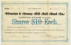
Silverton area
Rico
Durango
Tales of lost treasure
Railroads
Railroads associated with mining and smelting of metals
Denver and Rio Grande Western Railroad (1881-1968)
Rio Grande Southern Railroad (1890-1960)
Silverton Railroad (1887-1924), also called the
Red Mountain and Silverton Railroad
Silverton, Gladstone, and Northern [sometimes
Northerly] Railroad (1899-c.1915)
Silverton Northern Railroad ( 1895-1942)
Railroads associated with coal mining
Perins Peak Railway (1901-1926)
Railroads associated with lumber operations
Rio Grande, Pagosa and Northern Railway (1899-1936)
Pagosa Lumber Company Railroad (1906-1916)
Dolores area lumber company railroads
Hispanic Culture
Hispanic settlement in Archuleta County
Religion
Farming
Sheep grazing
Partido system
Herders
Marketing lambs and wool
Allotments and stock driveways
Agriculture and Settlement
Logging and Timber
Federal Public Land Management
Electrical Power Corridors
Natural Disasters in the San Juans
TCP Case Study:
Avalanche Paths
and the White Death
San Juan Forest Area Selected
Historical Timeline
III. Case Studies: Listing of Sites to Research
as Possible Traditional Cultural Properties
TCP
Consultation and Management: Other Perspectives
Theoretical
Issues on TCPs and the National Register Process
IV. Conclusions and Recommendations
Development, Consideration and Identification of TCPs
Mapping
Consultation
Data assessment
Management
and Administration Related to TCPs
Policy
Recommendations: Action Items
Policy Recommendations: Strategic Planning
V. Documentation
People
interviewed
Preliminary
oral interviews by Fred Blackburn
Interviews
by Virginia McConnell Simmons
Professional
staff consulted on this report by Andrew Gulliford
Preliminary
list of people who still need to be contacted and interviewed
Selected
Bibliography
Ancestral
Puebloan/ Prehistoric Native Peoples
Historic
and Contemporary Native Americans
Navajo
Pueblos
Ute
Environmental
& Forest History
Government
Surveys and Expeditions
Hispanic
Culture
Area
Military History
San
Juan Mining
Natural
Disasters
Railroads
Recreation
EuroAmerican
Settlement
General
Reference Books
Contemporary
Government Documents and Publications
Primary
Sources
Interviews
by Virginia McConnell Simmons
Oral
History Interviews in Historical Collections
Oral
Interviews Still to be Conducted
VI. Appendices
Lost
Canyon Stock Driveway—Mancos Dolores Ranger District
Old
Military Road/Ellwood Pass Road—Rio Grande National Forest
Ellwood
Mining Camp—Rio Grande National Forest
Historic
Ranger Daybooks and Hispanic Sheepherding
The
Del Norte & Antelope Park and Antelope Park & Lake City Toll Roads
Executive Summary
This report is intended as an overview of possible Traditional Cultural Properties (or TCPs) on public lands in southwest Colorado that may be eligible for listing on the National Register of Historic Places. TCPs are a type of cultural site that may not be a historic building, structure or archaeological site, and yet they have deep significance for associated groups living in the area. This report is predicated upon the need to identify, preserve, and protect traditional cultural properties and associated sites. Local, regional, and national interest in heritage tourism, and the high demand in the Four Corners area to experience history and prehistory in original natural settings, continues to bring tourists to our area, and to provide a powerful sense of place for local residents. Inventory and management concerns with TCPs will be discussed along with recommendations for future assessment and consultation particularly with Native Americans.
I. WHAT ARE TRADITIONAL CULTURAL PROPERTIES?
According to Bulletin #38 of the National Register, sites of traditional cultural significance refer to “beliefs, customs, and practices of a living community of people that have been passed down through the generations, usually orally or through practice. The traditional cultural significance of a historic property, then, is significance derived from the role the property plays in a community’s historically rooted beliefs, customs, and practices.” Critical issues related to TCPs as cultural sites include continuity over time, community identity, and traditional use. Citing from the Bulletin, specific examples relevant to southwest Colorado would include:
1. A location associated with the traditional beliefs of a Native American group about its origins, its cultural history, or the nature of the world;
2. A rural community whose organization, buildings and structures, or patterns of land use reflect the cultural traditions valued by its long-term residents;
3. A location where Native American religious practitioners have historically gone, and are known or thought to go today, to perform ceremonial activities in accordance with traditional cultural rules of practice;
4. A location where a community has traditionally carried out economic, artistic, or other cultural practices important in maintaining its historical identity.
Put into perspective, a TCP can be defined generally as a place “that is eligible for inclusion in the National Register because of its association with cultural practices or beliefs of a living community that (a) are rooted in that community’s history and (b) are important in maintaining the continuing cultural identity of the community.” Because of the diverse nature of exploration and settlement in southwest Colorado, possible TCPs on public land would include sites significant to a variety of Native American tribes such as the Pueblos, Utes, Navajos, and Apaches. Sites may also be significant to Hispanic traditions including communities of Penitentes or families that had engaged in sheepherding on both the east and west sides of the San Juan National Forest. Because sites may be significant if they represent locations where “a community has traditionally carried out economic or other cultural practices important in maintaining its historical identity,” then sites related to both mining and ranching traditions may qualify, though to date no such sites have been listed on the National Register.
This report is not exhaustive. It seeks to present a framework for future research and consideration by public land managers in southwest Colorado and to suggest types of sites, as well as linear corridors such as Indian trails, mining trails, etc. that may be essential to cultural continuity in remote areas of Colorado.
Methodology:
Criteria to Identify Traditional Cultural Places
-
A TCP is a permanent location; not an object or a moved item.
-
A TCP is rooted in community history and important to maintaining cultural identity in the community.
-
The integrity of the location remains--the landscape has not changed so significantly that the practice or belief no longer applies or makes sense.
Universally applied assumptions for this project include:
-
Prehistoric sites should be considered potential TCPs unless consultation with appropriate descendent native tribes determines otherwise.
-
Temporary sites such as arborglyghs or vegetation affected by a cultural activity may be potential TCPs.
-
Some TCPs will have multiple cultural and temporal affiliations.
-
The site should be greater than 50 years old to meet the National Register significance criteria.
The team considered land located under the jurisdiction of the San Juan National Forest and Bureau of Land Management in southwest Colorado. The rugged and varied terrain in this region led to conclusions that most TCPs would relate to the use of the landscape, the amount of impact on the land, or conversely, the impacts of the terrain on the cultural practice.
Organizational
Approach
Defining all of the existing and prospective
traditional cultural places within the jurisdiction of the San Juan National
Forest and Bureau of Land Management is a Herculean task. One way to manage
the huge quantity of data is to divide the universe of TCPs into broad
subjects representing major historical/cultural contexts of the area.
This method allows us to both identify known TCPs and to define categories for
newly discovered cultural resources. The team initially defined a list of
contexts that were amended and refined throughout the process. The team
created an overview of the category with examples and notes of known TCPs.
One type of forest resource that represents both intangible, impermanent resources, and traditional cultural properties, are culturally modified trees, which may be Ute ritually scarred trees or Hispanic arborglyphs. In either case, in situ the resource can not be protected or stabilized and will eventually topple. How then do we preserve and protect these cultural expressions unique to the San Juan National Forest and landscape? Some sites, such as Hispanic arborglyphs on high elevation aspen trees, may no longer be part of an active tradition because the sheep industry has collapsed since the 1950s because of increased use of synthetic materials instead of wool. Though sheep have lost their economic value in the state, herding traditions continue and ranching families may still retain high elevation grazing permits on public lands.
Similarly, Ute culturally peeled Ponderosa pine trees may represent a centuries old tradition of utilizing forest resources that is no longer practiced, but sufficient research has not been done to discuss the cultural significance of scarred trees one way or another. Hence, the need for more research, interviews, and fieldwork. This report is an overview for consideration and comment. TCPs remain cutting edge historic preservation because in most states, eligibility on the National Register is limited to two types of sites: archeological and historical sites. TCPs, on the other hand, represent landscape use that may not fall into either category. As of 2002, no Colorado sites listed on the National Register of Historic Places have been cataloged as TCPs. The federal guidelines exist for evaluating and documenting Traditional Cultural Properties, but most nominations to the Register, follow the standard criteria:
a. Association with events that have made a significant contribution to the broad patterns of our history.
b. Association with the lives of persons significant in our past.
c. Embodiment of the distinctive characteristics of a type, period, or method of construction.
d. History of yielding, or potential to yield, information important in prehistory or history.
An excellent example of a potential TCP from southwest Colorado is Mt. Hesperus, also known as Big Sheep Mountain. This peak is one of the four sacred mountains for the Navajos, and it is an historic gathering area for Navajo medicine men, and yet no artifacts may be found at the base of the mountain. Other potential TCPs, often associated with trails, are Native American collecting sites for roots, herbs, and other forest resources. Information on these sites rarely appears in the literature and will require extensive ethnography to analyze, designate and understand. Hispanic herders on the San Juan National Forest and Rio Grande National Forest in the 1930s gathered plants and herbs in high elevation meadows to take back to their villages in northern New Mexico. Whether that tradition continues is unknown.
Of the 4,751 archaeological sites on the Forest as identified by Dr. Philip Duke, these sites or corridors require further investigation as potential Traditional Cultural Properties of value to living inhabitants of the Four Corners area. The scope of this project does not include formal tribal consultation, which should take place in a government-to-government relationship between the U.S. Forest Service and the Bureau of Land Management and interested tribes.
Equally intriguing are TCPs that may represent community continuity for hardrock miners in Silverton and other small towns, as well as ranching communities. In each case, groups of people have used public land as part of their occupation over the last century, and there may be sites of traditional significance over and above economic pursuits. Ancient Indian trails, which became mining trails, are still used by miners as well as hikers and backpackers. Cowboys may still follow the same stock drives, and use the same corrals and meadows as they have done for a century on the west side of the San Juan National Forest. Whether such sites actually represent traditional cultural properties, will take more time to determine.
An intriguing class of high elevation sites unique to Colorado and the United States may be known and named avalanche runs. There are more avalanches between Durango and Ouray than anywhere else in the continental United States. Those avalanches killed dozens of miners and settlers and both oral and written accounts abound concerning avalanche dangers. Some sites have been commemorated with memorials and hence “are rooted in the community’s history and are important in maintaining the continuing cultural identity of the community.” The San Juan TCP Team will conclude with specific recommendations, but our goal is to present data and information for further consideration. Case studies will also be included, as well as a working bibliography.
II. SAN JUAN HISTORICAL OVERVIEW
Prehistoric Native American Overview
Native Americans have used and accessed what is now the San Juan National Forest for possibly 10,000 years. Archaic sites have been found on several ranger districts, and this research is best summarized in An Overview of the Archaeological Resources in the San Juan-Rio Grande National Forests by Dr. Philip Duke. A high elevation hunting blind may be found just east of Kennebec Pass where there is a natural corridor for game to flow east to west along what is now part of the Colorado Trail. After the Archaic hunter-gatherers left the area, Basketmaker peoples (? B.C. - A.D. 750) inhabited southwest Colorado planting corn at elevations of 8,000 feet and living in rock shelters, most noticeably the Falls Creek shelter north of Durango. Burials at the site were excavated by both amateur and professional archaeologists and collections from the site are scattered among several repositories. References to Falls Creek include Helen Sloan Daniels: Adventures with the Anasazi of Falls Creek (Occasional Paper #3 by the Center of Southwest Studies, 1976) and Prehistory in Peril: The Worst and Best of Durango Archaeology (1997) by Florence Lister.
Ancestral Puebloan peoples lived in the San Juan region beginning millennia ago, and their habitation sites cover the entire corner of the state though at lower elevations than the Basketmakers. Research on Ancestral Puebloan sites, both in published reports and by contract archaeologists, is voluminous and ongoing thanks to major projects such as the Animas La Plata Project in Ridges Basin, the Fort Lewis College Field Schools which have excavated sites such as Puzzle House and the Pigg House, and the work of the Crow Canyon Archaeological Center in Montezuma County where thousands of archaeological sites have been determined eligible for the National Register. Connections between prehistoric Ancestral Puebloan sites and contemporary Pueblo tribes bear further research, investigation and consultation. Within oral traditions of Pueblo groups, specifically the Hopi and Zuni, their ancestors accessed high elevation sites in the San Juan Mountains and they had ties to habitation sites in what is now the Canyons of the Ancients National Monument.
Because of drought and escalating violence, which may have culminated in cannibalism as a means of social control, by 1300 Ancestral Puebloans had left the Four Corners area and continued their migrations elsewhere. As with all great human migrations, there are both “push” and “pull” factors that stimulate movement. Ancestral Puebloans may have been “pushed” out of the Four Corners area by environmental and social factors, but they may also have been “pulled” to other areas by the new religion of the Katsinas.
Prehistoric: The study area contains archaeological evidence of prehistoric activities from the PaleoIndian periods to the present. Per the National Register definition for a traditional cultural location, a prehistoric site would require confirmation of cultural value from modern informants before a site could be considered a TCP. Many specific site locations probably have lost their meaning to modern descendents, but the descendents may carry traditions associated with a larger area encompassing the specific site location. Certain site types, however, would be more likely to have maintained site-specific importance as a TCP. Sites that are clearly used for resource procurement and appear to have been visited more than once are likely TCP candidates. If reviewed on a larger scale, rather than site by site, certain areas containing a higher density of certain site types could be identified as a TCP. The best sources to further this research would be the site files of the Colorado Historical Society and the San Juan National Forest, and the Colorado Prehistory Context for the Southern Colorado River Basin by Lipe & Varien et al., 1999.
Suggested Traditional Cultural Properties in this Category:
|
Theme |
Type of Site |
Examples |
|
Resource procurement |
Quarry |
Lime Mesa Limestone Quarry |
|
Transportation |
Trails |
|
|
Religion |
Astrally oriented features |
Chimney Rock |
Historic Native American Overview
The time period between 1300 and the coming of the Spanish to New Mexico in 1540 represents one of the most intriguing epochs in southwestern history. Pueblo peoples had moved southeast towards the Rio Grande river valley and Ute peoples moved into Colorado, apparently from the Great Basin area to the West. Uto-Aztecan speakers, the Utes became the mountain people whose territory included all of Colorado, northern New Mexico and Utah. Ancestors of Ute bands now living in southwest Colorado, particularly the Weeminuche, lived on the Uncompahgre Plateau and adjacent San Juan Forest lands. The White Mesa Ute Indians in southeastern Utah, who are enrolled as members of the Ute Mountain Ute Tribe, also are a source of information about traditional Ute properties in the western portions of Montezuma and Dolores Counties.
The Athabaskan-speaking Navajos also moved into the Four Corners area from the north but moved south of Ute territory into an area of Arizona and New Mexico and southern Colorado roughly bounded by the four sacred mountains of Mt. Hesperus to the northwest, Mt. Blanca to the northeast, the San Francisco Peaks near Flagstaff to the southwest, and Mt. Taylor near Grants, New Mexico to the southeast. They warred and fought with the Utes, and the San Juan River became the northern boundary for the Navajos and the southern boundary for the Utes. Early Spanish accounts describe nomadic peoples as “Apache de Nabajo,” and it is not until later in the 18th century that distinctions are made between Navajos living among the four sacred mountains and Apaches living to the north and east of Taos and the Spanish settlements.
At the beginning of Spanish contact, no tribes had horses, sheep or domesticated animals other than dogs. From 1540 until 1680 nomadic tribes warily watched Spanish soldiers and priests force their will upon the Pueblo peoples. Then, with the successful Pueblo revolt of 1680, everything changed for Indians in the West. The Pueblos made little use of horses and sought to kill them during the revolt, but the Utes and Navajos felt otherwise and minor horse stealing prior to 1680 increased to major theft after the Spanish had been forced to retreat all the way south to El Paso. The Utes, who had been primarily involved in the deer trade by bringing prime finished buckskin into the trade fairs at Abiquiu and Taos, saw the opportunity to become rich with horses as did the Navajo. Major horse herds were acquired by both tribes, as well as churro sheep herds for Navajo weavers. Utes traded horses far to the north, and in northern Wyoming and southern Montana they received a valuable trade item they could never barter for with the Spanish—guns traded across the Great Lakes by the British. Guns were also acquired from tribes to the east and French trappers and traders.
By the 1740s the entire Southwest was re-made by the swift and deadly combination of armed Native American raiders on horseback. The territorial boundaries for the historic tribes became more distinct with Apaches to the east of the Rio Grande and south into southwest New Mexico; Navajos within their Four Sacred Mountains, and Utes ranging across all of Colorado and onto the Great Plains to hunt buffalo. No longer confined to the mountains, Utes could now travel far and wide to hunt, and they began to adopt the material culture of leather shirts, leggings, teepees, and parfleches similar to the Plains tribes.
The Gobernador area of northwest New Mexico may have been especially important for the Navajo clans as they moved into the Four Corners. This area seems to have served as a “cultural hearth” and an origin place for many songs, chants, and ceremonies. In addition there is the architectural enigma of the “pueblitos” or tiny pueblos that dot the mesa tops and are built close to ancient male forked-stick hogans. Whatever the Athabascan people learned in the gobernador area, it helped solidify them as distinctly Navajo, though certain chants and ceremonies also seem to reflect Pueblo traditions. Intriguing ceremonial rock art suggests both Navajo and Pueblo influence.
The northern boundary for the Spanish frontier was the genizaro community of Abiquiu, which was constantly raided by Utes, Apaches, and Navajos. As the slave trade increased on the Old Spanish Trail, women and children were taken captives and brought east to Taos and Santa Fe or west to Los Angeles. The Paiutes so feared that their children would be taken as slaves by Ute war parties that they insisted on reservation lands to the north of Salt Lake City and well off the Spanish Trail. By the first decades of the 19th century Taos Pueblo had been rebuilt with few doors and entrances, and exits only by roof hatches, which could be secured when raiders came near. Ute oral traditions recount “cannibal” stories that may reflect family fears about losing children along mountain trails. Navajo oral stories also describe the slave trade, and one vivid story depicts the plight of a young girl, taken by Ute raiders, who escaped by stealing two horses. She rode so hard and fast to the south that one horse died beneath her. She cut the saddle off the horse, hung it in a tree, and rode on with the second horse until it died. Finally she walked and ran to safety. Three decades ago, in the same canyons where tradition says the story took place, an old cottonwood frame Ute saddle was found in a pinyon-juniper tree. The saddle is now in the Wheelright Museum in Santa Fe. Navajos believe the saddle is proof of the oral tradition.
Historic American Indians:
Suggested Traditional Cultural Properties in this Category
|
Theme |
Type of Site |
Examples |
|
Indian-non-Indian relations |
Treaty locations |
|
Case Study: Hesperus Mountain or Dibe’nsta
Hesperus Peak in the La Plata Mountains is one of the four sacred mountains in Navajo cosmology and represents the northwest boundary of the Navajo cultural area. In 1868 when the Navajos were still incarcerated at Bosque Redondo, the chief Barbacito said they would do anything if only they could go home and not be sent to Oklahoma. In his speech to General Sherman he described the boundary areas including Hesperus Peak as one of the Four Sacred Mountains.
Hesperus Peak figures in Navajo lore not only from the treaty’s nineteenth century date but also much earlier in Navajo myth and legend. One of the most important of all Navajo ceremonies, the Yei Bi Chai or Nightway Ceremony is performed only certain times of the year and is one of two major healing ceremonies held only during the winter months when the snakes are hibernating and there is no danger of lightning. This ceremony is performed for eight days and nine nights and is initiated when a patient first seeks the help of a hand trembler, who can sense and feel symptoms of a certain nature.
By mid-afternoon of the second day of the ceremony sand is used to make figures on the four sacred mountains and the sand is placed in all directions beginning with the east, south, west and finally the north. Talking God enters the hogan where the ceremony is being performed and he rotates himself around the patient four times in a clockwise motion beginning with the east and finishing in the north.
To this day Navajo medicine men, especially from Shiprock, New Mexico go to the area near Mt. Hesperus to gather sacred dirt and special plants for their medicine bundles. The heart and soul of the Navajo start with the four sacred mountains. Navajo medicine man George Blueeyes explains, “These mountains and the land between them are the only things that keep us strong…. We carry soil from the sacred mountains in a prayer bundle that we call dah nidiilyeeh. Because of this bundle, we gain possessions and things of value turquoise, necklaces, and bracelets. With this we speak, with this we pray. This is where the prayers begin.”
First Man and First Woman built the sacred mountains of the present Navajo land. According to author Raymond Locke, “They made them all of earth which they had brought from similar mountains in the Fourth World.” The sacred mountain of the north was named Dibentsaa or Mount Hesperus. Shonto Begay recalls a part of the Navajo creation story often told around the fire of his hogan. He explains, “The hero twins . . . were born for their mother Changing Woman, and their father, the sun . . . Monsters of great size and power roamed the land making life miserable . . . the hero twins were to save the people . . . in a great battle mountain ranges fell, lakes dried up and the earth trembled. One by one, the great giants were felled. After the people of the Fourth World were saved . . . they were given the four sacred mountains as guardians of our holy land, Dine tali.”
According to legend, the sacred mountains were the pillars that held up the sky and so as pillars they had to be fastened down. The sacred north mountain, or Hesperus, was tied down with a rainbow, black beads, mist, and many plants and animals were added. A dish of black beads, paszini, held two blackbird eggs under a cover of darkness, and on Dibentsaa lived Pollen Boy and Grasshopper Girl. Because of the sacred nature of Hesperus, “sacred mountains should not be climbed unless it is done in a proper way through prayer and song, and they should be returned to by medicine men every twelve years to renew their Blessingway prayers,” wrote Robert S. McPherson.
Peggy Beck, Anna L. Waters and Nia Francisco in The Sacred: Ways of Knowledge, Sources of Life explain, “There were four Holy Boys. These beings First Man called to him. He told the White Bead Boy to enter the Mountain of the East, Sisnajini (Blanca Peak in the San Luis Valley of south central Colorado). The Turquoise boy he told to go into the mountain of the South, Tsodzil (Mt. Taylor near Grants, New Mexico). The Abalone Shell Boy entered the mountain of the West, Dook’oslid (San Francisco Peaks near Flagstaff, Arizona). And in the Mountain of the North, Dibe’nsta (La Plata Mountains near Durango) went Jet Boy.”
The authors explain that the Holy Beings “fastened the mountain of the North, Dibe’nsta, to the earth with a rainbow. Over it they spread a blanket of darkness. They decorated it with bash’zhini, obsidian, black vapors, and different plants and animals. The lightning was sent to guard the Jet Boy’s doorway to the north.” Part of the sacred nature of Mt. Hesperus comes from the sacred nature of all four of the Navajo boundary mountains. They are visited by medicine men because “all the sacred mountains have their prayers and chants which are called Dressing the Mountains. All the corner posts have their prayers and chants, as have the stars and markings in the sky and on the earth. It is their custom to keep the sky and the earth and the day and the night beautiful. The belief is that if this is done, living among the people of earth will be good.” This knowledge is learned and practiced among the Navajo to maintain hozho or beauty.
Hesperus Peak is also known as “Big Sheep Mountain” because it was “made of sheep—both rams and ewes.” The Holy Beings provided riches in the form of livestock so herders petitioned Big Sheep Mountain for assistance to grow and bless their herds. Navajos believe “The mountains were put here for our continuing existence . . . All of the living creatures, like sheep, horses, cows, etc. said we will help with furthering man’s existence.”
The soil Navajos gather at Hesperus Peak, or dzillezh, is brought home to protect families and livestock. Blessing animals with prayers and special soil brings rain and more animals to the herds. An elder explained, “livestock is what life is about, so people ask for this blessing through dzillezh. From the sheep and cattle, life renews itself. Who would give birth in a dry place? This does not happen. You get many lambs and calves from the plants around here. On the tip of these plants are horses, cattle, and sheep. They are made of plants which are sheep.” Just as in accounts described in the book The Ecological Indian, the belief that there is a relationship among spirits, livestock, and plants is not unique to the Navajo. Authors Aton and McPherson add, “Navajo expansion north (of the San Juan River) and the use of natural resources were based in religious faith not scientific practice. For this reason, Navajos believed the more sheep there were, the more rain and plants would be available to feed them.” Hence, the religious aspect of Hesperus Peak takes on even deeper meaning.
Hesperus Peak Traditional Cultural Property Sources
George Blue Eyes quoted in Robert S. McPherson, Sacred Land, Sacred View: Navajo Perceptions of the Four Corners Region (Provo: Charles Redd Center for Western Studies of Brigham Young University, 1992) ; Raymond Friday Locke, The Book of the Navajo, 5th edition, (Los Angeles: Mankind Publishing Co., 1992); Shonto Begay, Navajo, Visions and Voices Across the Mesa (New York: Scholastic Books, 1995); Klara B. Kelley and Harris Francis, Navajo Sacred Places (Bloomington, IN: Indiana University Press, 1994) Andrew Gulliford, Sacred Objects and Sacred Places: Preserving Tribal Traditions (Boulder: University Press of Colorado, 2000); Peggy Beck, Anna Lee Walters and Nia Francisco, The Sacred: Ways of Knowledge, Sources of Life (Tsaile, Arizona: Navajo Community College Press, 1996); and James M. Aton and Robert S. McPherson, River Flowing From the Sunrise: An Environmental History of the Lower San Juan (Logan: Utah State University Press, 2000).
EuroAmericans:
SOUTHWEST COLORADO HISTORIC OVERVIEW
Traditional cultural sites have usually been found along trails or routes that represent linear corridors between natural resource areas and the 94 natural lakes and 10 reservoirs found in the area. Because of the rich tri-ethnic roots of the San Juan Mountains, different ethnic groups would have used the same access routes at different times. Both the Utes and the Navajos knew the southern edge of the San Juans and traveled widely throughout the area. Historically the current U.S. Highway 160 between Cortez and Durango was known as the Navajo Trail.
Key access routes into the San Juans include what became known as the La Garita Stock Driveway used by Hispanic sheepherders who brought thousands of sheep west from the San Luis Valley in the spring to the high mountains near Silverton in the summer. They traveled westward from the mouth of La Garita Canyon following La Garita Creek and moved on horseback up into the high country. Herders gathered herbs and high altitude plants and watched carefully over their sheep. Other routes the herders took followed some of the same trails used by the first miners and prospectors who came into Silverton via Cunningham Gulch after they followed the Rio Grande to its headwaters north from Del Norte.
The Baker prospecting party, varying in number from 100-300 people, arrived in Baker’s Park, the town site of Silverton, in 1860, having ridden north from Santa Fe upon hearing of gold discoveries in Colorado territory near Pikes Peak. Further developments waited until after the Civil War when military veterans returned to the San Juans and began prospecting in earnest in the 1870s. Those prospectors would have followed Indian trails and noted Native American cairns and well-used Indian springs and water sources. Because the land had been designated Ute land based on the 1868 treaty, a second treaty had to be written to exclude the mineral-rich San Juans. Known as the San Juan Cession, or Brunot Agreement of 1873, originally Utes had opposed signing the treaty but Ouray finally agreed because the government promised to locate his lost son—a promise that was never kept. Utes reluctantly signed the treaty but agreed to give up only the mountaintops where the minerals were, not the excellent hunting in the valleys of the Animas, La Plata, and Los Pinos rivers.
Despite the misunderstanding (or fraud) in which the Utes thought they were only selling the mountains peaks and the Anglos thought they were buying the entire San Juans including deep mountain parks and valleys, the Utes ceded all of the San Juans and were then forced on to a reservation considerably south of their traditional summer hunting ranges. Further restrictions came after the Meeker incident of 1879, which resulted in the complete expulsion of the northern bands from the Colorado and White River valleys. Because of difficult relations with miners and settlers, Utes seeking to move north probably switched their access routes away from the Rio Grande Valley and instead moved north of Hesperus and up the La Plata River to Indian Trail Ridge or the Highline Trail which begins near Kennebec Pass and goes north for miles.
AREA MILITARY HISTORY
The role of the United States Army is an often-neglected but important part of the San Juan region’s development. As the number of farmers and ranchers, prospectors, and entrepreneurs began to grow east of the Continental Divide in the 1840s, the Army had established forts in New Mexico and in what soon became Colorado Territory. The principal function of most of these forts was the control and punishment of recalcitrant Native Americans, beginning in the early 1850s. As reservations were created, another function was control of white intruders on Indian reservations. At the time when newcomers began entering the San Juan region, the nearest fort in Colorado was Fort Garland in the San Luis Valley, although a small post, Fort Plummer, also existed at Tierra Amarilla on New Mexico’s Chama River. Personnel at the posts included both infantry and cavalry units, with cavalry being better adapted to duty in the far-flung region.
After the Brunot Agreement in 1873 opened mining on the Ute Indian Reservation in the San Juans, tension arose because of intrusions by miners and resentments of Native Americans. Also, in the area around Pagosa Springs, the presence of squatters was a source of contention. Cavalry patrols from Fort Garland were frequent, but without a short, easy route to the San Juans, they were not very effective. Typically, troops had to travel southwest across the San Luis Valley, thence to New Mexico’s Chama River, and finally northwest into the area around Pagosa Springs, the Animas River, and so on.
Beginning in 1876, some of the companies at Fort Garland consisted of black cavalrymen, popularly called “buffalo soldiers.” One well-known company was Company D, Ninth Regiment, which served under Captain F. S. Dodge, a much-admired white officer. This was a well-disciplined “crack” outfit with high esprit de corps, earning honors in the Battle of Milk Creek at the time of the Meeker Massacre. (Following the Civil War, “buffalo soldiers” participated in the Indian Wars elsewhere in the West in the segregated Ninth and Tenth Cavalry Regiments and the Twenty-fourth and Twenty-fifth Infantry Regiments, always with white officers. Black soldiers also served in other integrated units at Fort Garland and elsewhere, but the races of troopers were not officially recorded. Neither the Tenth Cavalry nor either of the two all-black infantry regiments served at Fort Garland or in the San Juans.)
In 1876 the Ninth’s Company D and other units were sent to patrol the San Juan region. In October of 1878 a camp was established at Pagosa Springs on an elevation on the north side of the hot springs and occupied what now is the commercial core of the town site. Buildings were constructed of logs, as the local pine forest made this material plentiful. The original garrison consisted of Company D of the Ninth Regiment and three other companies. With land purchased from the Ute Indians, the military reservation of six square miles encompassed a one square mile town site centered around the hot springs. Originally called Camp Lewis, the name was changed to Fort Lewis on December 30, 1878. Regardless of size, a military installation normally brought jobs for civilians, adding to the local population. These civilian employees might include a storekeeper, wagon master and teamsters, herder, cook, blacksmith, wheelwright, and saddler. At Fort Lewis, a blacksmith was one of the first to be hired.
When the Meeker Massacre of 1879 in northwestern Colorado led to removal of all Ute Indians in Colorado to reservations in 1881, Fort Lewis was moved to a new location on the La Plata River, six miles south of Hesperus and midway across the Southern Ute Indian Reservation, which at the time was a long, narrow strip extending west of Utah. Some military personnel remained at Pagosa Springs until 1882. Black companies of buffalo soldiers were not assigned to the new fort, and, in fact, none served in Colorado after 1886. A few soldiers, black and white, remained as civilians after they mustered out, however, and they became part of the San Juan’s life.
Meanwhile, from its new location on the La Plata, Fort Lewis’s troops were sent to locations in southwestern Colorado when settlers were being threatened by Indians or vice versa, rustlers were stealing livestock, and various other incidents were causing alarm. After the military fort closed in 1891, under an Act of Congress sponsored by Sen. Henry M. Teller in 1911, the property became an Indian boarding school, bearing the name of Fort Lewis.
The Fort Lewis Indian School served Ute children and a few Navajos, with the highest enrollment being about 400. Like others, the school was not popular with Native American pupils and several died while there. Emphasis was on agricultural and domestic training. The boarding school evolved into a public high school, then into a junior college under the auspices of the Colorado State Board of Agriculture, and finally into a four-year college in 1964 offering free tuition for federally enrolled Native American and Native Alaskan students. This is the college’s sacred trust to American Indians.
A military wagon road, called Soldiers’ Road, across Ellwood Pass (also spelled Elwood) was constructed by personnel from Fort Garland to Fort Lewis at Pagosa Springs in 1878-1879. It was in an area surveyed by Hayden’s men in 1873. Early wagon traffic into the San Juan region had come from the south, by way of the Chama River, while mule or burro trains across the mountains used trails established by game and Indians, such as Summit Pass. Summit Pass became known as Ellwood Pass after the creation of a town called Ellwood, named for prospector T. L. Woodvale (L-wood) in 1879 on the west side of Ellwood Pass. (An Ellwood post office, established in 1882, is said to have been the first in what later became Archuleta County in 1885.) Construction of the Denver and Rio Grande Railroad to Durango in 1881 and the removal of Fort Lewis from Pagosa Springs to the La Plata River, soon made the military road nearly obsolete, although hardy travelers still used it.
An area on the east side, near the summit where the military camped, was known then and now as Government Park. Nearby Schinzel Flats was the wildflower-bedecked site where A. J. Flynn was inspired to write “Where the Columbines Grow,” Colorado’s state song. Because of boggy areas on the east side near the Divide and because of the twenty-five-degree grade on the west side, this location was not chosen for the automobile highway that was constructed instead at Wolf Creek Pass in 1913-1917. Also, a major flood in 1911 washed out parts of the Ellwood Pass road and most of Ellwood town, although the road is traveled by intrepid travelers with four-wheel-drive vehicles.
The following description of the military road’s construction is from The Denver Daily Tribune, December 10, 1878. It describes the difficulties of road building in the mountains, even with a small federal appropriation and the military’s resources.
Congress at its last session appropriated $5,000 “for the construction of a military wagon road from Ojo Caliente, New Mexico, to Fort Wingate, New Mexico, and from a point on the Denver and Rio Grande Railroad [in 1878 at Alamosa, Colorado] to Parrott City, Colorado.” This sum was assigned to Lt. Earnest [sic] H. Ruffner, Corps of Engineers, Chief Engineer of the Department of Missouri. A plan for its expenditure was submitted, approved by Department Commander, General John Pope, and work began September 1.
The line chosen was one running in a nearly due west direction from Alamosa to Pagosa Springs, where the new road would intersect the wagon road leading from Tierra Amarilla to the Animas River and west. . . . In passing up the Alamosa [River], a natural and easy water grade was followed with at no place very heavy work, but a considerable expenditure of time and patience. Open parks alternate with bits of wood, and occasional bluffs requiring some grading, and points and cliffs where blasting was necessary or a timber crib work to pass the obstructions. At Clifford’s cabin, nineteen miles from the new saw mill and at an elevation of ten thousand feet, began the ascent of the pass. The grade up the mountain side and through the woods is everywhere easy and gradual, and when the passage of the peat bogs on the summit is secured by corduroying in the spring, the ascent of the 1,550 feet to the Divide [Ellwood Pass, 11,775'] in five miles will be found easy for heavy freight. The grading from the summit for a mile to the west has been completed, and at this point and for some four miles beyond, uncompleted work will probably mark the season’s close and the exhaustion of the appropriation. The road is not completed at any point, but wagons can be driven over the newly opened road, for about thirty miles, twenty-four to the summit and six beyond.
Throughout the distance much remains to be done to make it safe, easy and wide to travel. Grading, clearing and retification [reticulation?] of the line, besides corduroying are still required. There remains on the Western Slope and down the East Fork of the San Juan some twenty-three miles of road to open. At the junction of the Forks is met a practicable wagon road down which twelve miles distant are found the Springs [Pagosa Springs]. The road leading down the East Fork of the San Juan will require more work than was met on the Alamosa, and will be steeper. This will not be objectionable, the heavier traffic passing west probably for some time to come. The establishment of a cantonment at Pagosa Springs, and the probability that there will, before long, be a permanent post in that vicinity, will make a change in the prospects. Easy communication across the mountains to Alamosa, only ninety miles distant; security against the Indians and natural advantages of the place will undoubtedly before long draw a large population to this vicinity.
B. Durango, Parrott City and Fort Lewis Toll Road
When Fort Lewis moved from Pagosa Springs to the La Plata River in 1881, Otto Mears quickly incorporated and built the Durango, Parrott City and Fort Lewis Toll Road during the winter of 1881-1882. The route lay on an old road that Mears purchased for his toll road. It has been said that Mears even selected the site for the new fort, and such a theory might be in keeping with his other activities elsewhere. Mears’s road to Fort Lewis charged tolls from the U.S. Army as well as from civilians. Consequently, most traffic adopted a different route that circumvented the toll gate, and Mears’s Durango, Parrott City and Fort Lewis Toll Road failed in 1882.
The Durango, Parrott City and Fort Lewis Toll Road was the third road incorporated by Mears and partners in the San Juans in 1881, following rapidly on the heels of Ute removal. The first two were the Dallas and San Miguel Toll Road, and the second was the San Miguel and Rico Toll Road. His plan was to link the Animas Valley and the Uncompahgre Valley. In 1879 he also had incorporated a proposed road from San Miguel to Dolores. In 1890 his grand plan was achieved with the building of the Rio Grande Southern Railroad. Black buffalo soldiers stationed at Fort Lewis south of Hesperus patrolled the area on horseback and sought to minimize disputes between Indians and settlers. At least one cavalryman, John Taylor, stayed in the area, and he married into a Southern Ute family.
SOUTHWESTERN MINING
By the mid-1700s, or even earlier, Spanish explorers were aware of precious minerals in the San Juan Mountains. A catalyst for Juan María Antonio Rivera’s expedition in 1765 appears to have been a piece of silver, brought to Abiquiú by a Ute to trade. The journal of Rivera’s first expedition has an entry, dated August 5, 1765, with a reference to an old “Yuta” {Ute} woman in the area of the La Plata River who knew about silver outcroppings. The Escalante journal, eleven years later, includes the name of the La Plata River (plata, sp.: silver). In the 1840s United States Army personnel, including Colorado Territory’s future Governor William Gilpin who was stationed at Abiquiú, was publicizing the San Juan’s riches. In the mid-1850s California’s forty-niners also were returning on this route and exploring for minerals as they went. One such party was led by “Captain” John Moss in 1856. Soon a wave of prospectors and miners flooded the Rockies in the Pikes Peak or Bust gold excitement, heading for Cherry Creek (at Denver) in 1859 and into the mountains west of Denver in 1860. It would only be a matter of time, depending in large part on resolution of Indian occupation in the San Juan Mountains, before mining west of the Continental Divide would transform the San Juans from a wilderness into hive of human activity.
In addition to threats from unfriendly Indians, legal title to mining claims could not be obtained on Indian lands. The latter obstacle was removed with the signing of the Brunot Agreement of 1873, which excluded mining areas in the San Juan Mountains from the Ute Indian Reservation. The delineation of the mining region provided boundaries that were not always respected by either faction, however. New opportunities arose rapidly after the summer of 1881, when Ute Indians were confined to smaller reservations in southwestern Colorado and northeastern Utah, following the Meeker Massacre in northwestern Colorado of 1879. The expanded mining region and transportation routes serving it occupied land that later became part of several counties and three national forests. Within this area were hundreds of silver veins, gold lodes, and placers. The silver belt, which accounted for the fame of the “silvery San Juans,” was estimated to be about twenty to forty miles wide and about eighty miles long, although the value of gold production actually exceeded that of silver in the long run. With dogged persistence and ingenuity, Otto Mears opened much of the area with his toll roads and narrow-gauge railroads, but the Denver and Rio Grande Railroad, which preceded Mears, played the decisive role in the region’s development.
A. Baker Expedition
(1860-1861)
In July 1860 “Captain”
Charles Baker organized an expedition to “Sierra La Plata,” in land
occupied by Ute Indians but not yet designated as a reservation.
He and associates organized the Abiquiú, Pagosa, and Baker City Road
Company that year. In October, twenty-one fellow prospectors traveled to the Dolores, Mancos, and Animas Rivers. Several
other parties also were on their way to the San Juan Mountains by October, and
Baker reported that there were “from three to five hundred men” present at
“Anamos City,” which was established as a supply center. That winter two
of his companions, Thomas Pollock and B. H. Eaton, a future governor of
Colorado, were quoted in the Rocky
Mountain News as saying that “the main field was in Baker’s
Park [Silverton] and its environs, where eleven districts, each containing
two hundred claims, were organized.” Perhaps these figures were exaggerated.
Nevertheless, in response to Baker’s promotion, an optimistic expedition,
including women and children, left Denver on December 14, 1860, for the San
Juans despite winter’s snow and reports that Ute Indians were unfriendly to
prospectors. This party, led by Thomas Pollock, seems to have varied in size
from 100 to 300, as people joined or left it along the way. With eleven wagons
loaded with provisions, most of the party traveled from Denver to the San Luis
Valley, south to the Chama River, where many San Juan promoters and
prospectors assembled, thence northeast to the Animas River. From there, Baker
and company proceeded north,
crossing the Animas River at Baker’s Bridge, thence past the Hermosa Cliffs
and Cascade Creek, Coal Hill and Molas Passes into the basin called Baker’s
Park.
Dissatisfied with their mineral discoveries, running short of supplies, splintered by interpersonal conflict, and threatened by Ute Indians, the expedition broke up in the spring of 1861. One group took with them four Navajo captive children, who had been traded to them by Utes. Some departed across the mountains via Cinnamon and Stony Passes. At Wagon Wheel Gap, it was said, the latter contingent left a broken wagon wheel, although travel at the time was so arduous that any traveler might have left a broken wheel. Disappointed by the results of their adventure and resentful of Baker, some members of the expedition publicly criticized him for promoting what they called a humbug, as had Denver’s newspaper all along. Disillusionment contributed to the departure of almost all prospecting in the San Juans during the remainder of the 1860s, and the outbreak of the Civil War and a wave of excitement in Idaho’s mining country also played a role in cooling ardor for southwestern Colorado Territory for a few years.
B. Parrott
City
On August 9, 1776, the Domínguez-Escalante expedition ascended
from the Animas River (El Río de las Ánimas) to the La Plata River (El Río
de San Joaquín—de la Plata), “in
which there are said to be veins and outcroppings of metallic ore. However,
although years ago certain individuals from New Mexico came to inspect them by
order of the governor, who at the time was Don Tomás Vález Cachupín, and
carried back metal-bearing ore, it was not ascertained for sure what kind of
metal they consisted of. The opinion which some formed previously, from the
accounts of various Indians and from some citizens of the kingdom, that they
were silver ore, furnished the sierra with this name.”
The Treaty of 1868 supposedly ensured that Ute Indians could claim Colorado Territory west of the Continental Divide as their reservation, but a few miners prospected and worked mines in the San Juans illegally. A notable exception was a mining venture that began near the mouth of La Plata Canyon when “Captain” John Moss made a private agreement with Ute Chief Ouray in 1873 to allow placers in a district occupying thirty-six square miles. Its first settlement was the town of Parrott City, which became the county seat of La Plata County from 1874 to 1881. (Described by Clarence Jackson, as “courtly,” “witty,” and “well-educated,” Moss had a manner with which Ouray would have been familiar, for he already was experienced in dealing with government officials, politicians, and promoters.) The source of Parrott City’s name and Ouray’s reward were Moss’s investors, Parrott and Company in San Francisco, which donated 100 horses and blankets to the cause. Moss’s boomlet faded within a few years, as did many later mining efforts in the La Plata Mountains, although Parrott City continued to have a post office until 1896, after coal mining had replaced placer mining as the principal activity southeast of the La Platas along Lightner Creek. Some gold mining did revive near the town of Mayday, just south of Parrott City, and at another community, called La Plata, as late as the 1960s, however.
C. Silverton area
Baker’s Park, the six-mile-long basin where Silverton came into existence, was not entirely forgotten during the
decade after the Baker party’s disappointments in 1860-1861. Interest
in the area revived after the Civil War. At the time, the economy of the
United States was still primarily agricultural, which left few choices for
adventurous young men other than to settle down as farmers, store clerks,
teachers, or preachers back in Iowa or Illinois. At first sight in the
early 1860s, some had been smitten with the wild, scenic San Juans, the
unfettered life of the wilderness, the dream of striking it rich, and they
returned. In the late 1860s and early 1870s, most trespassers on the Utes’
reservation were active in the area of Baker’s Park.
Several prospectors in 1870 and 1871 head-quartered around Howardsville, at the foot of Cunningham Gulch. This gulch was the western end of the infamous Stony Pass (el. 12,594') an extremely steep, rough route. Stony Pass was just north of Cunningham Pass, also called Rio Grande Pass. Like other trails across the Continental Divide, these too had been originally used by game which left traces, followed in turn by Indians. Cunningham Pass became a heavily-used pack trail, declining in importance after Stony Pass boasted a rudimentary wagon road in 1872. Whichever pass was used, the route from the east followed the Rio Grande to its headwaters, passing Wagon Wheel Gap and Antelope Springs before climbing to the Continental Divide and then descending steeply toward Howardsville.
When the San Juan Division of the Hayden Survey were in this area in 1874, Franklin Rhoda gave this description of the old Cunningham pack trail his party took from Howardsville, although Rhoda erred in calling the route Stony Pass:
[A] well-marked trail leads over to the Rio Grande. After passing the main bend, which is about two miles east of Howardsville, the side-slopes become steeper and steeper, and finally end altogether in becoming nearly vertical bluffs. . . .A number of mines are located high up the slopes wherever they are not too steep to be ascended. . . . Near the head of the gulch, the trail is very muddy and badly cut up. . . . It now leaves the creek and ascends the east slope. The grade may be appreciated by calling to mind the fact that from the bed of the stream to the pass the rise is about one thousand feet in one-and-a-half miles. The incessant travel over this trail by miners with their horses, mules and burros keeps it in a bad condition. The really bad part is only a small part of the whole distance. On the summit the ground is gently rolling. . . . The elevation of the pass above the sea, as determined by a single reading of the mercurial barometer, is 12,090 feet.
As conflicts between Indians and miners in the San Juan country increased, efforts had begun in 1872 to exclude mining lands from the reservation in the San Juan Mountains. After much wrangling, the Brunot Agreement, also called the San Juan Cession, was signed in September 1873, and mining claims thereafter had legal titles, and the race had begun in earnest.
By 1874, activity had increased not only around Howardsville and, soon, Silverton too, but also at other important mining centers. When prospectors found mines on the east side of the Divide at Summitville several miles to the south of Stony Pass and fairly close to Ellwood Pass, a thriving supply and freighting center sprang up at Del Norte on the Rio Grande in 1871. This town was founded by a few of Howardsville’s former prospectors. A member of the Baker expedition, Thomas Pollock, also became a resident. Del Norte would soon become a center for wagon traffic en route to the Silverton area via Stony Pass. When a separate State of San Juan was promoted by optimists in southern Colorado, whose designs included the San Juan mines, Del Norte aspired in vain to be its capital.
Other centers of activity were at Lake City and Ouray. Otto Mears had previously built a toll road from his hometown of Saguache to the first Los Pinos Indian Agency. When this agency was moved to the Uncompahgre Valley, Mears provided another road to the new agency, and when the Brunot Agreement was signed, with Mears’s assistance, he promoted the new town of Lake City, reached by his Saguache and San Juan Toll Road. The location of Lake City and its neighboring mines also benefited from access along the Lake Fork of the Gunnison River to and from the Gunnison Valley, where D&RG rails arrived in 1880. In the meantime, Mears built the Antelope Park and Lake City Toll Road to connect Del Norte and Lake City, despite competition it gave to his base at Saguache. This route later was taken over by Barlow & Sanderson’s stage line. With the establishment of the town of Lake City, trails from Lake City came over the Continental Divide by way of Engineer and Cinnamon Passes to tap into the headwaters of the Animas River and the Silverton area. Nevertheless, when Franklin Rhoda examined these passes in August 1874 for the Hayden Survey, he declared that he could not understand how the Saguache people (meaning Mears) ever hoped to bring a wagon road over them. Besides difficulty of terrain, the season for such travel was limited to mid-May until mid-October, although some hardy souls carried mail and supplies during winter on ten- or twelve-foot-long Norwegian skidors, called “snowshoes.” Toll roads were built over Engineer and Cinnamon Passes, and a stage line operated over the latter. Mears contracted to deliver mail and supplies to Silverton and Ouray, in addition. Travelers also entered the area from the south, by way of Animas City. The map accompanying Crofutt’s Grip-Sack Guide of Colorado, 1885 shows the routes of roads in the 1880s.
The competition from other passes did not significantly reduce traffic on the Stony Pass route between Baker’s Park and Del Norte (90 miles from Del Norte to Silverton). Stony Pass was the principal route from 1872 until 1882 into the San Juan mining country. As early as 1872, before the San Juan Cession was consummated, an attempt had been made to build a wagon road over Stony Pass and traffic over the pass had increased after the Cession. Attempts were made to improve sections of the road, with construction taking place as late as 1879. Most surprising about Stony Pass’s popularity is the fact that the topography was so difficult that wagons and stages often ran only to various stations and ranches on the east side, where freight and passengers were transferred to smaller conveyances or pack animals for the remainder of the journey. Gilmer & Salisbury; Greene, Juhle & Company; and the Brewster Stage Line operated freight or transportation services at various times.
The western side dropped a thousand feet per mile, requiring ropes to hold back wagons that were heavily laden with machinery and supplies, and wagons or pack trains going upgrade from the mines also had a severe task. Oxen sometimes were used to pull wagons on this route. Meanwhile, many travelers on foot or with burro trains continued to use nearby Cunningham Pass, which is about 500 feet lower than Stony Pass. By 1882, after the D&RG’s railroad arrived at Silverton, Stony Pass’s heyday ended. Nevertheless, in the 1880s mail still was being carried to Howardsville over Stony Pass three times a week as well as to and from Animas Forks, eight miles north, twice a week. A frequent complaint was the irregularity of mail service, which understandably was delayed by weather. One mail carrier died from hypothermia during a winter-time transit, and other travelers suffered severe frostbite. It is said that a woman gave birth atop the pass.
Mining camps and towns that sprang up shortly before and after the San Juan Cession were occupied by individualists who lived in tents or small log cabins during the summer with maybe a store and a saloon for bodily comforts, while they devoted their energies to striking it rich, hopefully very soon. The majority were American-born, single men, descended from emigrants from the British Isles and Northern European countries, while women (respectable and otherwise), even children, soon were living in the camps, too. Because of cold, snow, and the threat of snow slides, many prospectors left during the winter, to return again for the following short season when mudslides and rockslides took their turns at making life hazardous.
As small mining towns with rough-hewn amenities like hotels and saloons grew up, the first was Howardsville. Though never large, Howardsville became the first seat of San Juan County, when it was carved from La Plata County in 1874, and a log courthouse was built. The cluster of log cabins at Howardsville had a post office, “suburbs” called Bullion City and Niegoldstown, and by 1876 a school.
Mines clung to mountainsides hundreds of feet above Cunningham and Arrastra Gulches. As at other locations, trams with ore buckets soon were conveying ore down precipitous slopes, and miners also rode the buckets. The Highland Mary Mine was a noteworthy operation at the head of Cunningham Gulch. Staked out in 1874, its owners were spiritualists, with a medium guiding prospectors toward an underground lake of gold in King Solomon Mountain. The lake of gold never appeared, although the miners cut through much silver before they went bankrupt. Later the Highland Mary became one of the most valuable silver mines in the region, under different owners and guidance.
About four miles northeast of Howardsville was Eureka on the Animas River. There, the Sunnyside Mine was located in 1873. This great mine would yield gold until 1991, with some interruptions when it was shut down. Besides mining, milling provided jobs, and Eureka’s population grew to about 250, while the D&RG’s Silverton Northern Railroad (1895-1942) to Eureka helped the Sunnyside to prosper. The Sunnyside also had a tramway nearly three miles long. Mining was on several levels, with a zigzagging burro trail connecting the levels.
Another five miles up the Animas River lay Animas Forks, with mines scattered around this cluster of buildings. Despite its altitude, hard winters, and the vicissitudes of mining, Animas Forks became a town with several commercial buildings and homes that were occupied until World War II. (Reports that Thomas Walsh once lived here are incorrect.) Animas Forks was a hub for several good mines in its neighborhood and also provided solace to passengers who dared to ride stages across the Continental Divide to and from Lake City by way of Cinnamon Pass, above 12,000 feet in elevation.
Beyond Animas Forks were numerous camps scattered around Mineral Point. A burro trail headed from there down Mineral Creek and the Uncompahgre to Ouray, with mail being carried three times a week. “This is a villainous trail,” commented George Crofutt.” From Animas Forks, a trail over Engineer Pass, nearly 13,000 feet elevation, headed across the Divide to American Flats and Lake City on the Lake Fork of the Gunnison. Cinnamon Pass also connected this area to Lake City with a stage line. The carriers sometimes were delayed for two or three weeks by weather. Popular as these routes have become for four-wheel-drive fans, they offered only arduous travel for prospectors, freighters, and other hardy souls. The good news was that from Animas Forks, the trip was downhill all the way along the Animas River to Silverton on Otto Mears’s Silverton and Animas Forks Toll Road.
Competition existed among the camps, where stores, saloons, and dance halls vied for business. Silverton had a unique advantage in its location at the junctions of the Animas River, Cement Creek, and Mineral Creek and made good use of ample flat land for construction. As Silverton’s name implies, precious metals in this area were mainly silver originally, but gold production eventually surpassed silver in value, keeping many mines open. Silverton soon dominated all the nearby camps and stole not only business but also, literally, the county’s records away from Howardsville to become the new seat of San Juan County. The Greene Smelter was constructed with machinery and even bricks being delivered by burro train. Smelting tipped the scale in Silverton’s favor, as milling and refining of ores was a major hurdle for the scattered mines of the region. Howardsville also had had an early smelter, but the area’s silver ores proved difficult to process. For the first years, most ores, and then only the best, ores had to be hauled over the Continental Divide to reduction works at Lake City, Denver, or Pueblo.
Silverton became a real town, with streets for frame commercial buildings and houses, thanks to the presence of a sawmill. Silverton had many of the social amenities of a real community, even with church services being held from time to time, depending on the visit of a clergyman. The first services were held in the original schoolhouse, and in 1881 the Congregational Church was built, with H. P. Roberts as its pastor. Catholic priests in the 1870s traveled all the way to Silverton from the San Luis Valley, where the San Juan Parish had a circuit covering part of that Valley and the San Juan Mountains, too. George Darley, a Presyterian preacher based at Lake City, and other Protestants visited mining camps from time to time.
Silverton also became the principal center for communication between far-flung camps and towns, maintaining regular schedules for mail in all directions. Until railroad tracks reached mines at Ophir and Telluride, some of their mail was carried from Silverton twice a week on Crofutt’s “horrid trail.” After Otto Mears succeeded in chiseling a toll road (his “Rainbow Route” that is popularly called the Million Dollar Highway) south from Ouray by way of the Uncompahgre Gorge in 1884, Silverton had a better, if terrifying, link to the north.
[An additional note about the Million Dollar Highway and Ouray: "In the early 1880s Otto Mears constructed a toll road over Red Mountain Pass in order to get the ore out of the valley. The road was a major contributor to the efficiency of the mining industry in the Ouray-Silverton-Telluride District. Today, US 550 traces much of that route from Ouray to Silverton and is known as the Million Dollar Highway. The highway was so named for one of three reasons. The first and most entertaining possibility is the road was paved with gravel that contained gold, the value of which was not discovered until the road was complete. Second, the road was so steep and unstable that an early traveler stated “You couldn’t pay me a million dollars to go back over that pass.” Third, the road cost roughly one million dollars to pave in the mid-20th century. The early Million Dollar Highway was extremely treacherous. There were few places that two vehicles could pass each other, so sometimes it was necessary to back up for half a mile to let another wagon or buggy through.
The original settlement of Ouray was actually called Uncompahgre, and was established in 1875 after valuable ores, such as gold and silver, were discovered in the surrounding mountains. The name of the town was soon changed to Ouray, in honor of the Southern Ute Chief Ouray..."
Source: <http://cgi.ebay.com/ws/eBayISAPI.dll?ViewItem&item=6163968805>
on 3/18/05.
Duane Smith adds, "Mears did not do it all, Ouray County built some of it."]
What the town needed most, though, was a railroad, and it had arrived in 1882 when the D&RG built north through Animas Canyon from Durango. Silverton’s population rose to 1,500, and in 1885 a new schoolhouse was needed. With or without a railroad, the rustic towns, camps, and mines needed large quantities of such ordinary things as hay and oats for horses and burros, so the business of freighting by wagons also would be assured for years to come. With the need for vast amounts of timbers for mines, lumber for buildings, railroad ties, and firewood, timber-cutters would continue to denude the forests, not only around Silverton but also wherever a camp sprang up.
Silverton was able to survive the devaluation of silver in 1893, which devastated silver camps, because of the presence of gold in this area, and its population peaked at about 3,000 in the early 1900s. A large brewery kept a supply of liquid refreshment flowing. By the time of World II, Silverton had declined, however, until in 1959 a shrine, which stands above Silverton and honors “Christ of the Mines,” was dedicated as a votive offering, seeking God’s aid in the town’s economic revival. Parishioners of St. Patrick’s Church (built in 1905) and other townspeople put two years’ work into building the shrine, which features a statue of Christ carved from Carrara marble, and the mining economy soon improved, for a while.
Northwest nine miles from Silverton was Chattanooga, with a population of about sixty and a post office serving several mines. Chattanooga’s prospects brightened when Otto Mears built the Silverton Railroad up Mineral Creek in 1887. Until 1924, this railroad would connect mines at Red Mountain and other major mining areas, including the great Yankee Girl Mine in Red Mountain Park, to Silverton. The grade of the Silverton Railroad followed the bed of Mears’s already-existing Silverton and Ouray Toll Road, which had crossed Red Mountain Pass at great expenditure of effort and money. By then, Otto Mears had long since earned the moniker, “Pathfinder of the San Juans.”
Meanwhile, the Gold King Mine up Cement Creek at Gladstone provided ample justification for the third railroad out of Silverton, the Silverton, Gladstone, and Northern. This short line managed to keep running until 1915 when Otto Mears shut it down.
During the late 1800s mining changed in the San Juans. The Panic of 1893 struck a blow to silver production around Silverton just as it did at Creede east of the Continental Divide and at Leadville, far away in the Mosquito Range. Many mines in the San Juans survived and even thrived because of gold production, though. Miners themselves had changed meanwhile. No longer being prospectors who lived in isolated cabins, they had become wage earners in the 1880s, working for distant company owners. Many miners were living in boarding houses, and nearly half of them now were immigrants coming from eastern Europe and Italy. Unions were organized. Among the mine workers, Hispanic people seem to have been a minority.
D. Rico
Military officers first discovered gold in 1868 on Telescope
Mountain, then called “Nigger Baby Hill,” according to George Crofutt.
In The R.G.S. Story, 5: 69,
Nigger Baby Hill is said to have received its name because of an abundance
of black oxide of manganese, which caused miners to look like coal miners when
they emerged from work. Sidney Jocknick wrote that this hill was later salted
with so many claims “to catch ‘tenderfeet’ that its bed would have stood
tests as relics of Sodom 200 years later.”
Frank Hall in History of the
State of Colorado, 4:19, relates a piece of mining lore, which appears to
have been missed in other historical records. It represents a prospecting
venture by trespassers on the Ute reservation and is repeated here:
[In early 1872] R. C. Darling, having completed his contract with the government to survey the boundaries of the Ute and Navajo Reservations, and to run the lines between Utah, Colorado, and New Mexico¸ he concluded to return to the Dolores. Interesting several officers of the U.S. Army, and some capitalists in Washington, D.C., he outfitted a large party, mostly Mexicans [sic] in Santa Fé, and started for the mining district in southern Colorado. They reached their destination on the 4th of July, 1872, and celebrated that event by killing an enormous cinnamon bear, on the very spot now [1885] occupied by the Rico Electric Light buildings. They packed a few short boards the entire distance from Santa Fé, with which they made moulds for shaping adobe brick, and proceeded to construct a Mexican adobe furnace, near where the school house now stands, a short distance from the Glasgow Avenue bridge across Silver Creek. They extracted ore from the Atlantic Cable, Aztec, and Yellow Jacket mines, fired up and charged their furnace, and actually produced three small bars of base bullion, but their adobes contained too much lime, and when heated the furnace collapsed. After one or two unsuccessful trials the Mexicans became discouraged, and as their blow-pipe assay tests, the only assaying method they had, did not prove as rich as they had hoped, and as winter was approaching, they retraced their steps to Santa Fé.
Another incident not found elsewhere pertains to the scare throughout Colorado after the Meeker Massacre in 1879. Believing that they were in danger of being attacked by Ute Indians, the women at Rico were “corralled” in a new log cabin and dropped into the interior from the roof, since the structure still had neither doors nor windows, while most men took refuge in Frank Raymond’s store and others were posted as guards. “The only casualty was one burro killed by an excited guard, who mistook it for a bloodthirsty Ute.”
Mining had begun in earnest in 1878. Rico was linked to the Animas River area by the Rockwood and Rico Wagon Road, and to the north by Dave Wood’s freight service, as well as Meserole and Black’s stage line. But Rico did not have practicable transportation until, thanks to Otto Mears, the town was connected in 1891 with the Rio Grande Southern Railroad. The RGS line ran over Lizard Head Pass, at a relatively mild 10,000-plus feet, and Mears’s celebrated Ophir Loop to the Telluride and Ouray mining regions and thence north and east or west on the D&RG’s rails; after a southwesterly swing down-river to Dolores and Mancos, Rico was connected also to the D&RG at Durango and points east. Despite these seeming advantages, Rico’s prospects remained limited by its isolation and distance. Rico had quickly become a cornerstone in the San Juan mining region with amenities, as the county seat of Dolores County with two newspapers, two banks, hotels, electricity, school, the Grand View Smelter, and a population of more than 1,000. Although the area boasted the presence of gold and silver (often in the same mine), zinc, coal, iron, lime, lead, salt, timber, sawmills, fire clay, soda springs, game, and trout, Rico was handicapped because most supplies and ores had to be packed in and out by “burro punchers” until the arrival of the RGS in 1891. An assortment of methods were employed to process silver-bearing ores from the mines until railroad connections enabled access to Durango and other facilities along Colorado’s Front Range. Then, all too soon, depreciation of the prices of silver in 1893 spelled the fate of Rico.
E. Durango
The most significant boost for mining and mining towns came in 1881
with the arrival of the Denver and Rio Grande Railroad and the creation of its
new town, Durango, just south of old Animas City. The D&RG’s San Juan Extension from the San Luis Valley and points
east brought faster, more efficient transportation by way of Cumbres Pass.
No
longer were the San Juans a land apart from the rest of the State of Colorado.
In anticipation of the D&RG’s construction, Durango was laid out in
1880. By 1881 Durango already was the most important freighting and supply
center in southwestern Colorado, with numerous stores, banks, newspapers,
churches, and the offices of La Plata County, which previously had been
located at Parrott City. In
1883 a water works was provided. The construction of the Strater Hotel in 1887
testified to the social ambitions
of what had started out as a rough-and-tumble town.
In the same year, the first of Otto Mears’ railroads began to connect
far-flung mines and towns to the D&RG’s web.
When the D&RG arrived at Durango in 1881, so did a smelter, the San Juan and New York Smelter. To be successful, smelters required scientific expertise and large influxes of capital, which came from the East, and Durango’s works brought an end to the need for most of the small, inefficient mills and smelters that were scattered among the mines. Together with locomotives, smelter chimneys blackened the air over the city. The need for coal, coke, and charcoal spurred coal mining nearby as well as the timber industry. Coal mines became more important than La Plata County’s precious metals. Coal cars were pulled by mules to railroad tracks. Single coal miners lived in the companies’ boarding houses. The smelters used large quantities of coke, and lime was available north of Durango for flux. During the economic downturn of the 1890s, the San Juan and New York Smelting Refining Company passed into the hands of the Omaha and Grant Smelting and Refining Company, and within a half decade this operation was taken over by the huge American Smelting and Refining Company (ASARCO), which in following years dominated the economy of Durango.
Durango drew laborers, including immigrants and American-born Hispanic people who were shut out of employment at mines, not only in this area but also at places like Creede and Leadville. This segment of the labor force was able to get jobs at smelters and at Durango’s coke ovens. Smelter work was even more dangerous than mining, so this type of employment, which paid lower wages, welcomed immigrants and Hispaños. The major influx of Spanish-speaking people at Durango occurred about 1900, as a result of labor troubles with the Western Federation of Miners at that time. The new segment of population resulted in the beginning of Catholic services in South Durango, also called “the flats.” Both Hispanic and Italian people became part of Sacred Heart Parish. Discrimination in employment opportunities was not so prevalent with the D&RG as it was in other sectors of life, and Hispanic workers often found work, even as engineers. Workers in local railroad shops and section gangs or at smelters lived nearby in barrios, but many trainmen on the D&RG lived at Antonito or Alamosa in the San Luis Valley.
F. Tales
of lost treasures
The presence of precious metals enflamed an unquenchable thirst for
striking it rich by means of a lucky discovery of silver or gold, and this dream, in turn,
spawned tales about lost mines and treasures. Whether based on fact or fancy,
these stories became part of the lore of mining. Generally, in whatever part
of the West they occur, they share certain common elements. After a rich
outcrop or float is found, by accident more often than not, an emergency
arises — a snowstorm, illness, or hostile Indians — forcing the discoverer
to leave. He may cache some gold if he has sufficient time. He may leave a
blaze on a tree or a pile of rocks to mark the spot, sometimes even draws a
map, but neither he nor later treasure seekers are ever able to relocate the
exact site. Perhaps the tree has been burned or a rockslide has changed the
scene. Not surprisingly, the rugged San Juan Mountain region is the setting
for several of these events.
Sheepherders helped perpetuate treasure tales. With solitary weeks spent in the high country, herders had opportunities to repeat stories around their campfires, to dream of riches, and to investigate rumors they had heard. Although not the most common method of searching for treasure, one technique was somewhat like water witching, with two partners holding needles toward each other in hopes that the needles would move, indicating the location of the treasure.
1. Ute Creek, Old Ute Mine or Bear Creek treasure, a.k.a. La Mina Perdida de La Ventana (click here or on each photos for a larger view)
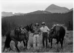 |
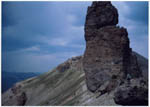 |
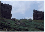 |
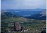 |
| Drs. Andrew Gulliford and Alfred Koumans approaching La Ventana, "The Window," on horseback in July of 2003. | View across the opening. (Photo by Andrew Gulliford, July 2003.) | "The
Window." (Photo by Andrew Gulliford, July 2003.) |
Fragment of the rock, downhill to the east. (Photo by Andrew Gulliford, July 2003.) |
This well-known treasure tale pertains to Spaniards, not Utes, but the setting is called the Old Ute Mine because it is near Ute Creek. The site is a short distance east of the Continental Divide, northwest of Pagosa Springs, in the area of La Ventana [name of an arch in Saguache County; Twin Mountains USGS map; elevation 8,927'] near Rio Grande Pyramid [13,756' summit in Hinsdale County, Colorado]. La Ventana, “the window,” is a notch on the Continental Divide that would indicate that searchers were close to the treasure. In about 1750 or 1780, Spanish-speaking miners from Taos, who were working a mine, were attacked by Indians. The miners were killed and their skeletons were left at the entrance to the mine. In the late 1800s a French prospector began searching for the mine, and when he died in the 1930s he left a map which he had drawn. According to the stories of two Hispanic men, they stumbled upon the cache in 1919. Another story is that Candido Archuleta found the location in 1912 while he was herding sheep in El Rincon La Vaca, but he had lost a paper with the address of the person whom he should notify to assure him of the cache’s exact site. Yet another version is that two Hispanic sheepherders said they found a site with bones, but they found no cache of gold. From time to time prospectors and sheepherders came into Durango with bags of ore, which they said came from Bear Creek, not far from Ute Creek. While attempting to return to this site, others inevitably became lost.
2. Treasure Mountain
Best known among the San Juan Mountains’ tales of lost gold is Treasure
Mountain, a peak located south of Wolf Creek Pass (Wolf Creek Pass
Another version of the Treasure Mountain story, placing the site almost on the Continental Divide, relates that Bernardo Sanchez was hired by Don Archuleta, a pioneer of Archuleta County, to guide him to Treasure Mountain. Although Archuleta invested considerable money in this venture, no treasure is known to have been found. Other attempts followed in vain. Treasure Falls on Treasure Creek, at the western foot of Wolf Creek Pass, reminds passersby of the Treasure Mountain legend.
3. Lieutenant Stewart’s placer, also known
as Kit Carson’s mine
During one of his journeys to California, Kit Carson is said to have
traveled with a contingent of the U.S. Army in 1847. Lore has it that they
traveled up the Rio Blanco and the San Juan River to avoid Indians and
followed Turkey Creek to Four Mile Creek. While washing pots and pans,
Lieutenant Stewart discovered flecks of gold in the stream and made a note of
the location so that he could return after the trip to California, but he lost
his notebook and, thus, the location.
Another story finds a Lieutenant Jim Stewart carrying mail to California in 1852, but Indians caused his party to take a detour up the Piedra River. Lore has it that Indians later destroyed landmarks so that the placer could not be found again.
4. Timber Hill
After stealing some gold bars from a smelter at Ophir, two smelter workers
departed on a circuitous route to Silverton and over Stony Pass. When a burro
“played out” near the eastern foot of Stony Pass, the thieves decided to
bury four bars and to take one with them with the intention of returning in
spring for the others. They left a blaze on a tree to identify the spot. One
man was shot in a bar and the other was too busy to return until, years later,
when the site was covered by a reservoir.
5.
Lost Trail
Ore being freighted in three ore wagons over Stony Pass became part of
legend. Near the Lost Trail junction, at the west end of Rio Grande Reservoir,
bandits were detected. Sacks of ore from two of the wagons were hidden in a
nearby marshy area before the robbers fell upon the teamsters, killed them,
and made off with the third wagon. Supposedly, the robbers took this wagon to
Silverton and sold the ore, and they never returned for the remainder.
* * * * * * * * * * * * * * * * * * * * * * * * * * *
* * * * * * * * * * * * * * * * * * * * * * * * * * * * * * * * * * * *
In the ensuing decades of the nineteenth and twentieth centuries, major
resource extraction industries within the San Juan Mountains included mining,
logging, and grazing both for sheep at high altitudes and for cattle at lower
elevations. Often accesses in and out of the forest represented an overlay of
historic trail use with newcomers using existing trail systems which, prior to
the access of railroads and forest roads, may have become toll roads. These
same trails, once used by Ute hunters, then miners and loggers, and then
sheepherders and cattlemen, now have recreational value for hikers and hunters
who access forest land.
Grazing on the forest has dramatically declined since World War II, specifically with precipitous change in markets for sheep, lambs, and wool. Cattle numbers have also been cut, in part for re-vegetation to occur in valleys and meadows deeply eroded because of overgrazing. Trail use continues, however, by hikers, backpackers and hunters. Recreational use may be one of the prime functions for these historic trails throughout the 21st century. For that reason, select trails in the San Juan National Forest need to be considered as traditional cultural properties, not linked to one particular ethnic group, but rather closely associated with continued use of the area by local inhabitants and visitors such as hikers who travel segments of the Colorado Trail. Such continuity over time and intimate familiarity with the local landscape is an essential part of historic preservation. Much more work needs to be done identifying, documenting, preserving and protecting historic corridors into and out of the San Juan Mountains, especially those corridors of original length and width that have not been converted into roads. These trails deserve Section 106 historic analysis and designation to the National Register of Historic Places. Contemporary hiking clubs may be stabilizing and modifying historic trails without adequate knowledge or awareness of associated historic resources.
The 1880s saw permanent mining in the San Juans with 30 years of successful mining between 1880 and 1910 after the Durango and Silverton Narrow Gauge Railroad moved north from Durango to haul ores down to the New York and San Juan Smelter. Silverton grew and prospered between 1880-1912 and all major stone and brick buildings and all formal clubs and organizations date from that era. In a single lifetime the Silverton mines boomed and declined. A young man arriving in Silverton at twenty-years-old in 1880 would have seen the town thrive, prosper, and decline by the time he reached fifty. In their heyday the mines brought to southern Colorado, Italians, Austrians from Tyrolia, English, Cornish, Welsh, German and Silesian miners as well as Chinese and Navajo railroad laborers.
Related roughly to the historic contexts developed for this portion of the state in 1984 by the Colorado Historical Society, mining in this region could be divided into at least two time frames. The earliest mining and its contribution to the settlement and urbanization of the area falls within the exploration period of the 1860s, and extends up to 1890. Individual prospectors and pioneer lode miners primarily characterized early mining. Unlike placer mining, lode mining in the San Juans required the import of various materials and equipment, forging the way for the development of transportation corridors and support communities. By 1890, many of the railroad lines and the town sites had been initiated, opening the region to larger scale corporate mining. The second time frame in mining covers the period after 1890 when large non-resident corporations ran the mines, and minerals were produced for an ever-broadening international market. In addition to precious metals, the mines in the San Juans produced zinc, lead, carnotite (which is processed into uranium and vanadium) and coal. Descendants of miners return to the San Juan country quite often to trace and commemorate their ancestors’ lives, and to visit their graves. The “old timers” of Silverton and Rico would be rich resources to interview for stories of who returns and how those visits are commemorated. Mining references are listed in the bibliography. Cemetery research, particularly the in depth work of Freda Peterson at the Silverton Cemetery, is also an important research source.
Suggested Traditional Cultural Properties In These Categories:
1. Mining and its contribution to urbanization, 1861-1891
|
Theme |
Type of Site |
Examples |
|
Establishments of towns |
Ghost town townsite |
Ironton, Animas Forks, Parrott City, Eureka, Howardsville |
|
Townsite |
Rico, Silverton |
|
|
Early prospectors |
A worked claim, cabins, small mining operations Arborglyphs |
|
|
Trails |
Burro trails, wagon routes used before the railroad arrived |
|
2. Modern mining and its national-international implications, 1882-1952
|
Theme |
Type of Site |
Examples |
|
Structures related to mining, but not directly used to mine |
Smelters, coke ovens |
Sunnyside Mill |
|
Mining structures |
Headframes, hoist houses |
Atlantic Cable headframe and hoist house |
|
Railroads/railroad related |
Railroad routes connecting mining locations and communities |
|
|
WWII Contributions |
Ore processing |
Uranium/vanadium production sites that have survived EPA clean ups |
|
Mining structures |
Van Winkle head frame in Rico |
|
|
Ethno-centric activities |
Ethnic neighborhoods in communities
Shrines |
|
|
Environmental clean-up |
If any sites exist that are 50 plus years old, headwater or discharge sites |
|
The Europeans soon became assimilated and their children learned English rapidly. In the quest for following veins of silver and gold, traditional native campsites would have been used by miners who may also have destroyed rock cairns and other Indians sites. At one time five narrow gauge railroads came in and out of Silverton and each railroad grade, following the path of least resistance, may also have impacted traditional native sites in the San Juans.
TRANSPORTATION: TRAILS AND WAGON ROADS
Many cultural groups used the same travel routes through the San Juan Mountains at different periods in time. Early footpaths led the way for hunters and gatherers, and may have been used later in time by the Utes. In 1859, Colonel John Macomb described worn trails from all directions converging on the Pagosa hot springs. An “Indian” trail traversed Coal Bank pass and down into the Animas Canyon, as reported by early miners and explorers.
In 1776, The Dominguez and Escalante expedition forged a route that became the basis for the Spanish Trail. Rumors of gold and silver in the San Juans furthered trail development as the potential prospectors followed routes known to trappers. Stony Pass was an ancient travel route, later used by the Utes and then by early miners. The Santa Fe, Pagosa Springs, Animas City, Silverton road lead miners to Baker’s Park (later Silverton) in the early 1860s. Various connecting routes departed from this road. A route connecting Animas City with Parrott City and Hesperus crossed the base of Animas Mountain at about the location of Miller Middle School and extended west to connect with Fort Lewis and Parrott City. The town of Rockwood was a connecting point on the Animas City-Silverton road for the wagon road to Rico. The early roads in the La Plata Mountains are not well documented and should be researched.
Agricultural transportation routes still have a place in the agricultural community, although they are slowly being displaced by modern conveniences. Stock drives now cross highways where there used to only be open country. One stock route still in use travels up East Animas Road (CR 250) in La Plata County, follows part of the former route of State Highway 160, and crosses over the modern highway north of the Needles store. The route continues to Durango Mountain Resort and up to the valley on the north side of the ski area. Some of this route roughly parallels the old Rockwood-Rico toll road. In many cases the highways we travel today follow established historic routes. The backcountry jeep roads all evolved from early travel ways between mines.
The material culture associated with the historic transportation routes hold great potential as TCPs. Post offices and tollbooths built along stagecoach and wagon roads should be anticipated in any cultural resource survey of these routes. Animal pens, arborglyphs and traditional camps should be expected along stock drives. Early electricity “line men” who traveled the routes of the power lines on skis and snowshoes had small shelters constructed to protect them when they were caught in the horrendous winter storms in the San Juan Mountains. These shelters could easily be confused with miners’ shelters and should be considered in relationship to the route of early electricity transmission lines. Some of the oldest former employees of the Western Colorado Power Company may be able to provide stories of these structures and the people associated with them.
RAILROADS
Following the removal of Ute Indians to reservations in 1881, the San Juan Mountains became an important location for mining, smelting, logging, commerce, and urban services, but the economic success of these enterprises depended on the development of rail transportation.
Equipment, supplies, merchandise, whiskey, and passengers were carried into the mountains, and ore, lumber, coal, livestock, and passengers were carried out. Because of the rugged terrain of the San Juan Mountains, the railroads built in this area usually required innovative engineering. All were narrow-gauge lines, commonly with steep gradients and tight curves. Although in some instances grades could follow, in part, the valleys carved by streams, round-about routes were required when a more direct line was impossible. I n addition to railroad corporations, some mines also operated tramways, and rails with freight cars connected to railroads.
Toll roads and railroads were essential to the survival of the isolated mining towns. Entrepreneur Otto Mears built so many of the transportation routes in southwestern Colorado that he is known as the “Pathfinder of the San Juans.” Mears is responsible for many routes, including:
- Silverton to Ouray toll road (Million Dollar Highway)
- Dallas-San Miguel-Rico toll road (partly the Dallas divide road)
- Silverton-Animas Forks-Mineral Point toll road
- Rio Grande Southern Railroad
- Silverton Railroad
- Silverton, Gladstone and Northerly Railroad
- Silverton Northern Railroad
Mears’ roads, and his spectacular engineering feats shaped Southwest Colorado. His work, alone, should be considered as a Multiple Property Listing on the National Register of Historic Places.
Even as toll roads were developed in the 1870s, the Denver and Rio Grande Railroad contemplated the best route to connect to the mineral rich San Juans. By 1881 the railroad had extended west from Alamosa to Durango, and was on its way to Silverton. The Rio Grande Southern was built to connect the western San Juans’ mining wealth to the existing Denver and Rio Grande Railroads at Ridgway and Durango. Since the RGS covered some of the most remote and rugged country in Colorado, the railroad also served as the only means for mail delivery and passenger travel. People in Rico boarded the train, for instance, to travel to their dentist, with plans to return the same day. Much of the highway that replaced the route of the RGS was not paved until the 1960s. The Rio Grande Southern reached Durango in 1893, and the route came from the west --Mancos.
The railroads had great impacts on the establishment and physical development of communities in the region. The town of Big Bend was located a few miles away from the proposed route of the Rio Grande Southern railroad; it was abandoned in favor of a new town along the route of the railroad named Dolores. Pagosa Springs suffered from a poor quality railroad spur connection to the main line of the Denver and Rio Grande, and never fully benefited from the railroad. Animas City soon faced obscurity as the Denver and Rio Grande built its own town of Durango located just a few miles to the south. It appears with the passage of time that Silverton ultimately won the location battle with the railroad. The depot is now in a deserted section of town and the train actually passes the depot to load and unload passengers in central Silverton.
The railroads also eased the development of a broader based economy, beyond the booms and busts of precious metal mining. Farmers and ranchers could capitalize on railroad freight rates to ship their produce and livestock. The railroads also brought goods and other elements of civilized society, such as teachers and clergy people. Communities with access to the railroad thrived, while the more isolated mining towns slowly withered.
The mountain climate created hazardous conditions, with long, cold winters bringing heavy snow and snowslides that frequently blocked routes, while the short summers might bring heavy rains and flash floods that brought mudslides and washouts. Railroad workers required unusual stamina. They were hard workers, or else they were fired or quit. They represented a variety of nationalities and races, including some Navajo construction workers. Hispanic men were in the majority among construction crews and gandy dancers (section crews). Yard workers came from various backgrounds, as did crews on trains, consisting of a hierarchy of conductors, engineers, brakemen, and firemen. Managers lived in nearby rail centers like Durango and Silverton, while owners lived in distant cities, with the exception of an individual like Otto Mears and lumber company men.
Many railroad rights-of-way have disappeared, but not the original Denver and Rio Grande. By an act of Congress, the Denver and Rio Grande Railway Corporation received its right-of-way as well as lands needed for depots, yards, shops, and other necessary facilities for the railroad’s operation. Because many of these railroads, their facilities, and associated towns occupied lands owned by or promoted by the railroads themselves, few of these properties are on public lands today, exceptions being small railroads that were abandoned, especially those serving lumber camps.
I. Railroads associated with mining and smelting of metals
A.
Denver and Rio Grande Western Railroad (1881-1968)
As the San Juan Extension was being constructed around the southern end of
the San Juan Mountains in 1881 from Antonito, Colorado, the railroad each month was
bringing hundreds of laborers to
work on grading crews. As John B. Norwood has described labor problems,
“Apparently most of the recruits deserted to the mines, returned home or
continued to other parts.” The
contractor said, “Our expense in this line clearly demonstrated that the
class of labor secured was the least desirable. Any number of worthless
fellows were anxious to get a free ride to Colorado.” Norwood continued,
“Out of this problem of recruiting labor grew an important decision: The Rio
Grande began recruiting local help, which meant the brown, lean and
ever-enduring Nuevo Mejicano. Indeed as the Rio Grande headed toward Santa Fe
and the San Juan, it was advancing into the heart of the New Mexican country
and culture. From that time forward, the Nuevo Mejicano would assume a
dominant role in the building of, and later, the maintenance of the roadway
and tracks of the narrow gauge.”
In 1881, the San Juan Extension of the Denver and Rio Grande Railroad reached the railroad’s own new town of Durango, just short of the existing town of Animas City, and quickly became the main shipping point and commercial center in the San Juan Basin. The railroad had a station, shops, roundhouse, yards, and other facilities that brought a large number of railroad employees to the area, many being Hispanic. Service on the San Juan Extension through Durango continued south to Farmington, New Mexico, on its Farmington Branch until 1968. The Silverton Branch [see below] continued as an excursion line.
The D&RG’s Silverton Branch, built in 1882 through Animas Canyon to Baker’s Park, where Silverton became the center for rail operations served silver and gold mines and smelters in the area. Construction of this branch required cutting a roadbed along a sheer rock cliff, called the High Line, above the Animas River where the gorge was too narrow to accommodate it. Frequent avalanches in the valley caused a snow shed to be built four miles south of Silverton. Three other narrow-gauge lines, owned by other companies, became feeders into the Silverton Branch at Silverton. After World War II Colorado and, with it, the San Juan region, changed rapidly, as population and tourism increased. When the D&RGW proposed to abandon its San Juan Extension in the 1950s, public clamor led to the ICC’s denial of the abandonment request. The D&RGW continued to operate the line, mostly for tourists, while pursuing abandonment of the line from Durango east to Antonito. The D&RGW succeeded in their efforts and made its last run between Durango and Antonito in 1968. The states of Colorado and New Mexico joined in the purchase of the Chama to Antonito route and developed the line as a tourist ride. Meanwhile the D&RGW had purchased a number of the buildings located around the Durango Depot with initial plans to develop the area as a tourist destination. The project broke down, the railroad leveled a number of the historic buildings it had purchased, and eventually the railroad sold the property to an out of town developer. The Durango-Silverton route was sold to Charles Bradshaw in 1981. Mr. Bradshaw succeeded, in 1988, in having the popular excursion route exempted from the oversight of the ICC, by successfully arguing that the train no longer carried any valuable freight other than tourists. The line was sold to another operator in the 1990s and continues to be a popular tourist attraction. It continues to provide the only mechanized access point, at Needleton Tank, for hikers visiting the remote Needles and Grenadier Mountains.
B. Rio
Grande Southern Railroad (1890-1960)
A narrow-gauge line built by Otto Mears and investors in Denver, the
Rio Grande Southern Railroad served the western area of the San Juans,
with its circuitous route passing through Telluride, Ophir, Lizard Head Pass,
Rico, Dolores, and Hesperus. This route was necessitated by the rugged
terrain of the mountains and Uncompahgre Gorge, and it advantageously served
important mining areas, lumber operations, and a coal mine. Its
operation was dependent on connections with the D&RG on the north at
Ridgway and on the south at Durango. It reached Rico in 1891, thereby
eliminating most traffic on the former Rockwood and Rico Wagon Road, and it
reached Durango from the west in 1893. The line was abandoned in
1951. Its trains carried freight and passengers, usually with a mixed
train. Between 1931 and abandonment, the line’s seven Galloping Geese
provided passenger and mail service with cars built with automobile engines
and rail wheels. Treasured by nostalgic rail fans today, they were
important to the way of life of local people and businesses along the line
during the Depression and World War II. Galloping
Goose No. 5, restored and operational, is kept at Dolores, while five others
still exist elsewhere. Several short lines connected lumber camps and
mines to the Rio Grande Southern. A spur of the RGS operated at Parrott
(Mayday) from 1906 to 1926. The spur began west of Hesperus.
C.
Silverton Railroad (1887-1924), also called the Red Mountain and
Silverton Railroad
Otto Mears built the twelve-mile-long Silverton
Railroad north from Silverton to Albany (near Ironton) by way of
Mineral Creek, Chattanooga, and Red Mountain with some short spurs.
The
original hope of investors was to connect Silverton and Ouray, but beyond
Albany, located in Red Mountain Park, there remained an impassable gap of
six miles to Ouray which forced the indefatigable Mears to construct
the circuitous Rio Grande Southern Railroad.
D.
Silverton, Gladstone, and Northern [sometimes Northerly]
Railroad (1899-c.1915)
This railroad along Cement Creek connected the Gladstone Mine to Silverton. It
had a never--achieved goal of reaching Lake City, too. Built by owners of the
Gladstone Mine, Otto Mears leased this railroad from 1910 until he bought it
in 1915 and then abandoned operations soon after the purchase.
E. Silverton Northern
Railroad ( 1895-1942)
The Silverton Northern Railroad was built by Otto Mears from Silverton
to Eureka, nine miles, in 1896 with an additional Green Mountain Branch, 1.3
miles, built in 1905. Mears also added a short spur into Cunningham Gulch.
The
Green Mountain Branch was removed in 1920, while the rest of the line closed
in 1939. Such extensions and removals reflected the current economics of
mining.
II. Railroads associated with coal mining
A.
Perins Peak Railway (1901-1926)
The five-mile, winding Perins Peak
Railway was built in 1901 by the Boston Coal and Fuel Company up Lightner
Creek to connect the Boston Coal Mine at Perins Peak to the Rio Grande
Southern Railroad at Franklin Junction, two miles west of Durango. The
railroad was sold to a subsidiary of the Denver and Rio Grande Railroad.
The D&RG leased the railroad to the RGS.
The line was abandoned in 1926.
III. Railroads associated with
lumber operations
While railroads were being constructed, timber was cut and milled along the
grades until the supply dwindled and spurs were built by lumber companies to
access stands of trees. Wood was used for railroad ties and for mine timbers,
as well as for construction of buildings and for fuel. In many places, logs
were skidded down to sawmills and rails. Names of some of these operations
changed from time to time, as did locations. Rails, mills, boilers, saws, and
shacks were moved from one location to another when an area became denuded and
new camps were set up in another part of the forest, leaving behind little
more than a pile of sawdust. After the San Juan Forest Reserve (1903) and,
next, the San Juan National Forest (1905) were created, the lumber industry
dropped off drastically, and the common practice ended of setting up new camps
served by spurs. Grades of many of these railroads have vanished from sight.
A. Rio Grande, Pagosa and Northern Railway (1899-1936)
Among several rail branches and spurs built north and south of the Denver and
Rio Grande, was the Rio Grande, Pagosa
and Northern Railway, built northward from Pagosa Junction to Pagosa
Springs in 1899-1900. The line was built by the Pagosa Lumber Company under an
agreement with the Denver and Rio Grande Railroad to eventually turn the line
over to the D&RG. It carried
lumber and sometimes other freight, sheep, mail, and passenger trains to and
from Pagosa Springs. In 1906 the
line became the D&RG Pagosa Springs Branch of the D&RG Railroad, which
operated the line until the Depression hit.
During its peak, three branches continued northward from Pagosa
Springs.
B.
Pagosa Lumber Company Railroad (1906-1916)
The Pagosa Lumber Company operated this subsidiary, running south along the
San Juan River from a point west of Pagosa Springs. It had more than fifty
miles of lumber spurs.
C. Dolores area lumber company railroads
This area had several lumber operations with railroads operated by lumber
companies. Two were operated by the Montezuma Lumber Company in the area
around Dolores and east of Norwood. One of these went to Haycamp Mesa with
several miles of spurs. It connected to the Rio Grande Southern Railroad at
Glencoe. The second Montezuma Lumber Company operation succeeded the Colorado
and Southwestern Railroad until about World War I. The Colorado and
Southwestern Railroad Company had taken over the Dolores, Paradox and Grand
Junction Railroad Company grade, which operated three lines north from Dolores
between 1913 and 1925, with the Horse Camp (or Horse Creek Camp) being the
center of its operations. It had more than fifty miles of track, including a
line between McPhee and Dolores until 1948.
The Rust’s Logging Railroad also served lumber companies between 1902
and 1906.
The material culture associated with the railroads is numerous and varied. The Fort Lewis College Office of Community Services has documented the remaining structures on the route of the Rio Grande Southern as part of the planning efforts for the San Juan Skyway. The Denver and Rio Grande route between Durango and Silverton now operates as a tourist ride, but the rolling stock is original (except for the diesel engines that are used in times of extremely high fire danger). The Durango-Silverton railroad, route and rolling stock are a national historic landmark (listed 1961). The Red Mountain Task Force has undertaken extensive cultural resource surveys in the mining district of the same name. The surveys have identified material culture related to both mining and the railroads. This survey work should be an important research resource. Volumes of material have been written about the railroads of the region and provide a good starting point in researching the railroads. The Center of Southwest Studies and the Animas Museum have oral histories of former railroad employees.
Automobiles and tourism have shaped many of the communities in the San Juan National Forest. Historic gas stations, auto courts and hotels are still to be found in most of these towns. Automobile travel brought more tourism, and affected the character of many communities with the introduction of automobile garages, gas stations, motels and restaurants that catered to travelers rather than to locals. Easier, more individualized transportation led to a recreation boom after World War II, resulting in new recreational facilities such as ski areas and additional campgrounds.
The less expensive transport afforded by truck travel led to demise of the railroads, but many communities still maintain ties to the railroad days. Dolores, for example, has resurrected the Galloping Goose, and built a replica of the old depot, while Mancos has built a visitor’s center in the style of its old depot.
Suggested Traditional Cultural Properties in this Category:
|
Theme |
Type of Site |
Examples |
|
Trails |
A trail segment re-used over time by various groups of people |
|
|
Railroads |
Support structures |
|
|
Freight related structures
Construction related activities |
|
|
|
|
Route of the transportation corridor |
|
|
Automobile Highways |
Tourism services |
|
|
Utility Corridors |
Electricity transmission lines |
|
HISPANIC CULTURE
Settlement by Europeans and people of mixed ancestry is relatively recent in the San Juan region. Ute Indians, and to a lesser extent Navajo Indians, were present in southwestern Colorado by A.D. 1300, approximately three centuries prior to the arrival of Spaniards in New Mexico and five and a half centuries before the United States took possession of what became southern Colorado in 1849. Spanish-speaking people did not settle in southern Colorado and the San Juan area after these regions were part of the United States. Spanish-speaking people had, however, been in the lower Chama River Valley since the mid-1700s, and only gradually did they move northward into the upper valley, where Indian raids still were discouraging newcomers as late as 1860. Nevertheless, by then, Tierra Amarilla was a permanent settlement. These families farmed and pastured sheep and goats on nearby land. As Hispaños subsequently moved into the San Juan Basin and the San Juan Mountains, the majority arrived from the south, either traveling by way of the Chama River or moving from previous homes in the Chama River Valley. In the 1870s Hispanics also were moving westward from the San Luis Valley, which had been settled in the 1850s by people from New Mexico.
When the mining excitement began about 1860, most prospectors entered the San Juan region by way of the Chama River. In 1859 U.S. Topographical Engineers under J. N. Macomb traveled up the Chama River to Pagosa Springs, and within weeks the Abiquiú, Pagosa, and Baker City Toll Road was organized on paper by Abiquiú’s Indian agent Albert H. Pfeiffer, Charles Baker, and others. With high hopes for profiting from the mining excitement, they also proposed moving the Indian agency to Pagosa Springs, and Pfeiffer even claimed ownership of the hot springs, although documents to prove such a claim are lost or nonexistent. The springs had long attracted many Indians to the healing waters, and a number of shelters had been built by the native people on the rocks. (See also, Pfeiffer-Navajo duel in the TCP Case Studies.) Establishment of Camp Plummer, later called Fort Lowell, at Tierra Amarilla in the 1860s provided increased safety for settlers and travelers in the Chama River Valley and north toward the San Juan Basin, in the area of the border between Colorado and New Mexico Territories. Following the Brunot Agreement signed in1874, freighting into the San Juan mines and settling of land in southwestern Colorado increased rapidly.
Before Fort Lewis was established in 1878, several Anglo people had settled at Pagosa Springs, one even claiming a mineral right that would be litigated for years. A few cabins were built, but most people camped there only in summer months while seeking cures for various ailments, and one such group, including a woman and boy leading a blind man, came in 1873 from Del Norte by way of the old Indian trail over Wolf Creek Pass. The arrival of Fort Lewis changed the economy and settlement of the area greatly as large quantities of corn, beef, hay, logs, shingles, and boards were required by the new post, although the Army post moved to the La Plata River within only three to four years.
While the post existed on the north side of the hot springs, a cluster of buildings and bathhouses was growing on the southeast side of the San Juan River and later occupied the fort’s site. The pine forests around Pagosa Springs and north of it attracted logging, and meadows became cattle pastures. Southwest of Pagosa Springs, the land was better suited to agriculture, with hay becoming an important crop. When Archuleta County was created in 1885, Pagosa Springs became its county seat.
I. Hispanic Settlement in Archuleta County
Published history about Pagosa Springs conveys
the impression that few if any Hispanic people lived in the area, but the name
alone of Archuleta County corrects this picture. The Archuleta family came
from the Chama River Valley to Conejos County (in the portion that became
Archuleta County). J. M. Archuleta, Sr., was elected state senator from that
county in 1876, but county officers were primarily Anglo-surnamed, then and
later, when Archuleta County was created from the western part of Conejos
County in 1885. The Archuleta family grazed livestock on the west side of the
Continental Divide, on Archuleta Mesa. Trouble arose because Pagosa Springs’
Anglos felt that they were taxed too much and the Archuletas were taxed too
little while they were being given preferential treatment by Ute Indians to
use their range land for grazing and to farm on shares. An indication of
ethnocentric attitudes is found in Los
Pobladores, which reports that when the school board at Pagosa Springs was
elected in 1886 (or 1885), Anglos “won out over the Mexican gang 15 to 1,”
according to the schoolteacher. Increasing numbers of Hispanic people were
settling along the Colorado-New Mexico border, while Anglos who attempted to
settle in the eastern end of the Southern Ute Indian Reservation were evicted
until allotment of the reservation in 1887. Regardless of existing ethnic
tensions, the county and Pagosa Springs were very dependent on business with
Hispanic sheep owners, herders, and the region’s wool brokers, as sheep
raising was a major industry.
Settlers also included individuals who were married to Spanish-speaking women. One such couple was Christian Stollsteimer and his wife Maria Amanda Barada, adopted daughter of famed fur trader Antoine Roubidoux. Beginning in about 1880, they ranched near the junction of the Piedra River and Stollsteimer Creek, at what became known as Francé. Stollsteimer was a partner with Albert Pfeiffer and others in grazing livestock. When Ute Indians protested that their cattle were trespassing on Indian land, Pfeiffer was able to get permission by identifying himself as part-owner of the livestock. Their original herd is said to have been brought to the Piedra River from the Rio Grande drainage, where both Pfeiffer and Stollsteimer had homes between Del Norte and South Fork; but the route used for moving the cattle across the Continental Divide is unknown. (The Wolf Creek Pass trail is said to be too precipitous on the west side for trailing cattle.) The Archuleta and Stollsteimer families were compatible, as is evidenced by the marriage of one of Christian’s daughters to an Archuleta.
In time, several families from the Conejos, Colorado, area moved west, joining other Hispanic people from the Chama Valley who lived in along the Piedra River and on or near the Southern Ute Reservation. Marriage between Ute Indians and Hispaños occurred. Stores in the area were owned by Chama River entrepreneurs. Besides farming and ranching, Hispanics worked at lumber mills, holding jobs especially on freight wagons, and at railroad facilities. Archuleta County’s Hispanic people occupied scattered farms or clustered settlements, not plazas built on a grid. Although there were Hispanic homes in La Plata County’s towns, like Ignacio and Bayfield, they were not numerous in Pagosa Springs. Homes and sheds were constructed with the materials that were present locally—normally adobe or logs.
II. Religion
Generally speaking, most Hispanic settlers in
southern Colorado and northern New Mexico were Roman Catholic. In rural areas,
the absence of resident priests caused the people to practice their religion
without close supervision, guidance, or Church sacraments - except when a
priest visited, as was the case during the early years of settlement in
southwestern Colorado. The absence of established churches belies the presence
of Hispanic, Catholic settlers.
Without priests, the devout people frequently had small shrines with sacred objects in their homes or even built oratorios where families and neighbors could gather for prayer. La Cofradia de Nuestro Padre Jesus Nazareno (also called La Hermandad de Nuestro Padre Jesus) was a brotherhood of men (often called Penitentes) who took care of many of the spiritual and social needs of the people. Meeting in a morada, a meetinghouse, they were assisted by women, who were called auxiliadores. One can assume that many men in the San Juan region were Penitentes, meeting at their moradas. Although Lenten and Holy Week rites have captured the attention of many gossips and writers, the Penitentes also were attending to important daily needs of their neighbors, such as performing wakes and burials, providing for widows, and even serving justice. Because the brotherhood was being suppressed by the Catholic Church in the latter part of the 1800s and the first half of the 1900s, secrecy became the norm.
Nonetheless, the brotherhood was very strong among rural residents in the area round Abiquiú, New Mexico, so it is reasonable to assume that the first Hispaños who moved up the Chama River Valley into the San Juan Basin were Penitentes. The same can be said about rural people who moved into the San Juan region from the San Luis Valley, where the brotherhood had numerous moradas until quite recently. Historian Virginia Simmons learned from a Penitente that there “used to be Penitentes around Pagosa Springs,” for instance, but it is unknown whether there are any now. A descendant of a family, many of whose members were Penitentes, says there were quite a few moradas but declined to reveal their location even to a relative. It seems unlikely that moradas would be very active today, since the numbers of brothers have decreased in the past few decades, even in the San Luis Valley, although some remain.
At least one Catholic chapel, built by local residents, did exist. For example, at Francé, a small Catholic church was built by the Stollsteimer family at their ranch on the Piedra River, southwest of Pagosa Springs, for services conducted by visiting priests and for private prayer. This adobe structure is still standing and is used on occasion.
Reflecting the Catholic Church’s inactivity rather than Hispanic numbers in southwestern Colorado, parishes were not organized in this region until the turn of the century. Rico was an exception with a small Catholic church built by about 1890, because Italians may have increased the need. Silverton’s Catholic church was built in 1905. In 1906 Sacred Heart Parish was established in South Durango for Hispanic and Italian Catholics, at first using an old schoolhouse that was purchased for its first church. Durango’s parish priests traveled to outlying missions at Ignacio, Allison, Hesperus, La Posta, Tiffany and Marvel. In 1940 a church was built at Ignacio, primarily for Hispanic people with a few Ute Indians as well, and its priest took charge of the missions to the east. Durango had Saint Columba Church and School established by an order of the Sisters of Mercy in 1881-1882. Although the ethnic orientation of Saint Columba’s parish was Irish, the Catholic Church was a very prominent early element of the community. Pagosa Springs had Saint Edwards Catholic Church, which was built in 1894 and burned in the 1950s. The Catholic Churches were all under the Bishop of Pueblo until the establishment of the Theatine Order in Durango, operating out of Sacred Heart Church in Durango. Pagosa Springs’ second Catholic Church, the Immaculate Heart of Mary, was built in 1948 and established its own parish in 1952.
III. Farming
Agriculture in southern Archuleta County was
predominantly devoted to livestock, chiefly sheep, with smaller numbers of
cattle and horses. Farms were mixed operations, raising some livestock and
some cash crops, mostly hay with lesser amounts of corn. Flood irrigation was
provided from small ditches. Families also raised kitchen gardens for home
consumption and some vegetable crops such as potatoes to sell to the mining
camps. Allotment of the Southern Ute Reservation attracted new landowners to
establish 160-acre farms along the Piedra, Los Pinos, and Florida Rivers, but
lands in the headwaters proved better suited to livestock and hay than to
tilling. Farther west, Anglo farmers, including Mormon settlers, were
producing hay, grain, and cattle in the La Plata River area. In Montezuma
County agriculture became dominated by farmland which produced pinto beans and
by range land, grazed by cattle, some belonging to very large outfits like the
Carlisle Cattle Company.
IV. Sheep grazing
Valleys in the headwaters of the San Juan River
and its larger tributaries, such as the Piedra River, offered excellent
grazing land, with stock numbering in the thousands. When Ernest Ingersoll
visited Pagosa Springs in 1882, he observed:
The vicinity of the springs is destined to yield large crops under irrigation, though at present there is little settlement there. Mexicans pasture their sheep as thickly as the fields will hold them; and try to give their flocks a few days in the basin at least once each season, believing that the drinking of the waters is of great benefit to the animals. . . . [The] upper part of the San Juan is unlikely to prove very profitable as agricultural land.
By 1890, according to Archuleta County’s assessment roll, there were 3,509 head of cattle, 17,840 sheep, and about 1,000 horses. By way of comparison, the number of sheep in all of Colorado in 1886 was two million. The economic downturn of the 1890s, due to both drought and depressed silver mining, seriously impacted all industries in Colorado, including sheep raising, and their market plunged. Following a recovery, by 1903 there were estimated to be in the San Juans 86,100 sheep which were owned in New Mexico and about 182,000 which were owned in Colorado, totaling 268,100. A report on the proposed San Juan Forest Reserve in 1903 listed the industries of the area as farming, sheep and cattle raising, lumbering, and mining, in that order of importance. In southwestern Colorado sheep outnumbered cattle by about three to one.
As available land and forage at lower elevations became insufficient year-round for large numbers of livestock, grazing practice had shifted in the 1880s from free roaming in valleys, mesas, and foothills to herding on mountain pastures in summer. Sheep thrived on alpine grasses and could negotiate rocky terrain but were destructive of ground cover and trails in lower areas where cattle could graze, with consequent quarrels between owners of sheep and cattle. By 1900 contention about preferred pastures, as well as ethnic conflict, frequently resulted in injury, murder, and killing of livestock. In western Colorado, hostility was especially virulent north of and along the Gunnison River, worse than in the San Juan area, although it existed there as well.
Generalizations that Anglos were cattlemen while Hispaños were sheep men do not always hold true, nor does information that one county or another was grazed solely or even primarily by cattle or sheep. Incorrect, too, are, the preconceptions that Hispanics did not own their own bands of sheep and that hired sheepherders always were Hispanic. As examples, the Archuleta family grazed large numbers of sheep on Archuleta Mesa, near the confluence of the Navajo and San Juan Rivers. The Stollsteimer family, part Hispanic, also owned large numbers of sheep, which they sold to Sargent at Chama. Some of the San Luis Valley’s major sheepmen also were Hispanic. And some of the herders were Ute or Navajo Indians.
Another outstanding example, Luis Montoya of Del Norte, refutes the ideas that Rio Grande County was used only by cattlemen during the grazing wars and that Hispaños did not own their own sheep. After operating a thriving freighting business between Del Norte and Summitville, he turned to ranching and raising sheep, the occupation his father and his brother also pursued. Some of Luis Montoya’s sheep were herded at Alberto Park, which Montoya named for his friend Albert Pfeiffer. This basin and Alberto Peak on the Continental Divide are at the Wolf Creek Ski Area, with spelling changed to “Alberta.” Another of Montoya’s friends was Ute Chief Ouray, who owned large numbers of sheep. Luis Montoya managed Ouray’s flocks. Montoya was the leading sheepman in southern Colorado with 10,000 sheep in the 1890s. As was customary, each of Luis’s sons was given a farm and a flock of sheep when he married.
Luis Montoya’s great granddaughter, Sarah Martinez, has described the high-country meadows where her family lived in a log cabin in the 1920s. The grass was about three feet tall, high enough that she recalls being able to hide in it when she was about six years old. Her father pastured sheep nearby, but no cattle, although the family had some milk cows.
The story of the José Adolpho White family of the San Luis Valley and the La Garita Stock Driveway have been described by his grandson, Frank White. When José first arrived in the Valley from New Mexico, he worked for early settlers, Espinosas and Trujillos, who had come in 1858 with sheep, goats, horses, and necessities for starting their ranch which was located at Carnero (now called La Garita). They gave White a few sheep and some land at La Garita Canyon, and he was able to buy the Espinosa property in 1894. He prospered as a sheepman. After the U.S. Forest Service came into being, sheep men in this area used the La Garita Stock Driveway. From La Garita Canyon, this driveway followed a trail that once had been used by Indians between the San Luis Valley and the Uncompaghre county and the San Juan Mountains.
When Forest Reserves and National Forests were created before and after 1900, grazing quotas and a permit system were established. Several stock driveways gave access to sheep, cattle, and horse pastures. Livestock, heading to allotments on forest land, were counted in pens at the entrance to driveways, and permit holders were assessed fees by animal units per month (AUMs). Originally, the allotments were for sheep, cattle, or horses. As horses that were used for transportation declined in numbers, horse allotments were eliminated, and some allotments became designated for “cattle and horses,” as some still are. Rangers checked allotments during the grazing season and often found livestock missing or on the wrong allotment. Despite many documented disputes involving cattlemen versus sheepmen, contention also occurred when sheep trespassed on an allotment that was leased to a different sheep permittee. Cattlemen were unhappy because fees per unit for cattle were about five times as high as for sheep. Despite resentment about fees and governmental interference, the advent of federal control helped reduce conflict and violence between people grazing cattle and sheep on public lands. In 1934 the Taylor Grazing Act introduced grazing regulations to other public lands that had not been covered previously by the national forests or reserved for other purposes.
In the San Luis Valley it was common for farming and sheep growing to go hand in hand. In early years of settlement, sheep came in handy for threshing grain, and in the first part of the 1900s farmers in the San Luis Valley who were growing large quantities of green peas and field peas put sheep on the cropland in winter, effectively cleaning up the fields and fertilizing them simultaneously. The sheep were moved to summer pastures on allotments in the Rio Grande National Forest.
V. Partido system
Many owners of sheep “rented” bands to individuals who hoped to build
up their own flocks. With this system, called partido,
an individual contracted with a sheep owner to herd a band with the
understanding that a certain percentage of the increase would become his.
The
herder risked going into debt to the owner if the flock decreased while in his
care, but by means of the partido,
system, many Hispanic herders were able to accumulate their own flocks. A
notable example was Luis Rivera, who started by herding for others and
eventually acquired his own large flocks. He is well remembered as a rico,
a prosperous patron of the Catholic Church at Capulin and a banker in La Jara
in the San Luis Valley.
A variation of the partido system was a contract used by Frank Bond of Española, who had mercantile stores and wool warehouses in the Chama River Valley and southwestern Colorado. Ed Sargent, who had warehouses in Antonito and Chama, also practiced this variation. These entrepreneurs used a contract that rented sheep for three to five years in exchange for wool at two pounds per head. This contract also involved risk to the renter, and indebtedness ensued.
VI. Herders
In the early years of settlement in the San Luis Valley, herders were the
young sons of Hispanic settlers or captive Indian boys, who tended the
livestock on open land in the Valley, without the necessity of going to high
pastures. As available land decreased, grazing moved up to mountain pastures.
The herders most often were Hispanic boys and men who returned to their homes
in the Valley for the remainder of the year. Native Americans also were hired.
An example of a family operation in the 1900s is that of Frank White. While he was a boy, Frank helped herd his family’s sheep in the San Juan Mountains. On the way up and down the La Garita Driveway White often found arrowheads and noticed “designs and markings” left by Indians. He also found tree stumps, which he believed Frémont’s party had cut during the disastrous expedition of 1848-1849. It is rumored that his grandfather long before had found the cache left by the Frémont party, and with the money he established his flock of sheep.
At a young age, herders became self-reliant. They normally camped in tents in the high country. Nights were cold, and rain or snow could make conditions miserable. At night the howling of coyotes and the hooting of owls added fear to the loneliness. Unless a sheep owner provided “store-bought” delicacies like potted meat and crackers, food usually consisted of beans, jerky, and coffee, supplemented by rabbits, squirrels, fish, and sometimes poached game. In the high country, edible wild greens and berries were scarce, but in sub-alpine country wild raspberries, wild currants, chokecherries, and rose hips were tasty additions in late summer. When illness or injuries occurred during the drives or in camp, remedios were at hand. Lore of folk medicines was well known and the materials for them were gathered—arnica, juniper berries, canaigre, thistle, wild onion, rabbitbrush, sagebrush, dandelion, evening primrose, bee plant, willow, yarrow, mint, wild tobacco, wild parsley. Where terrain permitted, some herders enjoyed the comforts of a sheepherder’s wagon with a small stove and a waterproof roof, but work still required a herder to be outdoors, often in inclement weather.
Herders had to keep their bands together and off poisonous weeds such as Loco Weed. Dogs helped by herding sheep, gathering strays, and protecting bands from predators such as bears and mountain lions but most especially coyotes. Burros and horses brought supplies from Creede and similar points in the lower county, but otherwise the herders were on their own, often with no company except the dog. As recently as the mid-1980s, Virginia Simmons, while camping, observed pack animals carrying supplies and blocks of salt on a trail leading from the La Manga Pass area into the south San Juans. Another time, a Mexican sheepherder with his dog tended a band of sheep while a short-wave radio played music from Juarez. In recent years there have been a few Basque, Mexican, and South American herders in the San Juans, as it has become harder to find herders willing to spend summers alone in high pastures.
In earlier years, herders were often men or boys from villages and small farms in the Conejos River area, whose extended families had settled on what was the Conejos Grant at the time. They had large families, and, as lands were parceled out to sons, the owners no longer were self-supporting so they accepted jobs. Loss of land to homesteaders or to new purchasers, and loss of water rights were additional causes of change. Virginia Simmons has personally been told of two incidents, illustrating that land loss was not easily accepted. In one instance, an Hispanic grandfather was shot and killed as a trespasser on land that had once belonged to him in Conejos County. In the other instance, an Hispanic man killed a cattleman who was trying to get land in Rio Grande County.
An oral interview with Jack Sylvester, who grew up at Center, Colorado, offers much detail about the life of a herder. He was born during World War I into a sheep-ranching family and grew up helping with sheep at home and herding sheep around the headwaters of the Rio Grande, in the area of Ute Creek. Following lambing in May and shearing around June 1, a crew of three to five herders would prepare to spend twenty-three days on the trail to the mountain meadows. Sheep were “counted in” at the corrals on June 20, and they were required to be back by September 15. He recalled the monotonous diet of mutton and beans, mutton and potatoes in camp, but he also fondly recalled the dogs, which responded faithfully to orders.
Although some ranchers did their own shearing, crews of Hispanic shearers went from ranch to ranch. While most worked in their own regions, some crews traveled great distances. Around 1900, J. C. Lobato, sheriff of Costilla County, was contracting to send crews to shear large flocks as far off as Nevada and Montana. Besides the expert task of shearing, “wool stompers” were hired to pack the wool into large bags, holding three hundred pounds of wool.
VII. Marketing
lambs and wool
In 1882 Ernest Ingersoll provided his observations about the value of sheep in
southern Colorado:
[Antonito, which Ingersoll calls by the earlier name “Conejos”] is the headquarters of sheep and cattle men of the San Luis Park [Valley]. In sheep, I learn that although about two hundred and fifty thousand are sold out of the park annually, fully five hundred thousand are left. The large majority of these are of the inferior sort called Mexican sheep, which are worth from one dollar to one dollar and twenty five cents a head. The better minority will sell at one dollar and fifty centers and two dollars a head, and this minority is increasing though a constant effort to improve the breed by introducing highly bred Merino and Cotswold rams. The average yield is two and a half pounds of wool annually, and the product is shipped almost entirely to Philadelphia, for use in making carpets. Cattle is less an industry here, because the sheep are so numerous as to consume most of the pasturage. Something like ten thousand head, however, are able to exist in the park and adjacent foothills, and are sold to great advantage.
Along the San Juan Extension of the D&RG, thousands of head of sheep and cattle were shipped each fall. Along the line, herders brought their bands to corrals, located at sidings where livestock was loaded into stock cars for their journey east. Chama and Osier were important shipping points in the mountains, while towns like Antonito, La Jara, and Del Norte in the San Luis Valley were filled with dust and the bleating and bawling of livestock. Narrow-gauge stock cars for sheep had two levels, into which the sheep were led by a “Judas goat.” In the San Luis Valley, an informant has said that many of the sheep were shipped under contract to Kansas City, where the contractor paid for freight as well as for animals. On the west side of the Divide, stations like Arboles and Chama were important. Later, trucks replaced shipping by rail. Dipping vats for sheep or cattle were used to kill diseases and ticks. These were located near points for shipping, whether by train or by truck. Beside a road in Saguache County, a deep trench, lined with concrete, had been cut in a low rise for use with cattle. Nearby were a boiler and a corral. A shallower trench would have been required for sheep.
In the fall, Jack Sylvester reported, his father sorted the lambs and sold about ninety percent, while keeping the rest to breed. Ewes cleaned up the fields in the winter, and some old ones were sold as mutton to Indians and Mexicans. Sylvester said that a sheep ranch had only two pay days, one being when wool was sold and the other being when lambs were sold.
After a slump in prices during the 1920s and 1930s, World War II revived the market for sheep and wool. The military fed mutton, not lamb, to soldiers, who retained a distaste for this kind of meat after the war. Large quantities of wool went into uniforms. In 1954 sheep and wool industry received a major boost when the National Wool Act provided a subsidy to supplement what growers received for wool and mohair, a goat hair. The development of synthetic fabrics similar to wool became increasingly available, and the subsidy was lost in 1995. Many sheep growers went out of the business subsequently, despite a new tariff on lamb imports, which were coming principally from Australia and New Zealand. Another negative impact on sheep growing in the late 1990s was the outlawing of commercial poisons for coyotes, which proliferated and created a major problem for sheep ranchers.
VIII. Allotments and stock driveways
The use of allotments and stock driveways reflects not only the policies
of the U.S. Forest Service and the Bureau of Land Management but also changes
in transportation and economics. Prior to motorized transportation, each
national forest had several stock driveway, crossing well-known passes, such
as Bonito, Hunchback, Wolf Creek, Lizard Head, and many others, plus those
winding through the forests without crossing the Divide.
On the San Juan National Forest, the Pagosa Ranger District had three stock driveways. These now are integrated with recreational use and are not used for livestock. For several years, stock has been trucked to allotments. In this district there are thirty-two allotments, and in 2002 none were being used by sheep. Cattlemen using allotments include a Jicarilla Apache and two Hispanic-surnamed permittees.
In the Columbine Ranger District, which includes Bureau of Land Management allotments north of Silverton and on the Continental Divide, there are a total of forty-seven allotments. Of these 31 are cattle grazing permits and sixteen are sheep, although at present the sheep allotments on the Continental Divide are vacant with the exception of the BLM’s Maggie Gulch permit. No old driveways are presently being used, although there are four newer ones in existence. Most of the stock owners are Anglo ranchers from Montrose, an exception being an owner of Basque heritage. This ranger district also includes the La Plata Mountains, but all the sheep allotments there are vacant.
The Lost Canyon Stock Driveway provided access for sheep as well as lesser numbers of cattle on Haycamp Mesa in the Dolores River area. This driveway is in the Mancos-Dolores Ranger District. (See appendix #1).
From the San Luis Valley stock was moved into the Rio Grande National Forest on three stock driveways in what is now called the Conejos Peak Ranger District. Two of these are active in 2002, one starting at La Manga Pass and the other in the Alamosa River area. The former lies only in the Rio Grande National Forest. South of La Manga Pass, in winter sheep go to grazing areas in Carson National Forest, so some sheep are almost never on private land. In the Conejos Peak district, all but one of its allotments are presently being used, with sixteen being sheep allotments. Historically, stock around La Jara used the short driveways west of that town in the Alamosa River area to drive their livestock to allotments in Rio Grande National Forest. The explanation for the continued high use of these allotments is easy, short access to them.
Farther north in the Rio Grande National Forest, about a half dozen stock driveways entered the San Juan Mountains, with others being in the La Garita Mountains. Historically, the most heavily used of these driveways was the La Garita Stock Driveway, which crossed the La Garita Mountains and continued into the San Juans in the Creede District. (The Creede and the Del Norte Ranger Districts have been combined under the name of the Divide Ranger District.) In 2002 there were a total of nearly five dozen grazing allotments in the Divide district, twenty-six of them being designated as sheep and goat allotments, but seventeen of these were vacant. Of those being grazed by sheep, three were in the Stony Pass area, contiguous to the San Juan National Forest; with the sheep being trucked up to the Continental Divide from Silverton.
Because of its historical importance, the La Garita Stock Driveway warrants a description, as written by Frank White:
[From the mouth of La Garita Canyon, it crosses] La Garita Divide to La Mesa de Neaves (near Lake City and Creede.} Then follows the Continental divide to West Ute Creek at the head waters of the Rio Grande also near Silverton. . . Sheepmen from throughout the San Luis Valley use this trail, some as far south as San Luis, Conejos and Capulin. In the early years they would spend close to two months as they drove their sheep across the Valley up the La Garita Stock Driveway to their summer ranges above timberline on the Alpine Boles, mesas and meadows of the La Garita Mountains. At the peak of its use well over one hundred thousand sheep traveled through this driveway both spring and fall.
AGRICULTURE AND SETTLEMENT
Open range grazing was practiced in the area from the 1870s until the passage of the Taylor Grazing Act of 1934. Ranching within the range of the San Juan National Forest is limited to seasonal activities, because of the elevation and climate of the region. Regular farming does not normally occur in this area, but the nearby farming activities at lower elevations are dependent on water emanating from the San Juan Mountains. The Montezuma Valley irrigation project, for instance, diverted water from the Dolores River in 1899, bolstering agriculture and instigating the settlement of Cortez.
Travel routes to specific locations and areas would define some potential TCPs as was addressed in the stock driveways in the Transportation category. Stock driveways were most strongly affected after WWII, when improved roads in southwest Colorado encouraged trucking livestock over the highways. Livestock, however, are still herded short distances.
Livestock herding has additional potential for TCPs in terms of sheep and cow camps. These camps are temporary by nature, but the general location of each camp is usually the same from year to year. The USFS and BLM grazing permit process is a good starting point to identify areas used and long term users. Oral interviews with the herders would be the best source to identify specific grazing patterns and camps. Arborglyphs, which are mostly attributed to sheepherders, might provide insight into traditional grazing activities, mostly practiced by Hispanics and Basques.
Year round activities could reflect communal efforts such as water storage and development, and centralized collection and distribution of livestock and produce. The water management issues have very intensive federal involvement and would also fit within a category addressing federal involvement in the region. (Note: see the Public Land Management Category for related topics).
Suggested Traditional Cultural Properties in this Category
|
Theme |
Type of Site |
Examples |
|
Traditional grazing practices |
Stock drive route |
|
|
Arborglyphs |
|
|
|
Traditional locations of temporary sheep camps |
|
|
|
Structures associated with seasonal livestock management |
|
|
|
Year round agriculture community activities |
Common processing, administrative, social or distribution buildings |
|
|
Water management features |
|
Without the lure of a desirable resource, the San Juan area is mostly too high in elevation and too cold to draw many permanent residents. Free land in the form of homesteading and the precious metals in the high country were the primary draws to the region. Communities in Southwest Colorado were usually the result of speculative real estate ventures featuring plots of land carved into rectangular grids, with scant recognition of the topographic constraints to development. Most communities were inspired by one of three opportunities--mining, the railroads, or agriculture. Pagosa Springs is an exception because it was platted by the Federal Government on public land and sold at auction after Fort Lewis moved away. Railroad towns, usually platted by railroad officials or in a partnership between the railroad and local railroad investors, featured the depot at the center of the town and oriented the grid parallel to the railroad route. Mining and agriculture towns that developed prior to the railroad usually had the depot and freight yards located at the edge of town, or at least in an area removed from the commercial core. The original character of these towns continues today, thanks to their basic layout and orientation of uses.
Towns that do not follow the model of railroad, agricultural or mining basis are also important because they represent an unusual development in local history. Rockwood, for instance, was first settled along the Animas City-Silverton road and became a pivotal point for a brief time as the junction for the Rico Road before the Rio Grande Southern provided reliable transportation to Rico. Modern Ute settlement was also affected by these three factors, combined with the Federal Government’s intent to prioritize white settlement over native traditional living patterns.
The evolving cultural development of these communities is still evident in the architecture and in some social customs of each surviving town. Carnegie libraries still survive in Silverton and Durango. Ethnic enclaves or neighborhoods, reinforced by religious and social affiliations, remain albeit they are diminished from their historic composition. In Durango, for instance, the Irish Catholics affiliated with St. Columba Church while the Hispanic and Italian Catholics worshipped at Sacred Heart Church. Navajos working in Rico all lived in the same neighborhood. Fraternal organizations, such as the Masons, are represented in practically all of the surviving communities by lodges or halls. Sometimes the historic buildings have been replaced, but the gathering place remains at the same location. This is the case with the Pagosa Springs Methodist Church, which has been at the same location since the 1880s.
Cemeteries also include information about the ethnic make up of a community. Cemeteries often suffer as communities grow in unexpected directions, leaving the graveyard in obscurity on the edge of town or even cut through by a road. Not only do the graves in the cemetery provide some clue as to the backgrounds of the residents, but also the layout of the cemetery often reflected the community values of the times. The prostitutes usually had a section of their own. Certain ethnic groups were separated from the main portion of the cemetery. Ghost towns also have potential to provide insight into their social structures through historic archaeological investigations.
Many of the towns in the study area have completed at least a partial architectural inventory of their community. Each town hall is an excellent resource for inventory forms and historic plats. The Colorado Historical Society’s site form inventory also includes inventory forms that were completed in these communities for state or federally funded projects. The local historical society for each town or county and the local libraries provide additional useful information. Many long-term social and religious organizations have official and /or unofficial historians who can provide valuable information as to the role of these organizations in modern society.
Some of the least known and documented resources with TCP potential are isolated rural buildings, such as country schoolhouses and former post offices. Many of these structures were abandoned when they were no longer needed, leaving behind people who cherished the memories of the place but are no longer active in its preservation. Allen Nossaman’s Many More Mountains, Volume 1, includes a list of early post offices in the San Juan County area that could be consulted in future cultural resource surveys. Many of the local historical societies have records of rural schoolhouses. The role of women and ethnic groups are still under represented in research and documentation of community development. Hispanic families were particularly powerful in Archuleta County economy and should be addressed further.
Suggested Traditional Cultural Properties in this Category
|
Theme |
Type of Site |
Example |
|
Community Establishment |
Typical Railroad town (depot and tracks center of layout) |
|
|
Typical Mining town (railroad presence not as strong) |
|
|
|
Typical Agricultural town design (often had larger lots) |
|
|
|
Cemetery
|
|
|
|
Development of social and religious organizations |
Building or location where an organization functions |
|
LOGGING AND TIMBER
Logging enjoyed an intense but short-lived prosperity in the area. Logging companies harvested timber between 1890 and 1945. By 1896, the New Mexico Lumber Company, under the direction of Edgar Biggs, C.D. McPhee and J.J. McGinnty, reached Colorado and created the towns of Chromo and Edith. The Pagosa Lumber Company run by Alexander T. Sullenberger soon followed in 1899. Both logging companies built numerous short railroad lines to transport the timber they harvested. While these railroads were specifically oriented toward freight, they raised great hopes and expectations in Pagosa Springs about new connections with the Denver and Rio Grande Railroad line and ultimately with the outside world.
Having depleted most of the timber resources in the San Juan River area, Sullenberger closed his operation in 1916 and moved on to other ventures in the Pagosa Springs area. His Pagosa and Northern Railroad continued under the Denver and Rio Grande Railroad’s ownership to provide a railroad connection (described by many as a bumpy experience at best) between Pagosa Springs and the main Denver and Rio Grande line located about 25 miles to the south in Pagosa Junction. The New Mexico Lumber Company moved to the Dolores area, building what was Colorado’s largest sawmill in 1924 and establishing a townsite named McPhee. New Mexico Lumber harvested timber until 1933. Resource depletion and the Depression ended any major lumbering activity in the region, although lumber mills operated sporadically in Pagosa Springs, Durango and the Dolores area until the mid 1970s. Very little material culture remains of the sawmill operations. A recent headline in a Pagosa Springs real estate guide touted the removal of the ugly eyesores that were the remains of the last major sawmill in Pagosa Springs. In the Dolores area, anything left of the McPhee townsite is under McPhee Reservoir.
Cultural resource surveys of the old logging railroad rights of ways and abandoned towns would provide new information about lumber operations in Southwest Colorado. A number of former sawmill employees live in the Pagosa Springs area. Some of the long term USFS employees stationed in the Pagosa Springs or Dolores offices may know of good candidates for interviews about this topic.
Suggested Traditional Cultural Properties in this Category
|
Theme |
Type of Site |
Examples |
|
Logging sites |
Camp |
|
|
Town |
|
|
|
Logging equipment |
Sawmills |
|
|
Logging Railroads |
Rights of ways |
|
FEDERAL PUBLIC LAND MANAGEMENT
The establishment of National Forest Reserves in southern Colorado was a part of President Theodore Roosevelt’s administrative policy to actively manage the public holdings in the West. The San Juan National Forest originally encompassed vast terrain located roughly between Dolores and the San Luis Valley. It was established in 1905 with a supervisor’s office in Monte Vista. The Forest Service initiated management of grazing on the Federal Government holdings of the area with the first grazing tax in 1906.
A new Rio Grande Forest was carved out of the San Juan Forest in 1908, maintaining the Monte Vista office as the headquarters for the Rio Grande Forest. A Durango National Forest was split from the San Juan National Forest (SJNF) in 1911. New offices were set up in Durango for its namesake national forest. The remaining, now reduced, San Juan National Forest was headquartered in the Pagosa Springs area in 1911. The first known Pagosa Springs office was the ranger station now known as the Treasure Guard Station located about four miles east of town. Pagosa Springs remained the headquarters for the SJNF until 1920, when the Durango National Forest consolidated back into the SJNF and the main office was located in Durango. All of the buildings associated with early years of the National Forest should be considered potential TCPs based on the role they played both locally and nationally.
Other USFS buildings of note include the employee housing and administrative office buildings constructed during the Depression in Durango, Dolores and Pagosa Springs. All of these structures are designed in a variant of the Pueblo Revival Style and are distinctive structures within their communities. The Forest Service also owns a number of log cabin style buildings that served as administrative offices, and in some cases as ranger residences. Examples of these historic structures include the Columbine Guard Station complex (which is now the Adaptive Sports Association) and the Columbine warming hut complex at the bottom of the Durango Mountain Resort, and the Aspen Guard Station located outside of Mancos, which is used by the USFS for their “Artists in Residence” program.
Other public land agencies began to have a presence in the early 1900s. Mesa Verde Park was established in 1906, ten years before the National Park Service’s creation and Hovenweep was designated in 1923. The Federal Grazing Act of 1934 extended the federal role in the lives of livestock raisers, and led to the creation of the Bureau of Land Management in 1946 when the Taylor Grazing Service Office was merged with the General Land Office. The BLM took an active role in managing the resources of public lands including agriculture, grazing, and oil and gas development.
In 1975 President Ford designated the Weminuche Wilderness under the 1964 National Wilderness Act. The Weminuche designation highlighted the beginning of a major shift in the approach to managing the National Forests, adding recreation to Roosevelt’s initial efforts toward managing the natural resources. Increased tourism and recreation have added a new dimension to the National Forest. Recreation is clearly evident in the expanded hunting, camping, hiking trails, back roads, and ski areas and in the increasing conflicts between users in search of compatible facilities. Multiple generations of families return to the same camping, hunting or fishing spots and may be creating traditional cultural properties of the future.
Federal
Programs
The Federal Government has an extensive presence in Southwest Colorado.
Following the negotiations and agreements with the Utes that were designed to
open the area to mineral development in the 1870s, the Federal Government
actively pursued ways to encourage farming and settlement by aiding the
railroads and making large tracts of land available to homesteading.
Depression-era public works projects proliferated in this region including projects in rural areas and on public lands, as well as public buildings in many communities. The federal devaluation of the dollar in 1934 led to an increase in the value of gold and an upturn in mining the old claims in the San Juans. Silver also appreciated in 1934 as a result of the Silver Purchase Act of the same year. Federal involvement continued into the Cold War era with the funding of uranium mining and processing through the Atomic Energy Commission. Many of the paved roads in southwest Colorado resulted from Federal funding after World War II to ease access to mines. The Rural Electrification Administration encouraged expansion of electrical service, providing for the development of cooperatives to purchase and distribute electricity in rural areas.
Water development, a powerful and omnipresent issue in the semi-arid climate of Southwest Colorado, was (and continues to be) a major Federal activity. WPA projects and the Bureau of Reclamation funded numerous water projects, including Vallecito Reservoir in 1938. McPhee Reservoir and Lemon Dam were also built using federal funds. A comprehensive survey of federal water projects within or next to the National Forest has not been undertaken.
Suggested Traditional Cultural Properties in this Category
|
Theme |
Type of Site |
Examples |
|
Administration of the National Forest |
Log structures |
|
|
Pueblo Revival structures |
|
|
|
Atomic Energy Commission Presence in the area |
Material culture remaining from carnotite mining |
|
|
Water projects |
Material culture |
|
ELECTRICAL POWER CORRIDORS
Electricity came early to the San Juans, partly due to the first industrial application of alternating current to power the mines at Ames in 1890. The demand for electricity for both the mines and the communities of the area inspired numerous private entrepreneurial developments of hydroelectric plants. Electra Lake and Trout Lake are water storage facilities built for power plants.
The Durango Power and Light Company was operating by 1886, Rico had a hydropower plant located at the Rio Grande Southern depot complex after 1890. The Animas Power Plant near Rockwood was working by 1906, and the Bridal Veil Powerhouse was operating by 1907. While some of these facilities no longer function, others remain a part of the modern power grid that serves southwestern Colorado. After closing in 1953, the Bridal Veil Powerhouse sat idle until the 1980s, when a Telluride innovator purchased the building from Idarado Mining and returned the building to its original function. The Durango Power and Light’s second plant operated until the 1970s and now waits for a new use.
In 1913, the Western Colorado Power Company purchased many of the power plants and provided consolidated power to the San Juans up to the late 1960s. All of the remaining power buildings and their associated water control features are important elements in the development of electrical power in the region. Records of the Western Colorado Power Company are archived at the Center of Southwest Studies.
Suggested Traditional Cultural Properties in this Category
|
Theme |
Type of Site |
Examples |
|
History of Hydroelectric Power |
Power Plants |
|
|
|
Water storage and control features |
|
NATURAL DISASTERS IN THE SAN JUANS
Fires, floods and avalanches characterize natural phenomena in the area. The Lime Creek Burn, which was the largest wildfire in Colorado history until 2002, covered 26,000 acres of land located between Cascade Creek and Grand Turk Mountain. Although the area burned in 1879, the sparse timber and scarring is still evident. In 1940, over 27,000 Englemann spruce seedlings were planted, resulting in the linear alignment of timber that is visible today. At over 10,000 feet in elevation, the sparse landscape has yet to return to its “pre-fire” condition and remains a testament to the devastation of more than 120 years ago.
There has been much speculation over whether this fire was a natural event or a last act of desperation by the Utes in resistance to the white incursion into their country. Allen Nossaman provides a thorough discussion of the various points of view in Many More Mountains, Volume 2, pages 258-265, and supports the currently held theory that it is more likely that this fire was a natural event, precipitated by an extremely dry spring. The timing of this fire prior to the Meeker Massacre caused a reaction in southern Colorado that bolstered funding and troops at Fort Lewis and relocated the fort to the more strategic La Plata drainage location.
In contrast to the parched conditions related to the Lime Creek Burn, the summer and fall of 1911 saw one of the wettest and most disastrous seasons in history. Heavy rains saturated the grounds until early October when the San Juan, Dolores and Animas River drainages all flooded. Pagosa Springs, Dolores, Rico, Durango, Silverton, Mancos and every other settlement located near a river in Southwestern Colorado suffered massive devastation from flooding that fall. Every town has its own story of the effects of this flood, which triggered extensive rebuilding. Information on this flood can be found in the local histories of each community and via local historical societies. FEMA (Federal Emergency Management Agency) and the Army Corps of Engineers, who administer activities within designated floodplains, may also provide additional data.
The rivers beginning in and crossing through the San Juan National Forest have great potential as TCPs. The rivers are important sources of food and plant materials for textiles. They provided the first source of (placer) mining and they provide the water for hydroelectric plants. The river corridors helped defined numerous transportation routes. The route of the Durango-Silverton railroad through the canyons of the Animas is as famous as the narrow gauge rolling stock.
In the high country that feeds the rivers, the San Juan Country has three key ingredients leading to high avalanche probability. Climates with broad fluctuations in temperatures, steep slopes, and high winds combine in the San Juans and the La Platas to create potential avalanche hazards. Modern travelers see the latest attempts to live with avalanches in the snow sheds built on Wolf Creek Pass and Red Mountain Pass. Early settlers and miners had much less protection, and had to adapt their activities to mother nature as much as they could. All mining histories of this region are filled with stories of deaths from avalanches. More research is necessary to determine which of the slide paths hold historical and ethnic cultural meaning, but the Riverside slide path between Silverton and Ouray is a likely TCP candidate. The slide has killed recent Colorado Department of Transportation snowplow drivers as well as travelers from 100 years ago.
Suggested Traditional Cultural Properties in this Category
|
Theme |
Type of Site |
Examples |
|
Fire |
Burn Sites |
|
|
Flood |
Structures built after flood |
|
|
Avalanche |
Slide Path |
|
Case Study: Avalanche Paths and “The White Death”
The Utes sensibly stayed out of the high mountains after the first snows of winter, but Anglo explorers coming into the country up Lime Creek and over Stony Pass learned to stay and build cabins despite the deep snows. By the 1880s as San Juan mining became more feasible with the arrival of the railroad into Silverton, gold and silver mining became a year around proposition. In the winter getting out of the mines and into town often meant life or death challenges with avalanches. The history of the San Juans is the history of struggle and survival with the elements, and there are countless tales of death due to winter weather, poor decisions, and accidents on snow-covered slopes. For both previous and current generations of San Juan residents there are tales of winter survival and ingenious methods of negotiating treacherous avalanche paths.
In his classic book on Southwest Colorado titled One Man’s West, David Lavender writes about working at the Camp Bird Mine and how in the 1930s “In wintertime the continual passage of the mules keeps a narrow ribbon of snow packed hard and firm, but to either side of this path is a soft, almost bottomless white morass.” He describes winter snows 35 feet deep and packers who placed blazes on trees. The trail blazes could not be seen at deep snow depths so packers “marked their route by tying rags to the tips of branches which at the time were within arm’s reach.” Lavender describes the confusion of summer tourists who could not imagine how fluttering bits of colored cloth got so high up on the pine trees.
The San Juans represent some of the highest mountains in the Rocky Mountain cordillera. Colorado has more 14,000-foot peaks than any other state, and the highest concentration of 13,000 foot peaks are in the San Juan Mountain range. Navigating through the mountain valleys and gulches in deep snow, especially in late winter and early spring, challenged many a miner. Lavender writes in One Man’s West, “Down the slope we’d just quit pounded the avalanche. A cloud of powdered snow rose hundreds of feet above it. Through the reverberations we could hear the air popping like a giant whip as it rushed in to fill the vacuum left by the slides.” He adds, “A wall of air surged ahead, booming like thunder from cliff to cliff.”
From Cascade Creek to Ouray are more avalanche runs than anywhere else in the United States. Over 100 runs exist and 60 cross U.S. Highway 550 as it moves north over Coal Bank Pass, Molas Pass, and then Red Mountain. Named avalanches along that route have claimed miners on foot, travelers in wagons, and even whole towns like Chattanooga. There are photographs, folk tales, accurate historical accounts, and markers left to commemorate the dead. A few of these avalanche paths qualify as traditional cultural properties because of the way they have been marked. The East Riverside avalanche path contains highway monuments for two snowplow drivers and a minister and his daughters who died within the last 25 years. Earlier deaths are also noted both in books by John Marshall and Jerry Roberts Living and Dying in Avalanche Country, and John W. Jenkins' Colorado Avalanche Disasters.
Jenkins describes an 1898 avalanche that descended 5,000 vertical feet in a run that extended four and a half miles with a wall of snow moving 225 miles per hour. Because traditional cultural properties link people to place, and because nowhere in the nation are there as many avalanches as in the San Juan Mountains, then the historic and contemporary responses to “the White Death,” represent TCPs erected by ongoing mountain communities. Most TCPs are specific to ethnic groups like Native Americans, but in the high altitude San Juans avalanches have resulted in specific responses to the landscape such as triangle-shaped stone diversion structures intended to deflect avalanches like those up Arrastra Gulch, and even living diversions such as the thick stands of pine trees planted just to the north of the Christ of the Mines Shrine at Silverton.
The slides have names like Henry Brown, Swamp, King Mine, Peacock, Battleship, the Brooklyn Group, Muleshoe, Telescope, Porcupine and Eagle. Avalanche runs have been christened Rock Wall, Snowflake, Wagon Box, Blue Point, Slippery Jim and Mother Cline. Hundreds of miners had to traverse the mountains even when “the avalanches were running on every hand.” Slides took out boardinghouses, tent houses and men walking to work on trails. Immediately search crews would begin to look for their friends trapped in the deep snow. Some were found and dug out immediately, and others were not found until spring, dead, at the bottom of gullies.
A powder cloud traveling at a moderate avalanche speed of 60 miles per hour because of snow crystals would have the same force as a 180 mile per hour wind, and the impact force of the snow can be 30-50 tons per square yard destroying everything in its path. That’s why avalanche deaths are commemorated, and that’s why avalanche paths sometimes have memorials near them. Future TCP research in the San Juans should include the human response to avalanche fatalities at specific sites and the commemoration of other winter deaths in the San Juans by markers and monuments. In New Mexico roadside crosses are considered by the State Historic Preservation Office to be TCPs, and here in southwest Colorado there are also markers near avalanche paths that should be identified, inventoried and protected as cultural resources.
San Juan Forest Area Historical Timeline
Seventeenth and Eighteenth Centuries
| 1626 |
|
| 1700 |
|
| 1760s |
|
| 1765 |
|
| 1776 |
|
Nineteenth Century
| 1824 |
|
| 1829 |
|
| 1833 |
|
| 1848 |
|
| 1852 |
|
| 1859 |
|
| 1860 |
|
| 1870 |
|
| 1871 |
|
| 1870s |
|
| 1872 |
|
| 1874 |
|
| 1876 |
|
| 1877 |
|
| 1878 |
|
| 1879 |
|
| 1880 |
|
| 1881 |
|
| 1882 |
|
| 1884 |
|
| 1885 |
|
| 1889 |
|
| 1890 |
|
| 1891 |
|
| 1892 |
|
| 1893 |
|
| 1894 |
|
| 1895 |
|
| 1898-99 |
|
| 1899 |
|
Twentieth Century
| 1901 |
|
| 1902 |
|
| 1903-04 |
|
| 1905-06 |
|
| 1905 |
|
| 1906 |
|
| 1909-1910 |
|
| 1911 |
|
| 1912 |
|
| 1913 |
|
| 1916 |
|
| 1918 |
|
| 1920 |
|
| 1921 |
|
| 1923 |
|
| 1926-1927 |
|
| 1930s |
|
| 1934 |
|
| 1936 |
|
| 1937-1940 |
|
| 1938 |
|
| 1938-1940 |
|
| 1940 |
|
| 1941 |
|
| 1946 |
|
| 1947 |
|
| 1952 |
|
| 1958 |
|
| 1963 |
|
| 1964 |
|
| 1975 | Congressional approval of the 500,000 acre Weminuche Wilderness within the San Juan National Forest. |
| 1977 | Drought. |
| 1979 | September 23: Last grizzly killed in Colorado in the south San Juans at the headwaters of the Navajo River. |
| 1981-82 | Heavy snow year. Pushed hundreds of elk into the Animas Valley. Now they are acclimated to winter feeding in the valley. |
III. Case Studies: Listing of Sites to Research as Possible Traditional Cultural Properties
A. Native American sites
Beaver Creek Massacre Site (Traditional Weminuche
hunting camp)
Located 16 miles north of Dolores and the site of Colorado’s last
Indian battle where a hunting party was attacked by local cowboys. On June 19,
1885, six Utes, three men, two women and a child were killed by Anglo gunmen.
The site is considered sacred by contemporary Ute Mountain Utes.
Big Water Springs
This possible TCP site is in Dolores County near Bradfield
Bridge. It appears to be both a Ute site and a lumber camp.
Chimney Rock
This is a very significant Ancestral Puebloan outlier site still in use
by Native American groups for summer singing and dancing. The 3,160 acre
Chimney Rock Archaeological District on the National Register of Historic
Places contains 90 sites and a Pueblo II greathouse of 55 rooms. The site
contains two major clusters including a small house village and a greathouse
with two kivas. The site may have been a base for Native Americans to gather
forest resources for the Chacoan system or it may have been a religious colony
and astronomical observatory for both solar and lunar observations, because
full moons rise near the pinnacles close to the time of winter solstices and a
phenomena known as “lunar standstills.” Anthropologist McKim Malville
correlates forty such events that coincide with two tree ring dates of 1076
and 1093 from the Great House. This would have made the site very
powerful and important during the second half of the eleventh century.
Eleven stone tablets or feather holders were found in which prayer feathers,
or paho sticks, may have been inserted indicating the site was a shrine and
prehistoric pilgrimage site. Pueblo tribes today still go on pilgrimages to
leave prayer sticks at a variety of shrines.
Each year tribal members from Taos come to bless the site because they believe that one of the Taos clans originated there. Beginning in 1968, Navajo crews did extensive rock and masonry work and stabilized the site and the kivas and house structures. The twin rocks of the site, Chimney rock and Companion rock may represent the mythological Twin War Gods, which are essential to Pueblo mythologies and origin stories that focus on the duality of human nature. Lister argues that the stone monoliths represent “the legendary province of the Twin War Gods” and that perhaps the Twin War Gods are there at Chimney Rock “enshrined in stone.”
East Animas Rock Art Site
Contains four petroglyphs of animals. Also known as the Watch Crystal
site on Bureau
Falls Creek
This is an extremely important Basketmaker II site from AD 1-500 that
is actually three sites, two rock shelters and an open hillside or talus slope
village. Over 42 individuals were excavated
here and Native Americans believe that those human remains should be returned
and re-interred. Material from the site includes human burials now stored at
Mesa Verde National Park, and rare artifacts including baskets, sandals, and a
necklace held at the Center of Southwest Studies on the Fort Lewis College
campus.
The Department of Agriculture issued a permit for excavation in 1938 and Earl Morris continued it in 1940. This is probably the most significant prehistoric high elevation site (at almost 8,000 feet) in the two million acre national forest and it is the northeastern most settlement of the Basketmakers ever found. The Falls Creek site defines the eastern Basketmaker tradition with both a North Shelter and South Shelter and it is the earliest evidence of planting corn.
Rock art from the site dates to 2300 BP, although heaviest occupation of the site was about AD 50. Listed on the National Register in 1993 as an Archaeological Area, a survey of an adjacent 1,500 acres revealed 51 additional sites including Basketmaker II, Basketmaker III, Pueblo I, and both protohistoric and historic periods, which would include Ute. Falls Creek qualifies as a TCP not because of the burials or the human habitation sites, but because of the highly specialized rock art and the “scores of small red, green, and black figures.” (Western San Juan Mountains, p. 203).
Piedra Pass in the Weminuche Wilderness
Evidence of Archaic hunters and probably much historic use, too.
Culturally Scarred Trees
Found throughout the Rocky Mountains, ritually scarred or culturally
scarred trees are a valuable Native American artifact or cultural resource.
In
the San Juan forest 104 sites have been identified with ritual scars on
ponderosa pines including at the Williams Creek and Target Tree campgrounds.
As in the Northwest, these scars may have been the result of Indian bands
traveling through the forest when food was hard to find and thus using the
cambium layer or inner bark either for themselves of as fodder for horses
during times of “dietary stress.” Processed in the spring, the inner bark
may have been consumed as a sweet delicacy when the sap was running. Scarred
trees are found alone or in groups and the largest cluster is 21 trees with a
total of 188 scarred trees identified on the forest. Removal of the bark, at
least among the Kootenai of Montana and Idaho, was a female task.
In comparison with scars or blazes used as trail markers, Native American scarred trees etched to reach the inner bark, have large oval scars often with ax marks at top or bottom and are often found along trails or water courses such as the Silverton to Rico wagon road remnant west of South Mineral Creek. Scarred ponderosas can also be found in wetlands along the trail to Ice Lakes. The cambium layer may have had medicinal value for Utes. In one Colorado study of 40 scarred trees, Martorano dated the trees between 1815 to 1875 when the Utes were being pushed out of their traditional areas by Anglo and EuroAmerican expansion in the state.
A San Juan National Forest campground that has two outstanding examples of culturally scarred trees is the Target Tree Campground just east of the Mancos Hill. Known as Ivikukuch or target tree, the site represents a place on the forest where Utes used a large ponderosa pine for target practice and where they gathered ponderosa pine sap for a kind of candy and then used the inner cambium bark of the tree for soups, stews and for making an herbal tea.
Interpretive signs bear the seal of the Ute Mountain Ute tribe and list Terry Knight as a consultant. One text panel reads, “As you explore Colorado you may notice large oval-shaped ‘scars’ on other ponderosa pines. This is evidence that the area was once Ute land. If, indeed, only the Utes practiced scarring on ponderosa pines and if those scars represent boundary markers, then perhaps those trees have both cultural and historical significance.
Navajo Sweatlodges
Found on the Dolores District
these were built and used by Navajo laborers working for the New Mexico Lumber
Company in the 1920s. One sweatlodge is at Miller Camp.
Pfeiffer -Navajo Indian duel—Highway plaque on U.S. 160
Accompanied by Ute mercenaries,
Albert H. Pfeiffer had served in the Navajo Campaign of 1863-1864. At one time
he was an Indian agent in the Chama Valley, and he was well-known as a friend
of the Ute Indians of southern Colorado and northern New Mexico, who adopted
him as a tribal member. The Utes and Navajos had been traditional enemies for
generations, frequently contesting land, respectively, north and south of the
San Juan River. The Pagosa Hot Springs was a site of contention concerning
ownership. To settle this dispute, members of the two tribes finally agreed to
engage in a duel between a representative of each tribe. A plaque, installed
in 1965 about eight miles west of downtown Pagosa Springs on the north side of
U.S. Highway 160, commemorates a duel in 1866 between Colonel Albert H.
Pfeiffer and a Navajo Indian. If the date of 1866 is accepted, the Navajos
would have been individuals who avoided incarceration at Fort Sumner. Because
this plaque is seen by many people traveling on U.S. 160, and because the
episode of the duel is sometimes questioned as a fabrication by revisionist
historians, this is presented here.
According to Charles O. Elliott, great-grandson of Albert H. Pfeiffer, the story told by Elliott’s grandparents, confirmed by Albert Pfeiffer himself during his lifetime, is that the duel took place in this manner. Utes and Navajos at the Pagosa Hot Springs were engaged in a fight that began at the Pagosa Hot Springs. Fighting with bows and arrows, they worked their way westward without victory for either side. Finally they agreed to a duel to settle their dispute, and a very large Navajo came forward to represent his tribe. The Utes, being short of stature, were reluctant to fight him, and Pfeiffer volunteered to be their representative, provided that he could choose the weapons, which turned out to be bowie knives, as well as rules for the fight. Because he had once been shot by a Navajo who had hidden a pistol under his blanket (Pfeiffer carried the bullet in his groin to his death), Pfeiffer stipulated that he and the Navajo would strip to the waist and that they would duel with knives. Pfeiffer stabbed the Navajo in the heart, killing him and thereby guaranteeing possession of the Pagosa Hot Springs for Ute Indians.
Early pioneers accepted this story as true. The site of this event was marked with a pile of rocks which later were removed during highway construction and were replaced a few yards away with the historical marker, where picnic tables are located. The marker was provided in 1965 by the State Historical Society of Colorado and the State Department of Game, Fish, and Parks.
Hesperus Mountain
This is one of the four sacred mountains in Navajo cosmology and
represents the northwest boundary
of the Navajo cultural area. See the
attached detailed case study.
Indian Trail Ridge (also known as the Highline Trail)
Spring Creek
The Spring Creek Archaeological District, south of Bayfield, was listed
on the National Register in 1984 and contains 15 prehistoric sites and ten
unrecorded sites dating from the Archaic through Ancestral Puebloan,
Athabaskan and Ute. Structures include pithouses, jacal room blocks and
possibly kivas.
Star Bead Shelter (5MT5380)
A Ute burial ca. 1860 overlooking the Dolores River Canyon is a crevice
burial with EuroAmerican goods such as glass seed beads, brass percussion caps
and a German silver concho. This is similar to the Los Atavios burial
(5MT5399) which included human remains and grave goods and was also recovered
by the Dolores Archaeological Project.
Twin Buttes
Between Durango and Lightner Creek, these buttes may have been sacred
to the Navajos as the route of U.S. Highway 160 parallels what some maps have
labeled as the Navajo Trail towards Cortez, Colorado.
Ute Trail segment
A trail segment originally ran where the road now goes between Coal
Bank Pass and Silverton and another Ute trail segment probably paralleled the
Lime Creek Road.
B. Hispanic Sites
Arrastra Gulch
Use of stone arrastras as an Hispanic mining and ore processing
technique is actually a centuries-old Moorish technique for extracting gold.
Silverton miners claimed to have found traces of mining from their Spanish
predecessors into the San Juans.
Aspen Art or arborglyphs
A total of 151 individual aspen carving sites with numerous carved
trees at each site have been identified in the San Juans. One site contains
150 carvings. Additional funding for this research has been provided to the
San Juans Mountain Association by the State Historical Fund based on earlier
surveys of aspen art. See John Peel, “Herders’ history told on aspen
trees,” Durango Herald, Aug. 6, 2001; Karen Thurman, “The Wooden Canvas:
Documenting Historic Aspen Art Carvings in Southwest Colorado” in Heritage
Matters, Nov. 2001; Electra Draper, “Aspen carvings speak volumes to
researchers,” in Denver Post, Nov.
14, 2001.
Historic Stock Driveways/Sheep Access
La Garita Stock Driveway, for instance, pre-dates establishment of the
San Juan National Forest in 1905 and was used extensively by Hispanic herders
from the San Luis Valley to the east of the San Juans to bring bands of sheep
west up and into high mountain meadows near Silverton. While herding sheep,
many of the male herders who lived during the winter in northern New Mexico,
would access high mountain meadows to gather roots and herbs. Also needing
study is the Pine-Piedra Stock Driveway and Hispanic grazing lease allotments.
C. Anglo-European Sites
Easter Ruin
Located in Canyon of the
Ancients may be a TCP for ranching families from Montezuma County who would use the site as a community gathering
place especially for activities around Easter. More oral history interviewing
needs to occur to document this site.
Christ of the Mines Shrine
Red Mountain Pass Highway Markers/Associations
with Accidental Death in the San Juans
See the Otto Mears highway marker and the marker to honor snowplow
drivers.
There are also two graves and markers near Chattanooga.
See
the detailed case study on avalanche paths and the White Death.
Italian stone bake ovens (?)
These interesting rock ovens are along railroad right-of-ways for two
of Otto Mears' railroads—the RR to Ironton from Silverton and
the RR to Dolores. Exact use and identification remains unclear.
Lime Creek Road
This is a forest road which is overlaid on the route used by the Baker
party in 1860. Includes CCC era road work and stone road barriers.
Historic Trails:
These are trails that were not
expanded into roads, have been used for decades, if not
centuries, and retain their sense of historic character and integrity of
place. They may also be associated with significant local sites and mines or
with local historic people such as Olga Little who brought pack trains from
Durango with food, supplies, and coal for miners to remote mines including the
Neglected Mine.
Junction Creek Trail
As hunting and mining access from the east into the La Plata Mountains.
Bear Creek Trail near Ouray
Access to the Grizzly mine; high on the north side of Bear Creek.
Now part of
recreational runs which link mining communities.
At present this
trail is also part of the National Trail system.
Engineer Trail is on historic maps with connecting routes.
Gold Belt Trail is north and east of Ouray and connects with other trails.
Gold Run Trail is on the Forest map near Dolores and went to Parrott City.
Highline Trail connects at the top of Kennebec Pass and heads north towards Rico.
Horsethief Trail connects
just north of Ouray and then goes towards Lake City.
Ute Indians used this trail to steal horses from the Ouray-Montrose
area and then they would take the animals to Lake City for sale.
A year or
two later they would steal them back and re-sell them elsewhere.
Rico to Silverton Trail can still be found and begins just west of the South Mineral Creek Campground. Scarred ponderosa pines are on this trail.
Purgatory to Rico Trail also bisects the mountains and contains both Native American and historic Anglo-European sites.
Historic Stock Driveways/Cattle Access:
Sites associated with Anglo
grazing sites in the high country since the 1870s may include corrals, meadows
and trail access and possibly even grazing allotments. One trail worth
studying that accessed the La Platas from the west side is the Good Hope Stock Driveway and the
Lost Canyon Stock Drive on the Dolores Ranger District. A recent
report has been researched on the Lost Canyon Stock Drive and is included in
the bibliography. Also worth studying would be the Mancos-Rico Wagon Road and the
Pine
River Trail.
Pyramid Peak and La Ventanna or The Window
Information about Pyramid Peak,
which is mentioned in the Ute Creek treasure tale (La
Mina Perdida de la Ventana), comes from the Franklin Rhoda survey in 1874
and is quoted in part from
Sprague, The Great Gates.
Rhoda’s party climbed “the Rio Grande Pyramid (13,838), twelve
miles southeast of Stony Pass. They were astonished to find on top a neat
ptarmigans nest of alpine grass, and ‘a nicely built monument of stones,
which we increased in height to about six feet. . . .The fact that the
monument was on the true summit indicated the fact that its builder was
something else than a common miner’.”
This peak, so named because of its symmetrical shape, is on the Bend of
the Continental Divide, a fifty-mile curve lying between Spring Creek Pass and
Weminuche Pass. The Window is a notch in the mountains regularly used as a
landmark by explorers. See earlier remarks in this report under mining. Both
Pyramid Peak and La Ventenna are clearly visible from many miles and are on
the same landscape plane.
Rock Cairns -- high elevation—as part of
surveyors’ work.
No study of cairns has yet been undertaken on the San Juan
Forest. Some will be sheepherder’s cairns; some may be Ute cairns or
possibly older, and some cairns will represent ongoing TCPs by local hikers
and climbers proud of their ascents. Twin Buttes—cairn on tallest butte or
east butte as an ongoing TCP.
Stony Pass (Anglo and Hispanic)
This is clearly a TCP and deserving of National Register eligibility.
See the bibliography for references to excellent work by Cathy Kindquist on
this significant corridor.
TCP Consultation and Management: Other Perspectives
Former federal employee of the Advisory Council on Historic Preservation, and now an independent consultant, Dr. Thomas King quotes Gordon Mohs as stating, “Without a proper inventory under the direction and control of Native people . . . It is doubtful that many spiritual sites will survive modern land uses.” King recently worked with the Sierra and Inyo National Forests who were updating their management plans for three federally designated wilderness areas that included ancient and important trade trails running across the “Range of Light” between the Sierra Nevada near Yosemite and Sequoia-Kings Canyon National Parks and California’s San Joaquin Valley on the west and the Great Basin on the east.
Some archaeological survey had been done and tribes had identified some areas of importance, but the information was relatively scarce. After lengthy consultation, which included Anglo outfitters and packers who represented a multi-generation community of interests in the mountains, the entire group decided not to engage in extensive inventory. Protocols for consultation were more important. The group agreed that they did not know all of the spiritual places along the trails before developing plans for trail access and management of areas defined by the tribes as sensitive.
King’s advice on TCPs is to “think through your management needs as the basis for deciding what (if any) identification you need.” In Glacier National Park he refers to recommendations for management that include hiker control, signage, limiting use of access roads and closing other roads, and installation of interpretive exhibits in cooperation with the Blackfeet. He believes that “in managing land one is trying to keep some sort of distance between TCPs and incompatible use.”
Management goals must be clear because tribes may not want to share sensitive information. Under 1992 revisions of the National Historic Preservation Act they do not have to, and federal agencies may not be able to do exactly what tribes request anyway. King suggests “active cooperative management” in the development of cultural resource management plans including regularly scheduled meetings to discuss management issues. Tribes may also ask federal agencies to hire tribal members to work on trail maintenance and “other activities that may have cultural implications.”
Dr. King refers to the Bureau of Land Management in California, which has negotiated a number of consultative agreements or “protocols” with tribes. He also suggests the concept of “ethno-habitat” described as “culturally defined places that may be associated with culturally important plant or animal species.” Key sacred site qualities for the Lummi Tribe include purity or protection from human disturbance, privacy or protection from observation by outsiders, isolation or separation from visual and auditory impacts, and permanence or protection from future disturbance. The goal is to manage properties to protect cultural values. King argues that what is important is real management of sites, not naming a place a National Register property.
Dr. King also argues that fallibility with the National Historic Preservation Act may limit a TCP as an ongoing cultural site when sites should represent a living part of the community life and development. He quotes James Weiner and Robert Winthrop, who advise, “The objective of cultural resource management policy should not be to ensure the strict perpetuation of earlier practices, or to demand an unbroken continuity of ritual observance. Rather to the extent feasible federal policy should be directed towards protecting and extending access to those resources and landscapes through which traditions can be adapted and renewed.”
The San Juan TCP Team agrees with some of Thomas King’s thinking, but also feels that much more site inventory needs to occur in the San Juan Mountains and that consultation should be on-going. Re-establishment of a San Juan Cultural Heritage Committee, as discussed in the Heritage Resources Management Issues Discussion: Special Topic Workgroup Meeting, November 20 1997, is an excellent idea. What follows are some additional considerations, conclusions and recommendations that are specific to resources in southwest Colorado.
Theoretical Considerations of Southwest Colorado Traditional Cultural Properties
We need expansion of vision in understanding overall cultural uses. Geography creates Traditional Cultural Places, and geography is cultural landscape. We must not delineate thousands of years of routes and uses at a particular location without considering that location as a Traditional Cultural Place.
v Ancestral Puebloan Contact with Ute ancestors. Future work in survey must address this contact issue through field archaeology and anthropology. Why does appearance of minimal ancestral Puebloan use of alpine forest and tundra suggest a culture already in place? Why do some Ute stories suggest a common ground with ancestral Puebloan people? Is there evidence we have overlooked?
v
Forests
and archaeology. Fires may provide opportunities to survey prehistoric
culture where there were once dense forest groves.
Historic Ute Land Usage
v We need to determine patterns and trails of Ute migration prior to Spanish arrival. We need a watchful eye for inscriptions and scarred or culturally modified pine trees.
v We need to know more a bout Ute contact with the Spanish. When did it occur? What evidence can we pursue to help understand the extent of that contact?
v What was the Ute contact with trappers in the Southern Rockies, probably from Taos? Because they were Anglo illegally trapping on what was then Mexican soil, what can we learn from Spanish archives? Where did this occur in the San Juan? What were the relationships created?
v How can scarred trees and historic inscription help tell the story? How can we create a terminology for different types of scarring, and how do those relate to differing cultural uses?
v We need an adequate survey for Ute Rock Art in arboreal regions.
v
What trails did the Ute people travel? Did those trails become
trails used by miners?
v What evidence can we find of the smaller wood or mountain bison or other wildlife using trail routes?
v Is there a way to estimate an overview of camps, locations, and numbers of individuals in each? Can we distinguish between traditional family hunting and summer areas versus group camp locations?
Spanish Explorers and Settlers
v When did exploration and naming first occur? What records are available in Spanish archives that may shed life on San Juan Forest uses by those first explorers? Can we develop an extended chronology of people and times in the San Juan Forest?
v How did early Spanish prospectors interact with Ute people in mining ventures?
v How did early Spanish mine? What evidences were found by 1860/1870 prospectors? Are visible evidences left? Place names exist such as Arrastra Gulch east of Silverton.
v Do inscriptions still exist on scarred trees of Spanish Exploration? What criteria can be established for identification of Spanish inscriptions on trees or stone?
Historic Anglo Explorers and Settlers
v Who were the earliest arrivals? When did they arrive?
v What trails were they following? What trails did they create?
v Where did they camp? What settlements were founded? Is there evidence of these locations left?
v What identification criteria may we design for routes and camps of early surveys?
v When did domestic livestock first arrive on both the east and west sides of the forest? When did sheep arrive and when did sheep and cattle first start grazing the higher elevations? Where did cowboys or herders camp? What trails did they use? What areas were grazed? What evidence on the ground verify those assumptions/observations?
v Identify and record inscriptions and scarred trees to help explain the movement. What types of blazing techniques were used? Can we identify and age different periods and types of blazes? What criteria should we use in recording and identification? Can we map and record cairn placements?
v Where are the first transportation routes in the early days of mining? Can we identify remnants through evidence?
v Where are outlaw camps, trails and hideouts, particularly in Montezuma County? What criteria should we develop in their selection?
v Where are camps that sprung up with the building of the railroad and shortly thereafter? Where are the areas that were cut for ties and bridge timbers? Where are stops along the line?
v Where are locations of hunting camps? How have they changed through time?
v Where evidences exist for WPA, CCC or other similar projects?
v Where are routes for early power and phone?
v Where are evidences of early water diversion and storage?
v Where are traditional food gathering areas for mushrooms, berries, herbs etc. for all cultures?
v Where are evidences of traditional trapping grounds, movements and dates? What evidence may we define for identification criteria?
IV. Conclusions and Recommendations:
Traditional cultural properties are now considered eligible for listing on the National Register of Historic Places under guidelines proposed in Bulletin #38, and as explained in the special issue of CRM titled “What You Do and How We Think.” TCPs represent sites that may have archaeological values, but they are cultural resource areas still in use or highly valued by local ethnic groups or groups associated with the sites such as Native American tribes. The sites represent respect for the past and the ancestors as well as current living traditions. TCPs are places that have been utilized for at least the last fifty years. Though Native Americans prefer to call TCPs traditional cultural places, they are in fact traditional cultural properties, and unlike songs, dances, etc. must be grounded in a physical setting.
All Ancestral Pueblo National Register significant properties are eligible for TCP status. These types of sites probably comprise 80-90% of all designated archaeological properties in southwest Colorado on public and private lands. Site significance is detailed on site forms on file at the Colorado State Historic Preservation Office and copies of the site numbers and names are available to researchers. Clearly, there is a problem with regard to consultation for TCPs in southwest Colorado, because the State does not have Ancestral Pueblo descendants on the Native American Commission. This impedes the initial process of contacting and consulting with the historical descendents and, ultimately, with the process of getting interpretations for TCP’s. The omission is detrimental to traditional descendents and researchers alike. If the State of Colorado, which holds the records of significance and supervises the National Register nomination process, provided a structure for initial TCP consultation, it would promote the processes of consultation and site interpretation and benefit all involved.
At the present time, most consultation on state and national levels is focused on NAGPRA issues, not on TCPs. These may overlap but are not equal. TCP consultation should be developed and pursued on a regular basis, separate from NAGPRA, because it allows descendants to learn about specific places from their histories; offers possibilities for interpretation of public properties and for academic, professional, and avocational research; and possibly sheds light on NAGPRA claims. As noted above, the State could facilitate this by establishing channels of communication that enhance the possibilities for TCP interpretations.
Research on TCPs must be interdisciplinary requiring information that comes from archaeology, ethnology, history, oral history and on the ground site visitation. Additional research and fieldwork is required to verify traditional cultural properties on San Juan Forest and adjacent public lands. Once a type of site is selected for further research, then a literature search, archaeological review, and oral interviews should be conducted. Unaltered Indian trails later used by miners to access remote mine locations may represent TCPs after adequate identification and documentation has been undertaken. Over centuries, those trails have evolved from Native American trails, to miners’ trails, to hikers trails. From a USFS perspective, one issue is how would management be different if a site is listed as a TCP instead of significant under criteria A? If a segment of an original trail or toll road is identified and documented with a D.O.E. or determination of eligibility as a transportation feature, should it or can it be listed as a TCP and placed on the National Register of Historic Places?
If mining sites and high country trails are possible TCPs, then so may be cattle gathering sites for ranching, historic stock trails that represent historic and continuous use, and other ranch-related sites that reflect ongoing traditions on public land that may be half a century or older.
Unfortunately, there are no non-Native American sites currently listed on the National Register as Traditional Cultural Places. This is in part because the importance of the site to a living culture is its main justification and hence the site can not be abandoned but must represent continuous use. If for tribes like the Utes and Navajos a site is important but does not reflect continuing use, then it may be more expedient to list the site as historic. Culturally scarred Ponderosa pines are also not found on the National Register as either historic sites or TCPs though clearly they had deep meaning to local Indian bands and represent a use of the landscape that occurred throughout the Southwest. Perhaps they can be listed in conjunction with adjacent camp sites or trails, but so far culturally modified trees have not come before the National Park Service for a D.O.E. or a determination of eligibility for the Register. Cultural sites are more clearly protected if they are located within either a documented archaeological or historical context.
Significant ongoing research questions include: Do culturally scarred ponderosa pines represent continuity of use and ongoing Ute Indian traditions? Are concentrations of arborglyphs on aspen trees that are adjacent to sheepherding stock driveways significant to living communities of Hispanic herders when those glyphs contain names, dates and other historical and artistic data? As Bulletin #38 of the National Register recommends, “Particularly where large projects or large land areas are involved, or where it is likely that particularly sensitive resources may be at issue, formal ethnographic studies should be carried out, by or under the supervision of a professionally qualified cultural anthropologist.” (p.9).
Unfortunately, though long range research on Ute use of the forest and public lands would be extremely valuable, current recommendations of the Ute Mountain Utes call for no such research. Instead, Terry Knight is recommending that consultation occur only within the framework of a “need to know” approach on specific sites. Better understanding of historic and contemporary Ute use of public lands within a broader context may not be possible at this time, though ongoing research related to the Animas La Plata project in Ridges Basin may open new avenues for dialogue and consultation.
Development, identification and consideration of TCPs
The following recommendations will assist in defining and locating TCPs in the San Juan National Forest.
Mapping
Mapping is an important tool in
defining both large scale TCPs and specific boundaries of a TCP. Maps
illustrate spatial relationships and help in assessing how different cultural
groups may have used the same locations at different points in time. The following recommendations address ways to capitalize on known
cultural locations.
1) Map existing database to identify larger scale TCPs and to predict
modeling of TCPs
Resource procurement sites, such
as quarries or areas with high concentrations of desirable plant materials may
be concentrated in an area that is still considered an important source by
descendents of prehistoric people. Seasonal procurement and visitation to
certain areas of the forest are very likely to have continued to modern times
but the specific site locations probably have changed within these specialized
areas. Descendents of the
prehistoric people may, as a result, carry a tradition associated with a
larger area encompassing the specific site location. If reviewed on a larger
scale, rather than site by site, certain areas containing a higher density of
certain site types could be identified as a TCP.
The San Juan National Forest and Colorado Historical Society maintain files of the cultural resources recorded on the Forest lands. Maps showing the locations of particular site types should show concentrations of areas of use that may lead to delineation of a TCP.
Future cultural resource surveys in these identified concentrations of similar site types can address these areas and consider aspects of these concentrations such as the boundary of the concentrated area, the current use of the area and any continuance of a tradition associated with the area.
2) Map known transportation routes
The relationship between travel
routes and other cultural features of the San Juan National Forest will become
clearer in a visual format and may help identify the locations of missing
trail segments.
3) Map prominent natural features
River corridors, frequently
triggered avalanche slide paths and landmark topographic features are
properties that may have traditional cultural importance.
4) Overlay features in items 1-3 to compare their relationships
Consultation
Consultation is an essential
element in defining TCPs. As shown in the examples of potential TCPs in this
document, local residents and visitors from a wide array of ethnic backgrounds
have ties to the area. Native American consultation will provide some insight
into tribal issues, and other “experts” such as the local historical
societies and historians carry a wealth of information about non-native local
traditions. The bibliography for
this document includes a list of potential informants to discuss potential
TCPs in the San Juan National Forest.
1) Develop a list of informed local people who can serve in consultation
capacity
Miners in Silverton, former
logging employees in Pagosa Springs, and sheepherders are examples of
potential consultants.
2) Create a consistent and regular process of consultation to determine
appropriateness of a TCP designation
Consistency in the process helps
build relationships between the agency (in this case the USFS) and the people
of the area. Consistency helps
assure the process will continue regardless of turnover in USFS cultural
resource management personnel.
Data assessment
The known information about
human use of the San Juan National Forest is a haphazard collection of data
brought about by various unrelated activities. As a result, the type and
quality of information that is available to a cultural resource specialist
should be assessed to determine significant gaps. The conditions of the cultural resources are also important factors in
considering a TCP.
1) Identify ephemeral cultural sites and assess if more information is
needed about these site types before they become obsolete.
Any cultural site that involves
alteration of vegetation will have a short life. Arborglyphs, for example, are usually carved into Aspen
trees, which have about a 100-year life cycle.
Ute tree scars may last longer because the evergreen trees have longer
lives. Time is always running out for some resources. The important ones should be recognized and prioritized for
study.
2) Develop the appropriate National Register listing for roads and
railroads constructed by Otto Mears.
Known as the “Pathfinder of
the San Juans,” Otto Mears created almost all of the major transportation
routes in southwest Colorado. Many
of his routes are now used for modern highways. Mears’ road building made or
broke many communities in and around the San Juan National Forest and
significantly defined the character of the region.
3) Increase emphasis on research in under-represented areas of history.
Ethnic groups are minimally represented in existing research. The Anglo-Hispanic-Ute relationships, particularly in Archuleta County, are extremely important factors in the culture of the San Juan National Forest. These relationships have received little attention.
4) Hundredth anniversary of
the San Juan National Forest
Other data gaps include:
-
Water and water management
-
Natural hazards including avalanches
-
Rural community structures such as schools and post offices
-
History of the San Juan National Forest
Management and Administration related to TCPs
In-house awareness is a vital
element in the identification and protection of TCPs. Knowledge of these cultural elements cannot be isolated to
the office of the cultural resource management personnel, because many types
of management decisions in the San Juan National Forest can affect cultural
sites. The following recommendations will assist in management of TCPs in the
San Juan National Forest.
1) Create an in-house educational document
2) Anticipate the possible impacts on TCPs by integrating the TCP
consultation process as a regular and consistent element of management
decision-making.
3) Develop a checklist of potential impacts on TCPs to be used in
management plans.
4) Support responsible stewardship on buffer
properties around the San Juan National Forest through partnership with local
governments.
Towns and counties located
within or next to the National Forest have impacts on cultural properties
within the Forest. Land use
regulations that allow development immediately adjacent to National Forest
lands will open the forest to a higher density of users in specific areas and
may affect access to public lands. The use of the land immediately adjacent to
but beyond the control of the San Juan National Forest can have significant
impacts on the forest in terms of view, noise, traffic, environmental quality
and setting which are all important criteria to define a TCP.
The Forest Service can be an active partner in the development of county or urban land planning efforts to anticipate and plan for these impacts. The fires of 2002 are an excellent example of the impacts of development in the interface areas on the edges of the forest, and illustrate the need for fire control standards in interface areas. Cultural resource protection in the buffer areas can be addressed in a similar method through the development of historic preservation legislation. Pagosa Springs, Rico, Durango and Dolores have adopted historic preservation ordinances for the purpose of preserving historic structures. Durango also has an archaeological ordinance. Ouray County has preservation regulations, and San Miguel County is in the process of creating a preservation program for the county. La Plata, Archuleta, Dolores and San Juan Counties do not have preservation legislation.
4) Consider the changing nature of TCPs and potential for new TCPs.
Policy Recommendations: Potential Action Items
1. Criteria should be developed by a panel of historians and archaeologists to aid the definition of features to seek and identify various type-sites. Continue to involve the private sector for help in these areas.
2. The San Juan National Forest should combine with Bureau of Land Management and private land sites to develop common stewardship of the historic continuum.
3. Emphases in historical documentation should be placed on scarred trees. Dangers of fire, elk winter grounds, logging and aging trees make this resource the highest priority.
4. Identifying the Parrot City to Bear Creek road used in the 1880’s as first wagon route into Rico should be a priority.
5. Identify Ute routes and trails through the passes of the San Juan Forest and any evidence presented to document those locations.
6. A major effort to record oral histories of individuals in Montezuma County associated with the use of the forest especially in the Beaver Creek and Lone Cone areas.
7. Further identification of sites along the Dolores River and potential routes/trails used by Utes and cowboys, as well as interactive sites between the two groups beginning in 1870s.
8. Conduct literature and historical searches to document Spanish and mining activities prior to arrival of prospectors in the 1860s.
9. Conduct a thorough review of work evaluating Paleolithic, archaic and Puebloan sites at elevations above 7,000 feet.
10. Develop historical “mini-publications” on individual historic sites and right of ways. A mini cultural resource series. Forming historical partnerships with County and City entities could develop this. These entities also need to form intercounty agreements and cooperatives on the preservation of mutually shared histories. Perhaps mini-publication will help.
Policy Recommendations: Strategic Planning
1. The U.S.F.S. and other interested agencies should support Native American students at Fort Lewis College interested in careers in tribal preservation and/or CRM careers within the Forest Service. A tribal internship program in historic preservation and interpretation could be established to draw upon the 17% of the Fort Lewis College 4,400 students who are American Indian.
2. The San Juan National Forest should engage in formal government-to-government tribal consultation with the Hopi Tribe relative to Fall Creek Falls; the Navajo Nation on Mt. Hesperus as a peak sacred to the Navajos; and with the Utes to develop a meaningful relationship on all manner of forest and public land consultation. Previous consultations have occurred on Falls Creek, but new discussions should take place with appropriate tribes and local stakeholders including Fort Lewis College. In Colorado, the best template for an excellent working relationship is the relationship between the Northern Utes and the White River National Forest. Tribal consultation includes budgeting for tribal leaders to consult and visit sites and should include a per diem expense and daily consulting fee for elders not on tribal cultural office payrolls.
3. Interpretation of sites, often in the context of a discovery experience with no signs, trail markers, etc., needs to be re-considered. Where signage and markers already exist, specifically at Ancestral Puebloan sites, more effort needs to be undertaken to engage Native Americans as interpreters and summer staff.
4. For successful Native American consultation on traditional cultural properties on public lands in Southwest Colorado, much more needs to be done to involve tribes such as the Hopis, Zunis, and Navajos whose current reservation lands do not include lands in Colorado. This is a major problem for funding land support from the Colorado Historical Society and other agencies that only seek consultation with tribes such as the Ute whose tribal lands are inside Colorado boundaries. Two hundred years ago and earlier there were no such political boundaries and the southern part of the state represented a fluid cultural mix of Hispanic, Native American, and Anglo residents and visitors. This issue of consultation is particularly acute for Ancestral Puebloan sites because more consultation needs to occur with Pueblo tribes who may feel that almost every archaeological site is a potential traditional cultural property because it is eligible for the National Register of Historic Places.
5. Specific research needs to be undertaken on the historical use of
mountain passes, trails, wagon roads and toll roads and their evolution.
For instance with the advent of the automobile, an effort was made to provide
highways across the nation, and the Colorado Highway Commission, created in
1909, sought to build automobile roads across the state. One of its goals was
to connect the eastern part of the state with Durango and the Four Corners
region. More immediately, such a road would connect the San Luis Valley and
Pagosa Springs. Rejecting Ellwood Pass, with its twenty-five percent grade and
a washout in 1911, Wolf Creek Pass (el. 11,775' ) was selected. This pass
previously was used by game, Indians, pack trains, sheep, but not by wagons.
Construction took place between 1913 and 1917. Many other routes in the San
Juans have need to be considered under Section 106 of the NHPA.
People interviewed:
Preliminary oral interviews by Fred Blackburn:
Jean and Clay Bader
a. Spruce Mill northeast of Transfer Park.
b. Chicken Creek Mill. Up Chicken Creek two cattle guards on the
West side of Wallaces.
c. Golconda Cabin now gone.
d. Outhouse Canyon
e. Blow Out
f.
North Fork Salt Ground across from Gold run trail.
g. Morrison Trail.
h. Jersey Jim Cabin destroyed.
i.
Clay Q Williams mine near the head of Bear Creek.
j.
Highline Trail divide between Hermosa to Trout Lake.
k. Grindstone Trail.
l.
Old Blazes on the Windy Gap Trail.
m. Bear Creek Trail.
Al Cannon
Al Cannon is the owner of the Circle K Ranch on the
Dolores River. They have been established as guides and outfitter for nearly
thirty years. Al’s special places and concerns were
a. Bubbling Springs and scarred tree’s at the head of Burnett
Creek.
b. Railroad grade up the Dolores River Canyon.
c. Stock Drive into Bear Creek down Munson.
d. Ryman Creek Tree scarring.
e. Dunton Wagon Road.
f.
Stock Drives and old CCC trails from Dunton and in Priest Gulch.
g. Old Cabin foundation near Rio Lado Canyon.
h. Arrowheads found in the head of Rough Canyon and potential Jump
or ambush site for game animals.
Wayne Goodall and Clyde Goodall
Wayne and Clyde have winter home range near Narraquineap
Reservoir and move cattle in the Lone Cone area. Clyde works in the area from
Wildcat Canyon to Priest Gulch.
Elsie Eppich
Of Mancos, Colorado. Elsie was born in 1913 and married into the Walter Hall
family. She and her first husband Clyde drove cattle between Dolores and
Dunton during the late 1920s and early 1930s wintered in the McElmo
Canyon. Route went up Trail Canyon (Gulch) in the McElmo via Narraquineap to
Dolores and on up river. Those going to Beaver split near the town of Dolores.
All herds required a spring pasture in mid elevation before going on to the
forest.
Tommy Jeter
Tommy Jeter is one of the best sources for oral history
in Montezuma County. Related to the Dobbins and Hall families in McElmo
Canyon. He exhibits an accurate and profound knowledge of the areas he has
explored. His concerns were:
a. Hay Camp Tracks and Trestle.
b. Old Wagon road from Dolores to Buckhorn Springs
c. Powder House near the Salter Y used by railroad during logging
days.
d. Corrals West of the Salter Y near Beaver Creek
e. Black Ant Mine in Johnny Bull canyon has a very intact
cabin.
f. Rosebud Mines and Sulfur mines and cabins head of Silver Creek.
g. Scarred Tree’s in Johnny Bull near Big Park in area known as
the potatoe patch farmed by Merle Coppinger.
h. Four Elk Camps in Johnny Bull. Two in the big park 2 in Rosebud
gulch (now known as Silver Creek).
i.
Indicates the current marker for the Beaver Creek Massacre was
NE of the gas plant.
Roy Paul
He has a massive database on Montezuma County,
specifically for references to Surgeon Byrne and the Beaver Creek Massacre, as
well as early settlement along the Dolores.
Bruce Bradley
Bruce
Bradley is an expert regarding research in archaic and paleolithic areas of
the San Juan Forest. He suggested that we review the context documents for the
Forest and see what has been done. His general feeling is that little is known
of these eras in the San Juan Forest, and that they will be difficult to
“see” without determining viewing criteria.
Interviews by Virginia McConnell Simmons:
Becenti, Gilbert. Rangeland Management Specialist, USFS, Divide Ranger District, Del Norte, CO. Interview, September, 17, 2002.
Buchtel, Brian. Rangeland Management Specialist, USFS, Pagosa Ranger District, Pagosa Springs, CO. Interview, September 11, 2002.
Elliott, Charles O. Great-grandson of Albert Pfeiffer, Monte Vista, CO. Telephone interview, September 14, 2002.
Getz, Carol Ann., Creede, CO. Letter to Simmons, September 20, 2002.
Kindquist, Cathy E. Gunnison, CO. Interview, September 16, 2002.
Martinez, Sarah. Great-granddaughter of Luis Montoya, Del Norte, CO. Interview, September 17, 2002.
Shawcroft, John B. Conejos County, CO. Interview, September 6, 2002.
Shepherdson, Ann. Rangeland Management Specialist, USFS, Pagosa Ranger District, Pagosa Springs, CO. Interview, September 11, 2002.
Snell, Gary. Rangeland Management Specialist, USFS, Conejos Peak Ranger District, La Jara, CO. Telephone interview, September 26, 2002.
Stollsteimer, Robert. Great-grandson of Christian Stollsteimer, Montrose, CO. Telephone interview, September 14, 2002.
Valdez, Eduardo, Del Norte. Telephone interview, October 3, 2002.
Wood, Rowdy. Rangeland Management Specialist, USFS, Columbine Ranger District, Bayfield, CO. Telephone interview, September 26, 2002.
Professional staff consulted on this report by Andrew Gulliford:
Imogene Bevitt, National Park Service, Tribal
Preservation Office, Washington, D.C.
Fred Chapman, Native American Liaison, Wyoming SHPO
Office.
Steve Elkinton, Historian, Trails Office, National Park
Service, Washington, D.C.
Linda Farnsworth, San Juan Forest and BLM Heritage
Resources Manager.
Carol Gleichman, Advisory Council on Historic
Preservation, Denver office.
Leigh Anne Hunt, archaeologist, Grand Mesa Uncompahgre
National Forest.
James Jefferson, Cultural Office, Southern Ute Tribe, Ignacio.
Thomas King, national consultant on TCPs.
Paul Lusignan, Historian, National Park Service, Keeper
of the Register’s Office.
Tom Van Solen, guide and outfitter, Durango and Bayfield
area.
Preliminary
list of people who still need to be contacted and interviewed:
Bev Rich, San Juan County Historical Society, Silverton.
Allen Nossmann, retired San Juan county judge and
archivist, Durango.
Kip Stransky, U.S.F.S., Durango.
Bif Stransky, U.S. F. S., Durango.
Florence Lister, archaeologist and writer, Mancos.
Frank Blackmer, Mancos.
Rose McCabe, Cortez.
Stanley McCabe, Cortez.
Bruce Tozer, Cortez.
Chester Tozer, Cortez
Zeke Zanoni, Silverton miner and author.
Appendices to Living in the San Juan Mountains
1. History of the Lost Canyon Stock Driveway, Mancos-Dolores Ranger District, by Leisl Dees
The Lost Canyon Stock Driveway has functioned as the primary route for moving livestock on Haycamp Mesa throughout the 20th century (Kane 1986:17). An occasional bovine may have utilized the driveway, but it was overwhelmingly used for sheep (Dick Lee 2001). Sheepmen drove their animals across the common driveway to access their summer grazing land, either public allotments or private holdings, desiring high cool ranges in order to produce dense fleece on the sheep (Dishman 1981:32). Stock driveways were used as regular thoroughfares and often had signs to designate the route used (Stewart 2001). The stock driveway consolidated access to public and private lands, thereby minimizing the impact of numerous sheep on the landscape.
Ranching in the Mancos and Dolores area began with cattle in the 1870s, but by the turn of the century, numerous changes had occurred in the cattle industry, and raising sheep was growing in popularity. National meat consumption dropped significantly in the early 1900s, and sheep provided an advantage due to high wool prices at the time (Dishman 1981:23, 29, 32). By 1910, the sheep population of Archuleta, La Plata, Montezuma, and Montrose Counties numbered 200,031; in contrast, the same counties had 68,508 cattle. It is also worth noting that cattlemen paid between 25 to 35 cents per head for grazing on forest reserves during the regular season; each sheep cost five to eight cents (O’Rourke 1980:126-127). Some relatively minor conflicts occurred between cattlemen and sheepmen in the area. In the Lower Dolores Valley, a former cattleman who purchased sheep saw 40 to 50 of his new animals killed by his former friends, who also cut tent stakes and scared the sheepherders (Dishman 1981:32). The conflicts in the area generally diminished with the fencing of ranch lands and the establishment of territory (San Juan National Forest 1970s:159). Quite often, family operations involved both sheep and cattle, sometimes at the same time and sometimes separately. In later years, the sheep and cattle men joined together their interests in one association (Dick Lee 2001).
The original Lost Canyon Stock Driveway ran approximately 25 miles, and was used by sheep operations such as the Mylers, Ritter Brothers, Taylors and the Hammond and Bernard operations (Kane 1986:18). William Myler, Fred Taylor and the Ritter Brothers reportedly began running sheep in Lost Canyon around 1903 (San Juan National Forest 1970s:164).
The Myler family and their descendants used the stock driveway throughout most of its life. William Irving Myler married Cora Edith Estes in 1889 and he worked packing a mule and burro train from the mines at Rico to the railroad at Rockwood. In the fall of 1895, the couple moved to a ranch between Dolores and Cortez, where they undertook farming and raising cattle and sheep. Their ranch had a small orchard and a garden, with more land for pasture and meadows. William Myler served as a Montezuma County Commissioner for 12 years and was a director of Cortez’s Montezuma Valley National Bank. According to a former neighbor, his holdings in the 1920s were estimated at about $75,000 (Dolores Star, 6 Jul 1995). The Mylers intermarried with the Ritter family on two levels: William Myler’s wife Cora had a sister, Mary Alverda Estes, or Verdie, who married Frank Ritter; she later married George Taylor, thus connecting with the Taylor family mentioned above (Dolores Star, 6 Jul 1995; Dick Lee 2001). In 1912, William and Cora’s only living child, Nona, married Frank Ritter’s younger brother, Earl; they divorced around 1928 and she re-married a Mr. Massingale (Dolores Star, 6 Jul 1995).
Frank Ritter and his brother Bill operated Ritter Brothers Livestock, with an office in Dolores. Their father, H.H. Ritter, had homesteaded in the area in 1874. Like his brother-in-law William Myler, Frank was a gentleman farmer, involved in area banking concerns and the telephone company (Richard Lee 2001). The Ritter family operations had a diversified economic base, with wild hay, alfalfa, small grains, potatoes, pinto beans and wheat, as well as livestock, including registered Hereford cattle and registered Hampshire and Suffolk sheep (Dishman 1981:32-33). Frank’s nephew, John, also recalled hogs, chickens, turkey, guinea fowl, and peacocks. The Ritter operations usually involved one hired hand, but additional employees numbered up to 10 to 15 men at times. Their ranch included lambing pens, a dark room for lambing, sheep sheds and goats used to help load sheep into railroad cars (Ritter et al. 1980).
According to 1910 Application for Grazing Permits, Frank and William Ritter began grazing sheep in the forest around 1895. An application by their younger brother Earl indicated that he had grazed sheep since 1904 (Application for Grazing Permits, Frank Ritter, 11 Feb 1910; William Ritter, 23 Feb 1910; Earl A. Ritter, 11 Feb 1910). By 1910, the Ritter Brothers grazed 1200 sheep, with 408 of those being lambing ewes (Grazing Permit, 25 Apr 1910). In 1911, the Forest Service built counting pens at an area known as “Buck Pasture,” located “about 5 miles east of Mud Springs on the old Bear Creek road.” Sheep herders were required to stop at the pens, and they could call ahead “from the Log Camp near Mud Springs” to let Forest Service personnel know when they expected to reach the pens. Sheep permittees were requested to keep sheep within the stock driveway, “which is clearly marked,” and move the sheep “a reasonable distance each day.” Herders received identification cards, and new permittees were required to have evidence that they owned their sheep (Correspondence, Ress Philips, Forest Supervisor to Sheep Permittees, 2 Jun 1911). The Ritters were allowed to increase the number of sheep on their grazing permit to 1,900 in 1915 “to try out the carrying capacity of the range” (Correspondence, Gordon Parker, Forest Acting Supervisor to Frank Ritter, 19 Mar 1915).
Frank Ritter and his son Lesley died in the influenza epidemic of 1918; Frank was survived by his wife, Alverda, or Verdie, and two daughters, Adlade and Daphne. Around 1919, Daphne married Oscar Schlegal (Richard Lee 2001). Schlegal’s German family was originally known as Von Schlegal, and they immigrated to Minnesota and then moved to South Dakota before Oscar Schlegal came to the Dolores area in 1911. By marrying into the Ritter family, Schlegal continued the family practice of raising sheep, and he continued to run them on the Lost Canyon Stock Driveway. Daphne and Oscar Schlegal’s daughter Sylvia Thais Schlegal was born in 1920 (Dick Lee 2001).
Dick Lee, who was born in 1919, began visiting the area in 1933, as his aunt and uncle, Mate and Charlie Knight, had a ranch nearby the Schlegals. He attended school for a year with Thais Schlegal and then served in World War II doing naval construction in the South Pacific. He returned to the area, and he and Thais Schlegal married in 1947. Once again, the family sheep interests continued through the family maternal line. Both Oscar and Daphne Schlegal died in 1957 (Dick Lee 2001).
Dick Lee remembers a large number of sheep running on the Lost Canyon Stock Driveway—approximately 50,000 head a year. Some of those sheep came over from Utah, but many were from the immediate area. Dick Lee continued to use Suffolk sheep, but he interbred these with Rambouillet bucks, and later, in the late 1960s and 1970s, raised Columbia sheep. Having run sheep in the area from the 1940s to the 1970s, Dick Lee has many memories of using the Lost Canyon Stock Driveway. They would generally come in by Summit Lake and have their first camp at a drift fence, then passing the Bayless family camp at Myler Reservoir. Lee remembers camping at Pole Springs, sometimes staying as long as a week. They would proceed past Gold Run and then drive the sheep into Bear Creek. A bridge crossed Bear Creek in high water. The time spent on the driveway varied a great deal, sometimes getting to the rangelands in two days if needed. In earlier years, the sheep were taken up to the high rangelands in May; this was later moved to June and then to July, with the return initially coming in September and later in October. Dick would often help move the sheep camp, using eight to 10 horses. After roads came in the area, they used a pick-up and a trailer up to Burro Peak, and then they switched to horses to get to the Bear Creek area (Dick Lee 2001).
Oscar Schlegal and Dick Lee used both Navajo and Hispanic herders to run the sheep up the driveway and watch them on the rangelands. Navajo herders came from Montezuma Creek, Mancos Creek, Hogback and other parts of the Navajo Reservation, and they included Ben Whitehorse, Leonard Begay, Frank Yazzie, Joe Harrison, Cowboy Yellowhorse, Logan and Harry Bililly, and Pete Lee, known as “Red Brother.” A Navajo named Tom Jackson, who had been a miner in Rico, stood out, as he, unlike many Navajo herders, would kill a bear. Hispanic herders included Simon Muniz, who remarked that he was “just plain old Mexican,” and Joe Correa, who herded for numerous ranches, as he reportedly got tired of looking at the same old sheep. Dick Lee recalls that the Forest Service rangers often wanted to come to sheep camps for the food, as the Navajos made good fry bread and the Hispanic herders cooked up good biscuits. They would carry canned goods up the stock driveway, as well as apricots, peaches, ranch eggs and watermelons. When the weather was right, they would butcher a ewe, storing meat in a little ice cave at the head of Bear Creek (Dick Lee 2001).
In the mid to late 1920s, Oscar Schlegal had a man named Douglas H. Hindmarsh working for him, but Hindmarsh bought sheep from Harry Dyer around 1935 and then ran his own sheep. The Hindmarsh family operations used the Lost Canyon Stock Driveway for about four years in the 1930s and then used a freight road to access Bear Creek. Around 1940, they began to summer their sheep around Rico. Douglas’ son Russell remembers running the sheep with fond memories, as he loved the mountains and there were numerous people running sheep in the area (Hindmarsh 2001).
Another sheep operation with an initial connection to the Mylers was that of partners Bruce Bernard and Frank Hammond. In the early 1930s, Bruce Bernard purchased the Myler ranch (Hammond 2001; Dolores Star, 6 Jul 1995). Bruce Bernard had operated a trading post on the Navajo Reservation at Shiprock since 1909, and he had a strong interest in the improvement of Navajo sheep (Linford 2000:265; Foutz c.1998). He partnered with Frank Hammond, who came from a ranching family, and the Hammonds moved into the Myler ranch in the early 1930s. Frank’s son, Kelly, remembers the move, as he was born in 1924, and he suspects that Frank Philly, for whom Frank Hammond worked at the time, recommended Hammond to Bruce Bernard (Hammond 2001). Allan Whitmer, who worked for Bruce Bernard at his trading post in Shiprock, recalls that Bernard kept about 500 registered ewes behind his store at Shiprock, with the commercial band that Hammond looked after numbering about 2,000 (Whitmer 2001). The commercial band wintered on the mesas south of Farmington, New Mexico, and spent their summers in Colorado, using the Lost Canyon Stock Driveway to get to their range. Jack Manning, who also worked for Bernard, remembered that Bruce Bernard put much effort into helping the Navajos breed their sheep, by selling, renting, lending or giving away animals for breeding to Navajos as far away on the reservation as Kayenta and Chinle. He particularly worked with Rambouillet and Suffolk crosses, getting the sheep horns further away from their heads before they began to curl in order to avoid maggots. Bernard traveled around the country showing sheep (Manning 2001). In the early 1950s the Hammond-Bernard operations began using trucks, and Bernard sold his operations around that time, shortly before he died in 1952 (Hammond 2001). Frank Hammond subsequently served as Montezuma County Sheriff (Whitmer 2001).
The Cline family operation also ran sheep along the Lost Canyon Stock Driveway. Fred Cline married Homa Louise Morgan in 1927, and Homa’s father Harry Morgan and uncle Frank Morgan had sheep operations around McPhee. After running cattle in the late 1920s through the 1930s, Fred Cline joined Frank and Harry Morgan in their sheep operations around 1936. In 1938, Fred brought his first sheep herd, and he continued to build his numbers over the years by buying out other sheep operations—1,400 head of ewes from Majors and Carpenter in 1939; 1,800 head from Belchers in 1943; sheep from Bill Porter in 1947, and sheep from Harry Rodgers in 1954. Throughout these years, Cline summered his herds in numerous places: Dunton, Deer Creek, Flat Top, and at the head of Lost Canyon. It is unknown what part of his herd he ran on the Lost Canyon Stock Driveway. Fred also purchased the Hammond-Bernard sheep operation and the Adams’ herd, giving him a 5,000 head sheep operation. In the 1970s, he ran sheep from the Lizard Head area (Homa Louise Morgan Cline 1979; Kay Cline 1973).
According to Dick Lee, other families who ran on the Lost Canyon Stock Driveway included the Bayless family and the Robbs, including Wayne Robb, Arlo Robb, and Milton Robb (Dick Lee 2001). Russell Hindmarsh also remembers the Bayless family from Utah and the Walker family (Hindmarsh 2001).
After World War II, sheep were the chief livestock in the area, with a number of family operations, like the ones noted above. In the 1950s and 1960s, the demand for wool dropped with the popularity of synthetic fabrics, and the market for lamb meat dropped as well (Dishman 1981:39). By this time, the sheep operations in the area had changed as well, with many operations using trucks rather than the Lost Canyon Stock Driveway to reach their summer ranges. Regular sheep usage of the driveway ended in the late 1960s, although occasional usage for cattle going between pastures within an allotment continues to the present day (Stewart 2001).
Sources:
Little written
material exists on the Lost Canyon Stock Driveway itself.
According to the Dolores District Office for the San Juan National
Forest, United States Forest Service, the office purged their records in the
1940s and 1950s of stock permits and related materials.
Thus, much of this report relies on memories of local stockmen and
others familiar with livestock operations in the area.
In particular, Dick Lee graciously shared his recollections and offered
numerous suggestions for further research. Lee and his son Richard clarified
numerous details, and Richard generously provided copies of correspondence and
permits pertaining to the Ritter family, which are cited in the text. These materials belong to Richard Lee of Dolores.
Additional sources have been consulted at the Mancos Valley Historical Society, the Center of Southwest Studies at Fort Lewis College, the Dolores District Office of the San Juan National Forest, United States Forest Service and the public libraries in Mancos, Cortez and Dolores. The Dolores Star edition of July 6, 1995 included a copy of an interview that Anna Florence Robinson conducted in 1934 with Nona Myler Ritter Massingale, William I. Myler’s obituary and Anna Robinson’s recollections about the Mylers. This material came from a Civil Works Administration project and was published through the courtesy of the Colorado Historical Society. This was found in miscellaneous historical materials at the public library in Cortez.
REFERENCES CITED
Cline, Homa Louise Morgan
1979
Interview with Deborah Duranceau, Dolores Archaeological Program.
Anasazi Heritage Center, Dolores.
Cline, Kay
1973
“Fred Cline,” Interview for a Dolores High School English
assignment, in Our Past—Portals to the
Future: An Oral History of Dolores and the Surrounding Areas, p. 33, vol.
1, Dolores Public Library. Johnson
Printing, Boulder.
Dishman, Linda
1981
“Ranching and Farming in the Lower Dolores River Valley.”
In River of Sorrows: The History
of the Lower Dolores River Valley, edited by Gregory D. Kendrick, pp.
23-41. U.S. Department of
Interior, n.p.
Foutz, Russell
c.1998
Interview with Brad Cole, Northern Arizona University, Cline Library,
United Indian Traders Association Legacy Project.
Available on-line at http://www.nau.edu/library/speccoll/exhibits/traders/oralhistories/
Hammond, Kelly
2001
Telephone interview with the author, 17 Aug 2001.
Hindmarsh, Russell
2001
Telephone interview with the author, 20 Sep 2001.
Kane, Allen E.
1986
“A Cultural Resources Survey of the Morgan Timber Sale, Montezuma
County, Colorado, San Juan National Forest, Colorado, Cultural Resources
Report, Mancos District.” San
Juan National Forest.
Lee, Dick
2001
Interview with the author, 5 Aug 2001.
Lee, Richard
2002
Telephone interview with the author, 10 Aug 2001.
Linford, Laurance D.
2000
Navajo Places: History, Legend,
Landscape. University of Utah
Press, Salt Lake City.
Manning, Jack Vernon
2001 Telephone
interview with the author, 11 Aug 2001.
O’Rourke, Paul M.
1980
Frontier in Transition: A History
of Southwestern Colorado. Colorado
State Office, Bureau of Land Management, Denver.
Ritter, John W., Maurice
Ritter, and Irene Tibbits
1980
Interview with Susan Goulding, Dolores Archaeological Program.
Anasazi Heritage Center, Dolores.
San Juan National Forest
1970s
Forest History.
n.p.
Stewart, Clifford, San Juan
National Forest Range Conservationist
2001
Telephone conversation with the author, 6 Dec 2001.
Whitmer, Allan
2002
Telephone interview with the author, 11 Aug 2001.
2.
Old Military Road/ Elwood Pass Road, Rio
Grande National Forest, b
A road into southwestern Colorado was needed as settlers and miners began to move into the area and the military needed a road connecting Fort Garland in the San Luis Valley and the soon to be built Fort Lewis in Pagosa Springs to help protect these people. Lieutenant E. H. Ruffner from the Army Corps of Engineers began making several surveys for possible routes over the San Juan Mountains in the early 1870s. In 1877, Lt. Ruffner conducted a survey from Fort Garland to the Alamosa River and on up to the continental divide, over Elwood Pass and down the East Fork of the San Juan River to Pagosa Springs (P.G. Duke, Gary Matlock and Rose Marie Havel 1985:102). Lt. Ruffner also surveyed a route further to the south over Cumbres Pass in 1877. According to John Motter, in an 1878 report, Lt. Ruffner recommended against following the route over Elwood Pass and down the East Fork of the San Juan, even though the route was the shortest it did not justify the costs to construct the road through such difficult terrain (Motter no date:47).
Construction of a wagon road that followed the route over Elwood Pass and down the East Fork of the San Juan River was begun by the Army in 1879. According to John Motter, the Army was appropriated $10,000 to construct the wagon road in the spring of 1879 (Motter no date:69). For southwest Colorado, the road was to be a major transportation and communication corridor with the San Luis Valley and the rest of the state. Construction began on the eastern portion of the road first and progressed westward toward Elwood Pass and then began to make its way down the East Fork valley. However, before the wagon road was completed, the Army had moved Fort Lewis from Pagosa Springs to a location west of Durango called Hesperus. The Army abandoned construction of the road and records are not clear as to who may have completed the road into Pagosa Springs, but it may have been finished by early 1880 (P.G. Duke, Gary Matlock and Rose Marie Havel 1985:34).
Around this same time period a route was being opened over Cumbres Pass to the south in 1877 and the Denver and Rio Grande railroad reached the mining communities in the San Juan Mountains in 1881 by way of the same pass. The opening of these routes and the move of Fort Lewis to Hesperus created a situation where the East Fork route appeared to be obsolete before it was really utilized. Following its abandonment by the Army, the Old Military Road came under the maintenance of the State of Colorado. By most accounts from the sources researched, the Old Military Road was a difficult road to travel, in need of repair most of the time and little used. However, early newspaper accounts from Pagosa Springs reported the hope that the road would open up resources in the Pagosa Springs area, if it were maintained properly by the state and counties.
Reading newspaper accounts from 1890 through 1900 provided reports on the use of the road and even its condition, however, most of the accounts from The Pagosa Springs News talk about the opportunities that an improved and maintained road would provide for the region. The first report stated, “If the wagon road up the San Juan river had been built as it should have been there would now be a great activity at Elwood camp (The Pagosa Springs News, 26 May, 1892).” Many accounts regarding the Elwood mining camp were full of optimism and stated that Elwood would become one of the great mining camps in the state. Of course, a lot of this optimism was dependent on reliable transportation and passable roads. An example of this belief appeared in the paper in the middle of 1892, “Prospectors are thick at Ellwood, and capitalists are also beginning to make their appearance there. The News predicts that Ellwood will be one of the great camps in the state. Should the state wagon road be constructed this year it will help the camp wonderfully... (The Pagosa Springs News, 14 July, 1892).”
Accounts in the published sources used for research wrote that the State of Colorado took over the Old Military Road shortly after the Army abandoned it in 1879 (P.G. Duke, Gary Matlock and Rose Marie Havel 1985:34,103; Motter no date:39). However, reports in the newspaper from 1893 show that it was not until that year that a state road was completed. The first account on September 8, 1893 describes how the state wagon road is having work done on it and is not open for travel and then a later report states, “The state road is now completed, and the wisdom of the measure and of the men who urged its adoption is apparent in the increased traffic and reduction in tariffs between Antonito and Pagosa Springs. It will result in the development of a number of wealth producing resources in Archuleta county now lying idle and unimproved”(The Pagosa Springs News, 24 November, 1893).” It is not clear from these reports if the state had been maintaining the road from the time the Army abandoned it or if it took the state until 1893 to do anything about the road. The question of how the road was maintained becomes more clouded due to newspaper reports from 1898.
One of the more exciting accounts highlights how dangerous it was for those who traveled the road. Joe Mann, a homesteader and miner from the Elwood area, reported to the newspaper “that a four horse team bringing freight over from Del Norte for Mr. Hatch went over the bank near timber hill and smashed things up in general. The load included several hundred pounds of dynamite but it did not explode, but things were wrecked in general. Rio Grande county will no doubt have a lawsuit on hand. Perhaps in future that county will pay some attention to the road on this side of the range (The Pagosa Springs News, 4 November, 1898).” In the same edition, the newspaper took time to scold the county that did not maintain their section of the road, “The road between here and Summitville is well worked in Archuleta and Mineral counties, but you can tell by its bad condition when you strike the Rio Grande county line. That county should keep up its share of the road (The Pagosa Springs News, 4 November, 1898).” The sources consulted for this report stated that the State of Colorado maintained the road until the Wolf Creek Pass road was constructed in 1916. It is not clear if Colorado abandoned the road and the counties took over maintaining the sections that ran through their boundaries or if there was an agreement to maintain the road together.
These were not the only accounts regarding the use of the road over Elwood Pass. There were many brief reports in the newspaper stating that individuals were heading from Pagosa Springs to their mining claims near Summitville or making their way into the San Luis Valley to the communities of Del Norte, Monte Vista, Alamosa and other communities in the state. The mining camp of Elwood during the 1890s had a number of mines and some attempted to ship ore via the state road and there were homes and a business located at the camp as well. However, by the turn of the century, it appears that mining in the area was dying and people began to move out of the East Fork valley. In a phone conversation with August William Warr on November 6, 2001, Mr. Warr stated that his parents, Wade and Ella Warr, and Joe Mann were one of the last year round residents in the East Fork valley between 1909 and 1912. Wade and Ella would use the state road to go into Pagosa Springs in October using two wagons to get their winter supply of groceries for operating the Black Diamond Mine. August Warr stated that they didn’t get back into town until the following April because the road was impassable due to winter snow. A devastating flood in 1911 washed out the road into the valley of the East Fork of the San Juan River. Following the flood that destroyed the road, it took 27 packhorses to carry the Warr’s winter supplies to the cabin site. The devastating effects of the flood had made it extremely difficult for transportation in the valley and in the summer of 1912 the Black Diamond Mine was closed. Joe Mann also died in 1912 and it appears that the East Fork valley no longer had any year round residents or a usable road.
Prior to the flood of 1911, the region had been clamoring for the state to build a new road that could be used year round. John Motter states in his book, “One more step was needed before Pagosa Country could completely enter the modern era. She needed a good all-weather road to the north and east for auto traffic. Indeed, the need for an outlet was felt by the entire San Juan Basin (Motter no date:131).” The state highway department began to study the issue and intended to follow the same route that went up the East Fork of the San Juan River and over Elwood Pass. State Highway Commission engineer J. E. Maloney wrote an account of the initial stages of planning for the new road up the East Fork. It began with a trip in 1910 through the region and by 1913 a Construction Committee was formed to begin survey work and other planning. In 1914, J. E. Maloney and others were returning to Pagosa Springs after surveying routes and they traveled through the area of Wolf Creek Pass. Mr. Maloney surveyed and kept notes regarding this route and after some discussion he strongly advised the selection of the Wolf Creek route. Eventually this route was chosen and by 1916 the Wolf Creek Pass road had been built (Motter no date:133). Travelers no longer needed the road through the East Fork of the San Juan River.
This was not the complete end for the road. In 1907 the Colorado Telephone Company constructed a important telephone line through the East Fork. The road through the valley would need to be minimally maintained in order for the company to service the line. An article appeared in the November 1, 1907 issue of a local Pagosa Springs newspaper that described the progress of the telephone line as proceeding nicely. In 1911 the Colorado Telephone Company transferred the line to the Mountain States Telephone Company and the line was operated by Mountain States until 1955. Jud Thiele, who owned the Pagosa Springs Telephone Company, purchased a section of the line from Platoro to Yellow Jacket in May of 1955. Mr. Thiele then sold the line to Oswald Reeves and his family over a year later in October 1956. It was shortly after this last purchase that the telephone line up the East Fork was discontinued and the wire was salvaged. However, the poles that held the line can still be found along sections of the original road (P.G. Duke, Gary Matlock and Rose Marie Havel 1985:103-104). Mr. Motter states that at some point a natural gas pipeline was laid along the route of the East Fork road. He does not provide any date for its construction, but it is still there today.
From its construction in 1879 until the present, the Old Military Road through the East Fork of the San Juan River has continued to be a transportation and communication corridor. The natural gas line continues to transport its product and today tourists and hunters travel the road in a landscape that has not changed much since the first settlers and miners traveled through the valley. Many people are on the road to enjoy the scenery or are searching for big game and they don’t realize or see the important history of this corridor. It was an important link to the outside world for the people of southwestern Colorado. Evidence of this history has been washed away by the flood of 1911 and other subsequent floods and by the ravages of time. Some of the structures important to this history have been destroyed by people using logs from cabin and mine sites for their campfires. It is important that this historic corridor is preserved and its history documented for future generations.
Sources
In order to reconstruct the history of the Old Military Road, sources
were consulted in the Center of Southwest Studies at Fort Lewis College, the
Sisson Library in Pagosa Springs, the Pagosa Springs District Ranger Station
in Pagosa Springs, and an oral history interview with August William Warr of
Pagosa Springs (September 7, 2001). Two
published documents were consulted, Pagosa
Country: The First Fifty Years
(John M. Motter, no date) and A Class II
Cultural Resource Survey of the Proposed East Fork Ski Area , Mineral and
Archuleta Counties, Colorado (P.G. Duke, Gary Matlock and Rose Marie Havel,
1985).
The Pagosa Springs News was an important resource for information on the road through the East Fork valley. There are two microfilm reels at the Center of Southwest Studies at Fort Lewis College. The first reel contains the editions from April 10, 1890 through December 27, 1895 and the second reel covers the dates January 1, 1897 through December 28, 1900. In addition, there is a map in the collection at the Center of Southwest Studies that has the state highway over Elwood Pass marked on the map. The map is titled “Topographic Map of Colorado 1913”. There is a solid green line that marks a road over Elwood Pass, through the mining camp of Elwood and into Pagosa Springs. According to the legend of the map, this green line is a state highway. This highway was what was known as the Old Military Road or Elwood Pass road. The Colorado State Geological Survey, R. D. George, State Geologist, Boulder, Colorado produced the map.
REFERENCES CITED
Duke, P. G., Gary Matlock and Rose Marie Havel A Class II Cultural Resource Survey of the Proposed East Fork Ski Area, Mineral and Archuleta Counties, Colorado. Department of Anthropology, Fort Lewis College. Durango, Colorado.
Motter, John M. n.d. Pagosa Country: The First Fifty Years. No publisher.
The Pagosa Springs News. Pagosa Springs, Colorado. 1897-1898.
Warr, August William 2001 Telephone interview with the author, 6 November 2001.
3. Elwood Mining Camp
Site, Rio
Grande National Forest, by Nik Kendziorski
The Pagosa Springs News predicted that the Elwood mining camp would be “one of the great camps in the state” (The Pagosa Springs News, 14 July 1892). For the next several years the paper continued to “predict” that Elwood would rise to greatness. However, Elwood never fulfilled this prediction. Unlike its well-known neighbor, Summitville, Elwood never had a great rush of people or great discoveries of valuable minerals. In researching the history of the camp, it apparently wasn’t written up in any books or geological papers. Therefore, most information regarding Elwood for this report comes from newspaper reports.
The mining camp of Elwood was situated on the East Fork of the San Juan River “near the mouth of Bear Canyon” (San Juan and Montezuma National Forest History, Vol. 1, 1905-1971:44). The camp sat near Crater Creek and Bear Creek and on the Forest Service map was located in Section 31, T. 37 N, R. 3 E. Elwood was situated in the Crater Creek Mining District. It is unclear as to the actual beginning of the mining camp at Elwood, but apparently people began to prospect the area in the early 1890s. According to Mr. August William Warr, there was a certain type of quartz that had been found in the Summitville area that signified the presence of valuable minerals. The area of Elwood was approximately 10 miles southwest of Summitville, so there were prospectors combing the mountains from the Summitville area. Apparently, some prospectors found the same type of quartz in the area of the East Fork of the San Juan River. The prospectors figured that this area would also have gold (Phone conversation with August William Warr, 6 November 2001).
It is difficult to pinpoint the beginning of the Elwood mining camp. However, using familiar names that appeared often in the newspaper accounts and the language of the reports, it is possible to surmise a start to Elwood as an organized camp. Many of the same names appeared in the newspaper accounts regarding Elwood throughout the ten-year period that I was able to research. One of the people mentioned on numerous occasions with ties to Elwood was Jacob Lane. The paper reported in August of 1891 Jacob Lane came down from his camp to leave a specimen of ore (The Pagosa Springs News, 20 August 1891). It makes no mention of the camp of Elwood. This is the first mention of the area that would become Elwood. From early 1890 until August of 1891, there is no mention of the Elwood mining camp in the newspaper. Josiah (Joe) Mann is another individual who is mentioned quite often in subsequent reports regarding Elwood. Joe Mann lived on a homestead on the East Fork of the San Juan River and it was often reported in later accounts that Joe Mann was down from Elwood. The newspaper reports that “Josiah Mann was down from the hills last Friday” (The Pagosa Springs News, 19 May 1892). The account from 1892 continues by stating that “extensive work will be done on the San Juan this season in developing mines” (The Pagosa Springs News, 19 May 1892). Both accounts don’t mention the mining camp of Elwood. The area may have acquired the name by that time, but it was not being widely associated with accounts that were coming from the area.
One week later the paper reported that Chicago capitalists were scouting mining property along the San Juan River. In the same paper we have the first mention of the camp at Elwood. It lamented that if the wagon road up the river had been built as it should have been, “there would now be a great activity at Ellwood camp” (The Pagosa Springs News, 26 May 1892). Therefore, it appears that Elwood found its beginning as an “organized” mining camp during the 1892 season. We also learn that reliable transportation was vital to the development of a camp. This was an issue that plagued the mining camp of Elwood all through its existence.
The summer of 1892 brings a flurry of activity to the Elwood area and there are numerous accounts in The Pagosa Springs News touting the discoveries in the mines at the camp. A number of accounts reported that a prospector had brought in a “fine specimen” of ore from their mine and that prospects for Elwood were looking good. Men like Bob Young and Jacob Lane were mentioned often as bringing in “fine specimens” and reporting news from the camp. Only one mine is mentioned by name in the accounts from 1892 – the Mineral Wonder. 1892 also brought accounts that prospectors “are thick at Ellwood and capitalists are also beginning to make their appearance there” (The Pagosa Springs News, 14 July 1892). Other reports stated that prospectors were “numerous” and that capitalists were “expected” in camp at any given day. A man by the name of Henry Moore claimed that he had made a strike that “he thinks will make him wealthy the rest of his days” (The Pagosa Springs News, 15 September 1892). The newspaper itself did its best to promote the camp by boasting that “important mining transactions will take place in the near future which will bring Ellwood to the front as one of the best mining camps of the state” (The Pagosa Springs News, 29 September 1892). Great activity, promoting and boasting were underway in 1892 at the mining camp of Elwood.
Promoting and boasting were not the only activities in the camp. Reports were brought in to the paper that cabins were being erected, roughly twenty five people were in the camp and that some of the prospectors were preparing to stay through the winter (The Pagosa Spring News, 8 September 1892, 15 September 1892). The newspaper accounts of 1892 were full of hope, promise and predictions.
The winter of 1893 started off with the prediction that Elwood would become a “little Creede boom” and that the camp would be given a “high toned” name to befit its promise as a mining community. This same account also provided a glimpse into the ethnic makeup of the camp. The paper stated, “No one is barred from this camp except Mexicans.” It continued with a peculiar paragraph that referred to African American prospectors, “The colored population in this camp will darken the moon in the month of May, causing an eclipse” (The Pagosa Springs News, 6 January 1893). It is apparent that African American prospectors were to come to Elwood in May of that year, but with such an unusual statement it is unclear as to how they were accepted.
August of 1893 brought the first big strike in the Elwood mining camp. The headline for the column read, “RICH STRIKE In the Robert Burns at Elwood” (The Pagosa Springs News, 18 August 1893). Bob Young and several other proprietors held interest in the mine. It was reported that the tunnel was roughly 125 feet in length at the point where the vein was cut. The exact value of the strike was not known at that time, but in usual fashion it was touted as being valuable and hopes ran high that this strike would spur further development in the camp. The paper felt for sure that Elwood would rival Creede and any other camp in the state. Excitement was so great that it was reported the following week that Jack Young and W. H. McCormick, part owners in the Robert Burns mine, had accidentally burned down their assaying office (The Pagosa Springs News, 25 August 1893). The excitement over the Robert Burns strike was short lived. The newspaper reported in early September that Bob Young had visited the office and stated that the find at the mine did not meet expectations (The Pagosa Springs News, 8 September 1893).
The disappointment of the Robert Burns strike apparently didn’t dampen spirits or stop development of more mines. Aside from the occasional report from Elwood, the newspaper also ran columns with headlines like “Elwood Mines” or “Elwood Camp”. The columns provided more than just the short description or anecdote regarding Elwood. The Pagosa Springs News wrote such a column in mid September that provided some details about other mines in the Elwood camp. Charles H. Freeman brought news that interest in Elwood was on the increase. Young Brothers & Co. had completed $400 of development work on their East Boston Lode. The paper also lists the owners of the Robert Burns as Jack Young, Robert Young, Joe Miller, W. H. McCormick and a man identified only as McMahan. The Robert Burns had completed 300 feet of development work on its upper level.
Also, the owners had completed 200 feet crosscut and 50 feet on the vein. The owners were reported to have “a four foot body of ore averaging $28 in silver, $15 in gold and 47 percent of lead” (The Pagosa Springs News, 22 September 1893). Other mines mentioned in the report included the Big 6 Lode owned by Reagan and McMahin, the Red Bird worked by Joe Miller and Mr. Clendaniel, and the Silver Lake owned by Jacob Lane & Co. A paragraph in the same paper listed the owners of the Silver Lake as “Jake Lane, Taylor, Freeman, and Hallett” (The Pagosa Springs News, 22 September 1893). The report stated that six men were at work on the mine. The newspaper concluded the paragraph by raising its level of promotion for the camp by stating “that Elwood must be the great camp of the southwest” (The Pagosa Springs News, 22 September 1893).
The late fall of 1893 brought one more important development to the growing camp at Elwood. In late October a man by the name of D. P. Hatch arrived in Pagosa Springs from Chicago. He brought with him ten tons of milling and concentrating machinery, including a 7,000-pound boiler, that was destined for Elwood (The Pagosa Springs News, 27 October 1893, 10 November 1893). By mid December the machinery was in place and expectations that Elwood would soon experience a boom were running high. The newspaper felt this new development and the completion of the state road that passed through Elwood was exactly what was needed to move the camp forward. The individual miner was not going to bring Elwood into prominence. Capitalists with money and machinery were needed along with reliable transportation routes. D. P. Hatch had brought machinery and capital and the state had improved the road through the region. Elwood was now set to grow and prosper.
The Elwood Mining Company headed by D. P. Hatch had its mill in place and the newspaper felt that Elwood was ready to open up immense bodies of ore in 1894 that would “put the ‘La Platas’ to the blush” (The Pagosa Springs News, 1 June 1894). Minorities were also making it into the papers this season. The paper reported the “colored” gentlemen were working their mining property in Elwood. The miners were from Durango and they eventually formed the African Co. The paper again used an odd reference in describing the African American population of the camp by reporting, “The African Co. is pounding away at the Uncle Dick, and at the same time building accommodations for any friends who may visit them from the Nile” (The Pagosa Springs News, 1 June 1894). The important message from this account is that things were going well enough at the mine to build a permanent structure to house themselves and their workers. It was also a sign that Elwood was gaining further permanence as a community.
Several new names appeared in accounts on the mines at Elwood in 1894. F. E. Tyler is one that gets mentioned several times and in subsequent reports over the next several years. Others were George McGee, E. M. Taylor, and J. H. Hallett. Outside of the mines, there was great activity in the development of Elwood as a community and not just a rough mining camp. In July of 1894 it was reported that F. E. Tyler was building a large house in Elwood (The Pagosa Springs News, 20 July 1894). No further description was given regarding the house, but it does not appear that it was a crude cabin that one might find in a mining camp. This was indicative of the success that Mr. Tyler was having. According to reports, he was having success in his mines and in the summer of 1894 he possibly established the first and only advertised business in Elwood. In September F. E. Tyler began running an advertisement in The Pagosa Springs News. The ad stated, “Frank E. Tyler, Mines & Mining, Fully Equipped Assay Office and Chemical Laboratory, Ellwood, Colorado, Specimens for assay may be left at this office” (The Pagosa Springs News, 21 September 1894). The ads ran for several months in the paper and then disappeared. It is not clear whether F. E. Tyler got out of the business or just stopped advertising in the paper and relied on word of mouth.
Two other important events to note also occurred in late 1894. First, George McGee announced he was getting married in August. The August 24, 1894 edition of the paper announced, “Mr. George McGee of this place and Miss Hattie Hancock of Aspen were married by Judge D. L. Egger at the San Juan hotel on the evening of August 21, 1894.” The couple then took up residence in Elwood and an element of domesticity was added to the camp. The other important event to note occurred in October of 1894. The paper never recorded how many people were living in Elwood, but apparently it warranted the establishment of a voting precinct in Elwood in 1894. The report stated the precinct was in Mineral County and that “Mrs. Maud Garvin and Mr. F. E. Tyler were appointed election judges” (The Pagosa Springs News, 19 October 1894). Being able to vote in Elwood was short lived. In August of 1895 it was reported that those wishing to vote would have to travel to Wagon Wheel Gap in the fall (The Pagosa Springs News, 2 August 1895). These reports presented confusing information.
All other sources consulted for this report had placed Elwood in Rio Grande County. Based on maps and other source material, Elwood was situated near the line dividing Mineral and Rio Grande counties. The issue was apparent in a report from late August of 1895. The Pagosa Springs News reported, “Elwood will probably remain in Rio Grande county according to the surveyor general’s letter to Mr. Tyler, until a new survey is made and approved” (The Pagosa Springs News, 30 August 1895). No other references to the issue or how it may have happened have been found during research. Based on current sources and published materials, Elwood was eventually declared to have been in Rio Grande County.
The first major headline for Elwood in 1895 stated, “$110 Per Ton” (The Pagosa Springs News, 19 April 1895). The Robert Burns mine had encountered an ore body valued at $110 per ton on the dump. At this point, F. E. Tyler had begun leasing the Robert Burns from the owners previously mentioned in this report. According to the report Mr. Tyler was offered a good price for the ore from the smelters in Durango. It was estimated that it would cost $20 per ton to ship to Durango, leaving a profit of $90 per ton. The report compared this to the $40 per ton coming from the Creede mines and the usual boasting continued that Elwood would become a great camp (The Pagosa Springs News, 19 April 1895). In June, a mill run of the ore had returned 134 ounces of silver per ton and some lead and gold. Mr. Tyler hauled the ore to Amargo and then shipped it to the smelters in Durango (The Pagosa Springs News, 14 June 1895). Mr. Tyler changed his shipping plans in July and had the ore hauled to the South Fork station just west of Del Norte and then shipped to Pueblo. He claimed that his shipping costs would drop from $22 per ton to $10 per ton by shipping to Pueblo rather than Durango (The Pagosa Springs News, 19 July 1895).
July also brought the prospects that a Post Office would soon service the Elwood community. By October, details had been worked out and Robert Young was appointed postmaster and the Post Office was supplied from Summitville (The Pagosa Springs News, 18 October 1895). According to Place Names of Colorado, Elwood had a post office in 1882-1883 and from 1895 through 1899. I have been unable to determine if the 1882-1883 date refers to an established camp or town of Elwood. Nonetheless, with the established post office in 1895, it appeared that Elwood was improving and could one day live up to the predictions.
Late August of 1895 brought another substantial report from the mines of Elwood and the column was titled “Elwood Notes”. Forty men worked at the camp in 1895, with some on the Robert Burns and the East Boston Lode and the rest worked for themselves. Jacob Lane worked the Lake lode with good results. Mr. Hatch and the Elwood Mining Company worked the East Boston tunnel and Quartz Mountain. The latter had been previously owned by the Young brothers and named Rob Roy.
Trouble occurred between the owners of the Robert Burns and Mr. Tyler who had been leasing from them. Apparently the owners refused an extension of bond. Mr. McMahn and Mr. Regan had also brought a suit against the owners of the Robert Burns mine. The suit was to be heard in November by the courts. It is not clear why the suit was brought or what the outcome was at the time. Activity on the Robert Burns must have been significant because a couple by the name of Mr. and Mrs. Hartbauer provided bed and board for the miners (The Pagosa Springs News, 30 August 1895). The rest of 1895 appeared quiet and reports were not as numerous. One small report in October had F. E. Tyler working a sixty-foot tunnel on the Good Hope mine in Elwood (The Pagosa Springs News, 4 October 1895).
News regarding Elwood in 1895 ended with a mining application in The Pagosa Springs News on December 6, 1895. The application stated:
Mining Application No. 1105, Mineral Survey No. 9932. U. S. Land Office, Durango, Colo., Dec. 3, 1895. Notice is hereby given that John C. Young (for himself and co-owners, Robert Young, Joseph Miller, W. H. McCormick and George McGee), whose post office is Pagosa Springs, Colorado, has made application for a patent for 1,500 linear feet on the Robert Burns Lode, bearing silver, with surface ground 300 feet in width, situate in Crater Mining District, Rio Grande county, State of Colorado, and described in the plat and field notes on file in this office, as follows, viz:...
Please see the newspaper for the full description of the mining application. It describes in detail the dimensions of the claim. This was the only application found in the newspaper regarding claims in Elwood.
There is a gap in the sequence of years and 1896 is not included in the microfilm at the Center of Southwest Studies. The sequence starts again in 1897 and continues until 1900. From 1897 until 1900, the reports and enthusiasm from Elwood appear to diminish. The paper no longer reports bold predictions for the camp and headlined columns are no longer appearing on a regular basis.
The only major activity in 1897 was recorded in August and September. The Silver Lake tunnel, owned by Jud Hallett and Charles Freeman, reported two assays. The first one showed 324 ounces of silver and $4 in gold and the other produced 260 ounces of silver and $2 in gold. It was believed that the Silver Lake would be a shipper before the end of the season (The Pagosa Springs News, 13 August 1897, 3 September 1897). D. P. Hatch continued to work in Elwood and a man named John Williams worked his individual mine claim. Few accounts of the mines were found for the 1898 season as well. Reports mentioned that men like C. H. Freeman and George Ober were looking at Elwood and Summitville mines. The only major news was reported in September when the Elwood Mining Company sold their mining interests in Elwood to the Cosma Tunnel Company. The latter company was composed of “eastern capitalists” (The Pagosa Springs News, 29 July 1898, 30 September 1898). The only account from 1899 reported, “The Elwood mining company, which recently purchased the D. P. Hatch mining claims at Elwood, will commence developing the same this fall. The company is composed of Chicago capitalists and W. L. Shiverick has assumed the management of the concern” (The Pagosa Springs News, 9 September 1899). By all accounts, activity began to decline in Elwood and by 1900 there were no reports or accounts from the Elwood mining camp.
Remains of structures and equipment can still be seen in the area of Elwood. However, most of the structures were either washed away or buried by the 1911 floods (San Juan and Montezuma National Forest History, Vol. 1, 1905-1971:44, Phone conversation with August William Warr, 6 November 2001).
Sources
In order to reconstruct the history of the Elwood Mining Camp Site,
sources were consulted in the Center of Southwest Studies at Fort Lewis
College, the Sisson Library in Pagosa Springs, the Pagosa Springs District
Ranger Station in Pagosa Springs, and an oral history interview with August
William Warr of Pagosa Springs (September 7, 2001).
I also conducted a follow up phone conversation with Mr. Warr on
November 6, 2001. Two published
documents were consulted, Pagosa
Country: The First Fifty Years (John M. Motter, no date) and A
Class II Cultural Resource Survey of the Proposed East Fork Ski Area , Mineral
and Archuleta Counties, Colorado (P.G. Duke, Gary Matlock and Rose Marie
Havel, 1985).
Research indicates two spellings of the mining camp have been used in the past and present. It has been spelled either Elwood or Ellwood. It appears that the former spelling is the most widely used. Therefore, if it is spelled two different ways in this report, the spelling written in the report is presented as it is in the cited reference.
The most important resource for information on the Elwood mining camp came from The Pagosa Springs News. There are two microfilm reels at the Center of Southwest Studies at Fort Lewis College. The first reel contains the editions from April 10, 1890 through December 27, 1895. The second reel covers the dates January 1, 1897 through December 28, 1900. Much of the detailed information regarding the camp came from writings in this newspaper and it appears that the decade of the 1890s was the height of the Elwood mining camp.
In addition, there are three maps in the collection at the Center of Southwest Studies that have Elwood marked on the map or listed as a town. The first map is titled “Colorado”. James McConnell School Supplies of Denver, Colorado published the map. The Caxton Co. copyrighted it in 1894. The mining camp of Elwood is marked on the map in Rio Grande County. Currently, the map is hanging on the wall in the resource library of the Center of Southwest Studies. The second map is titled “Topographic Map of Colorado 1913”. Elwood is marked on the map and it is in Rio Grande County. There is a solid green line that passes through Elwood. According to the legend of the map, this green line is a state highway. This highway was what was known as the Elwood Pass road or Old Military Road. The Colorado State Geological Survey, R. D. George, State Geologist, Boulder, Colorado produced the map. This map is also hanging on the wall in the resource library near the microfilm machines. The third map is a Rand, McNally & Company’s Indexed Atlas of the World. It is of the state of Colorado and it is copyrighted 1898 and 1895. Elwood is not marked on the map; however, it is listed on the back under “towns” and “addenda”. It states, “Elwood, 10 m SW Summitville, K-8”. This map is in the collection and is located in Cabinet 1, Drawer 6.
REFERENCES CITED:
San Juan and Montezuma National
Forest History, Vol. 1, 1905-1971
n.d.
San Juan and Montezuma National
Forest History, Vol. 1, 1905-1971
The Pagosa Springs News
The
Pagosa Springs News. Pagosa
Springs, Colorado. 1890-1900.
Warr, August William
2001 Telephone
interview with the author, 6 November 2001.
4.
Historic Ranger Daybooks and Hispanic Sheepherding
In order to reconstruct the history of Hispanic grazing leases in the national forest, sources were consulted in the Center of Southwest Studies at Fort Lewis College, the Sisson Library in Pagosa Springs, the Pagosa Springs District Ranger Station in Pagosa Springs, and a collection of six journals from the early twentieth century written by forest service rangers. Two published documents were consulted, Pagosa Country: The First Fifty Years (John M. Motter, no date) and A Class II Cultural Resource Survey of the Proposed East Fork Ski Area , Mineral and Archuleta Counties, Colorado (P.G. Duke, Gary Matlock and Rose Marie Havel, 1985). Also, I consulted the six volumes of Remembrances published by the San Juan Historical Society in Pagosa Springs.
Peggy Jacobsen, a retired forest service ranger, provided the author with a collection of journals written by forest service rangers stationed in the area just northwest of Pagosa Springs and has allowed them to be used in this research. These unpublished journals provide a glimpse, not only into the daily activities of a ranger out in the field, but also to their interactions with the gentlemen who had grazing permits for sheep on the national forest. No other published documents which told the story of sheep grazing in the national forests and that also provided names of the individuals on specific allotments were found. The journals will provide a base upon which further research can be conducted into the personal lives of the sheepherders and more can be discovered about their families and how long they grazed sheep on their allotments.
There are six journals from the early 1900s that depict the daily duties of a ranger in the young United States Forest Service system. The first journal dates from 1917 and spans the dates of July 15th through October 20th. The second journal is from the year 1921 and covers the dates June 1st through August 31st. The third and fourth journals are from 1924 and span the dates June 1st through September 30th. The fifth journal covers June 1, 1925 through June 30, 1925. The sixth journal continues from the year 1925 and spans the dates July 1st through July 30th. The fifth and sixth journals are that of a ranger named Glenn Dalton. The first four journals mentioned above do not have the name of the ranger who recorded them.
One of the important aspects of these journals is that they provide the names of sheepherders and on occasion the allotment that they have a permit. As many names as possible will be documented and this will provide information which can be used to further research families who may have grazed certain allotments for generations. Family members may still be in the region and could be contacted for more information and could possibly provide an oral history of their family’s activity on the national forest.
It appears that the first sheepherders entered the country around Pagosa Springs in 1882. Their ethnicity is not mentioned, but another statement reports that when the first settlers entered the Piedra Park and O’Neal Park areas, there were only a few bands of Hispanic owned sheep that were grazing the region (San Juan and Montezuma National Forest History, Vol. 1, 1905-1971:143). As more settlers moved to the area just northwest of Pagosa Springs and more cattle and sheep were brought in to graze, conflicts between the two livestock groups became more common. The document regarding the history of the San Juan and Montezuma National Forest mentions that a line known as Missionary Ridge was established to separate cattle and sheep. The line was in an area between Dutton, Martinez, Cade, McCabe and Four Mile creeks and it established that sheep would graze on the west side of the ridge and that cattle would graze on the east side of the ridge (San Juan and Montezuma National Forest History, Vol. 1, 1905-1971:144). This line reportedly reduced the conflicts between the two groups and in reading the journals it is apparent that the rangers handled reports of livestock grazing on the wrong side of the line. However, it is not clear if this line remained in its original location or was modified. Some journal entries mention a cow line that does not appear to be in this area.
Many of the journal entries are short and not too specific, however they provide a glimpse of the daily contacts with sheepherders and the duties that the ranger must perform in maintaining the range. The entries mention how good the grazing is on a range and its water quality, they detail the counting of sheep, the putting up of signs on the stock driveway, the daily duties around the ranger station and his handling of disputes between various groups. Most importantly, the ranger documents the names of these sheepherders and sometimes the allotment that they are allowed to graze their sheep. In addition, all the journals seem to mention moving around to various ranger stations in the area - Cimarrona, Turkey Springs, Bridge, and Piedra.
All of the following entries are from the journal dated July 15, 1917 through October 20, 1917. As research of the journals progressed, it became apparent that there were numerous types of interaction that the ranger had with the sheepherders. One aspect of the ranger was to check on the sheep and the general health of the range. Entries from July 17, July 28, and August 3 provide examples of this duty. On July 17, the ranger checked on the Rodriquez and Candelaria sheep and everything appeared fine. The ranger rode to the Cimarrona Division on July 28 to the Rodriquez camp and reported that the sheep and range were in very good shape. On August 3, the ranger reported that the range out on the lower part of the Little and Big Sand Divisions was in good shape due to the fact that sheep had not been in the area at that point.
Some of the most important entries report the interaction between sheepherders and they are usually not of a positive nature. Entries from July 22, July 27, and September 5 detail some of these types of encounters. The ranger met with B. A. Rodriquez on July 22 at the Cimarrona Ranger Station. Mr. Rodriquez stated that Frank Gallegos had stopped on his range as Mr. Gallegos moved his sheep and they had eaten quite a bit of Mr. Rodriquez’s lower range. The ranger did not report on how this situation was handled or if he planned to talk to Frank Gallegos. The July 27 report noted that the ranger discovered a bunch of sheep belonging to Agustine Lopez on range that belonged to B. A. Rodriquez. In this situation, the ranger did not find a herder or camp man and left a note for Mr. Lopez to get his sheep out of that range. On September 5, B. A. Rodriquez reported that Mr. Quintana had claimed a part of the range given to him and wanted the ranger to take care of the problem. Again, the outcome was not noted, but the location of the dispute appears to be range located between the Weminuche and Williams creeks.
Previously, Missionary Ridge and the invisible line that was drawn up to separate sheep and cattle was described. The ranger who wrote this journal had to respond to a couple of incidents involving a “cow line”. It is not clear if this is the same as the line called Missionary Ridge or another line that was drawn at a later time. Entries from August 10 and September 17 documented the situation. The ranger received a report on August 10 that some sheep were crowding the “cow line”, as he called it, and he rode out to check the situation. He stated that sheep crossed the line, but not enough to damage the range for the cattle. Based on the ranger’s description, this cow line was located near the Piedra Division. On September 17, the ranger responded to another report that sheep were grazing on the wrong side of the cow range on the Drift Fence Division. Upon inspection, the ranger found that no sheep had grazed on the cow range and had only left the stock driveway to get some water in a nearby creek.
One of the situations that the ranger had to manage was dissatisfaction with the range or allotment by the sheepherder. On July 23, the ranger checked on Abram Martinez to make sure he had located his range. Mr. Martinez was not happy with his range due to the fact that water was scarce on this allotment. The forage was good but the scarcity of water made the range less desirable. The ranger showed Mr. Martinez where his lines were for his allotment and made no further comment on the situation. The ranger set out on August 25 to find the Teofilo Martinez camp and sheep. The range they were on had little forage left and they could not use a mesa nearby because there was no water. The ranger instructed them to move down the face of the mountain between the Weminuche and Big Sand creeks and use that area. If it rained, then they could take their sheep up on the mesa. The Martinez camp did not like this arrangement and the ranger did not blame them. The range that they had been asked to go to was not as good of range and it was still close to their normal range and the sheep wanted to wander back to their normal range. The ranger remarked that they had lost 200 head of sheep that had headed back to the old range. The ranger commented that if their old range was taken away from them that they should receive comparable range elsewhere. He did not mention why their old range would be taken away from them. Possibly another sheepherder would have moved on to that range and claimed it.
Abuse of the range by sheepherders was one issue that got a strong remark from the ranger who wrote the journal. On August 6, the ranger camped for the night on Big Sand creek. He wrote in his journal that the Archuletas, who were in charge of the Hatcher sheep, and a bunch of sheep in the charge of Bert Roush had not “been using the range in a stockman like manner.” He remarked that the parks above the forks of the creek had had their grass eaten all the way down and “it looks like they thought that that was the last grass and they wanted to get it all.” He stated that it “is the worst abused range since I have been in the service that I have found.”
The following entries are from the journal dated June 1, 1921 through August 31, 1921. The ranger appeared to be based out of the Turkey Springs Ranger Station and on July 4, 1921 he noted in his journal that it was his 7th year at the Turkey Springs station. The majority of entries in this journal documented the ranger’s activity of counting sheep. The important pieces of information from these entries are the names of the individuals that brought sheep to be counted and occasionally the range that the herders were going to graze. This journal, although it mainly deals with counting sheep, does provide a good range of names and the divisions they grazed sheep. The ranger reported on June 17 that he went to the Ben Martinez camp and inquired about an Inspection Certificate. Ben Martinez stated that the sheep would be inspected on June 18. On June 26, the ranger counted the Munoz sheep headed for the Eagle Division and one band of sheep for N. Rodriquez that was destined for the Rio Grande Forest. The ranger noted on June 27 he counted 1 band of sheep for Teofilo Martinez, which he wrote came to 1,356 sheep. On June 28 the ranger wrote that he posted 50 driveway signs between Devil Creek and the corner of a big pasture in the center of a driveway. In addition he counted 1 band of sheep for the Gallegos Bros. that were headed for the Rio Grande Forest, one band for A & D Gallegos going to the Pine River and one band for a Mr. Candelaria going to the Rio Grande Forest. Again, on July 3, the ranger counted sheep at the corrals. He documented one band for Necomedez Sanchez and two bands for Frank Lopez; both men were headed from Parkview to District 2 on the Piedra. The ranger counted sheep on July 6 and July 7 for P. Gallegos, Andrea Trujillo, R. M. Lucero, and Pablo Ortiz. On July 8, the ranger counted 2 bands of sheep for B. A. Rodriquez headed for the Williams Creek Division. The ranger wrote on July 10 that he counted 1 band of sheep for Jacquez for the Devil Mt. Division, one band of sheep for Quintana for the Weminuche Division and 2 bands of sheep belonging to Sebedeo Martinez. The ranger rode to the top of Devil Mountain on July 13 to inspect the range of Onofre Jacquez and later in the day he counted one band of sheep for Pedro Quintana going to Rio Grande Forest. On August 14, the ranger contacted J. Martinez and Juan Aragon to discuss a request by another sheepherder to graze on parts of their range on account that the two did not have as many sheep that year. The ranger did not note what the answer was in his journal.
The following entries are from the journal dated June 1, 1924 through June 30, 1924. The predominant activity mentioned in this journal was counting sheep and the entries provided names that have been mentioned often in other journals. On June 16, the ranger counted sheep for a Lino Garcia and then proceeded to the Martinez corrals to count sheep. The Martinez family and the corrals have been mentioned in several entries across several journals. The ranger drove first to the Ben Martinez place and then continued down to Jose Martinez’s corrals and counted sheep on June 19. An entry from June 25 noted that the ranger counted sheep for a J. M. Chavez. This journal does not have as many entries that deal with many of the herders out on the range and does not mention which divisions they are going to graze.
The following entries are from the journal dated July 1, 1924 through September 30, 1924. Again, the few entries that discuss interactions with sheepherders revolve around counting sheep. Entries from July 1 and July 8 had the ranger counting sheep for Felix Gomez, B. A. Rodriquez and a trip to the Gomez corrals. This journal contains a large amount of information, but provides less information regarding specific Hispanic sheepherders and grazing issues.
The following journal was written by Glenn Dalton and is dated June 1, 1925 through June 30, 1925. A name that has consistently appeared in the journals since 1917 is that of B. A. Rodriquez. On June 19, ranger Glenn Dalton counted the sheep of B. A. Rodriquez. Again, on June 20 the ranger spent a day counting many bands of sheep. Another name that has appeared in almost all the journals has been the Hersch Merc Co. It is not clear from the journals who owned or operated this company, but it would be beneficial to research this company further to see who operated it. It appears the rangers would abbreviate the word Mercantile to Merc. in their writing. The entry of June 21 had Glenn Dalton writing that he came across Rafel Rodriquez in charge of a bunch of sheep belonging to Nicholas Rodriquez. Rafel Rodriquez wanted to remain in his current spot (not mentioned) for 3 or 4 days, but ranger Glenn Dalton did not allow him to remain there and Mr. Rodriquez became sulky and moved out of the area as slow as possible.
The final journal researched was written by Glenn Dalton and is dated July 1, 1925 through July 30, 1925. No specific mentions of dealing with Hispanic sheepherders were recorded in this journal. Ranger Dalton would usually put how many hours he spent dealing with grazing, but there was very little detail in the journal entries themselves.
One of the most often mentioned names or families appears to be Martinez. Research produced information on a Martinez family that raised sheep in the area of Martinez Creek. It is not clear if the Martinez family and individuals mentioned in the journals are the same, but based on the description of the area from the journals and the information contained in the research, they could be the same family.
In 1879, Jose Benedito Martinez homesteaded northwest of Pagosa Springs and lived there for five years on his property. He returned to a farm he had in La Plata County and rented out his land in Pagosa Springs. Benedito Martinez returned to his homestead in Archuleta County in 1888 and homesteaded another 160 acres on what is now called Martinez Creek. The creek was eventually named after the Martinez family. Within a year the family had accumulated approximately 1,120 acres and had created seven ranches from this acreage. The Martinez family had also accumulated a flock of sheep that had grown to 27,000 head; this was second only to the 100,000 head of sheep owned by the Archuleta family. Jose Benedito and his wife Liberta had eight children. Jose Teofilo, Beny, Juanita, Jose Benedito, Maria Lavriana, Reynaldo, Federico, and Lorenzo were born between 1874 and 1891. The family was active in local politics and other aspects of life in Archuleta County. The family history does not go into great detail about the sheep ranching business (Pierce, 1991:25).
Jose Benedito passed away in 1944 and it appears that his children and grandchildren over the years helped out in the sheep business, but branched out into other aspects of community life in Archuleta County. His oldest son Jose Teofilo Martinez was elected a county judge in 1934 and held that position for 20 years. Jose Teofilo’s son Emmett, Jose Benedito’s grandson, was born in 1902 and grew up learning the family’s ranching business on the Martinez Creek Ranch and the Snowball Ranch. However, Emmett’s mother believed that her children should be educated and after Emmett graduated from high school it appears that he moved on to different endeavors (Pierce, 1991:26).
The ranger noted in the journals a Ben Martinez and the Martinez corrals. The ranger may have shortened Benedito to Ben in his writings or Mr. Martinez my have gone by the name Ben outside of his family. The family history does not name all the grandchildren of Jose Benedito Martinez or other relatives, but they may be some of the sheepherders mentioned in the ranger’s journal. A more extensive family history would need to be conducted in order to discover any relation to the Martinez individuals mentioned in the journals. However, based on the description in the journals and the location of the Martinez’s ranches on Martinez Creek it is likely that the individuals mentioned in the journals and the Martinez family are related. The Martinez family settled in the area early and established themselves as a large sheep operation in the county. Today, a grazing allotment even bears the Martinez name and is located in the area where they operated their ranches.
One aspect that the Martinez family history did not cover was the daily operation of their sheep business or what is was like to take their sheep into the national forest. An oral history by Jack Sylvester provides some context for the journal entries. Mr. Sylvester grew up in the San Luis Valley and helped his father with their sheep ranch. The Sylvester family moved to the San Luis Valley in 1892. Mr. Sylvester learned Spanish from his father’s Hispanic sheepherders who he mentioned were mainly from northern New Mexico. The family moved their sheep from the valley up to summer grazing spots in the national forest. Mr. Sylvester stated that as he got older he went on the trail with the sheep. They spent twenty-three days on the trail with bands of sheep and they grazed above timberline. They grazed around the headwaters of the Rio Grande and then moved to the south side of the river to their summer allotment on Ute Creek (Jack Sylvester 1994 March 15:2).
The process of managing the sheep remained pretty constant from year to year. Mr. Sylvester remarks that bucks were turned in for breeding in November, May was spent where the grass was green for lambing season and then they sheared the sheep after lambing season around the first of June. June twentieth was the day they were allowed to trail the sheep to their summer allotment on the national forest. The sheep were brought to the counting corrals on that day and then were moved to the summer range. The sheep were required to be out of the national forest by September fifteenth (Jack Sylvester 1994 March 15:3). According to Mr. Sylvester, there was no typical day in a sheepherder’s life. Fishing was good when they were up on the summer range and the herders would only catch what they might need for supper that night. The wages at the time for the herders was thirty dollars a month and board. The board included beans, mutton, potatoes, Karo syrup, and sometimes jam and rice. At the sheep camps in the summer, the menu was less varied and usually consisted of potatoes and mutton cooked together or beans. Coffee was also vital in the sheep camps (Jack Sylvester 1994 March 15:4-5).
Life for a herder wasn’t always easy. Early fall storms could result in a loss of thousands of dollars because the sheep would lose weight and they were sold based on their weight. Mr. Sylvester recalled one fall when eight inches of snow fell before the sheep were out of the high country and it cost his father ten thousand dollars. Predators such as coyotes, mountain lions, and bears caused problems and worries for the herder and would result in the loss of sheep at times. Lightning storms also caused worry in both animals and the herders watching over them. On the trail, they could be caught in the middle of a lightning storm with lightning and thunder all around them and the sheep getting nervous and then all of a sudden the sun would come out (Jack Sylvester 1994 March 15:5,7-8). Mr. Sylvester also recalled an instance where a herder named Louie Candelaria prevented him from splitting his back down the middle. Mr. Sylvester, while shearing sheep, had backed under a wheel used to sharpen cutters and Louie Candelaria gave him a swift kick to prevent him from standing up and splitting his back open. Mr. Sylvester was always grateful for that kick (Jack Sylvester 1994 March 15:7). Regardless of the hardships, Mr. Sylvester enjoyed the life of a sheep rancher and provided a glimpse into the daily activities of a herder in the high country.
The
journals written by rangers in the early twentieth century have provided names
of individuals who herded sheep on the national forest and gave a glimpse of
what their activities were on the forest.
First hand accounts and other documentation were scarce, but the
journals and this report provide a foundation for further research.
An extensive oral history project and genealogical search would help to
connect the names in the journals with family and relatives still in the
region. Conversations with people
at the U.S. Forest Service and chance encounters during research with people
in the region have indicated there might be people who could provide further
details on sheepherding in the national forests.
REFERENCES CITED:
Keel,
Ty
1994
Oral History Interview with Jack Sylvester, March
15, 1994. Center of
Pierce,
Shari. David C. Mitchell, ed.
1991
Pagosa
Springs, Colorado 1891-1991 Centennial Edition: A Historical
San
Juan and
Montezuma
National Forest
n.d. San
Juan
and Montezuma National Forest
History, Vol. 1, 1905-1971.
5.
The Del
Norte & Antelope Park and Antelope Park &
Today’s Silver Thread Scenic & Historic Byway follows the general route first laid down by the Del Norte & Antelope Park Toll Road and the Antelope Park & Lake City Toll Road. These two toll roads were instrumental in bringing miners and settlers into the Lake Fork and Animas Valleys and provided a vital supply route for mines and settlements in the 1870s.
In 1873 and 1874, the Del Norte & Antelope Park Toll Road was constructed by a group of Del Norte businessmen. The 55-mile long section of road began in Del Norte and followed the Rio Grande to Antelope Springs. The same Del Norte businessmen were responsible for the Antelope Park and Lake City Toll Road construction in 1875. This section of road followed a path over the Continental Divide by way of Spring Creek and Slumgullion Passes to the booming mining town of Lake City. The $5000 spent constructing the Antelope Springs to Lake City section of road and the earlier development of the Del Norte to Antelope Springs road was well worth the effort as prospectors, miners and settlers rushed into the developing mining region. Eventually, as the mining regions developed, large amounts of ore were hauled out from the mines by way of the toll roads providing additional profit for the toll roads.
Another section of road continued from Antelope Springs up to Stony Pass and then down Cunningham Gulch to Howardsville and continued into Silverton. Attempts to improve this section of road and make it viable for regular use occurred following the completion of the Del Norte to Antelope Springs section of road. A group of interested citizens went to Del Norte to convince them to fund a toll road from Antelope Springs to Silverton. They persuaded the leaders of Del Norte to form the Del Norte and Baker’s Park Toll Road Co. to complete this section of road. However, shortly after this meeting, the leaders of Del Norte decided that it would be more profitable to complete a toll road from Antelope Springs to Lake City over Spring Creek Pass and Slumgullion Pass.
Determined residents of Silverton and the Upper Animas Valley continued to try and improve the road over Stony Pass and a route over Cunningham Pass. Companies such as the Del Norte & San Juan Wagon Road Co., the Rio Grande & Cunningham Gulch Wagon and Toll Road Co., the Silverton & Grassy Hill Toll Road Company, and the Stony Pass Wagon Toll Road were formed to provide transportation routes out of Baker’s Park and over to Antelope Springs. These were difficult routes and following the arrival of the railroad into Silverton in 1882, travelers rarely used the routes. Arrival of the Denver & Rio Grande railroad into Wagon Wheel Gap in 1883, Lake City in 1889, and Creede in 1891 diminished travel along the toll roads.
The Barlow & Sanderson’s Stage & Express Line was the main source of transportation that linked Del Norte to Lake City from the inception of the two toll roads until the arrival of the railroad into the region. Because of the treacherous terrain and difficulty of the route to Baker’s Park, the stage line never provided service into Silverton. Barlow & Sanderson had six color-matching horses pull Concord coaches that were painted bright red and black with shiny gold trim. Along the toll roads from Del Norte to Lake City there were a number of road stations that were usually placed every 12 to 13 miles. The stations ranged from the “home stations” which provided lodging and meals for the travelers to the more basic “swing stations” that were designed mainly to service and stable the horses. Stops along the toll roads were called Bunker Hill Station, Riverside Station, Rio Grande Station, Antelope Springs Station, Fields Station, and Powderhorn Station. A traveler leaving from Del Norte to Lake City would spend about 36 hours on the stage, including an overnight stay in Wagon Wheel Gap.
The arrival of the railroad in the 1880s and early 1890s to the region forced the stage line to go out of business. Travelers along the toll roads diminished and the route saw little traffic. Beginning in 1915 the route from Del Norte to Lake City saw development as a road to meet the needs of automobiles. Paving of sections of the road began to occur in the 1950s and 1960s and finally culminated in 1984 with the entire route paved. In October of 1990, the Silver Thread was designated as one of the state’s first Colorado Scenic & Historic Byways.
Time, nature and human progress have wiped away many traces of the old toll roads. However, important remnants can still be found along the routes. In the fall of 2001, a group of people interested in the old toll roads, including a descendant of the Sanderson family, traced the trail of the old roads from Lake City to Del Norte. They were looking for remnants of the old roads and the associated buildings of the road stations. Many sections of the route have been altered by nature and the paving of certain sections for the present Silver Thread Byway, however, as the group discovered, there were some sections that were still intact and signs that noted the presence of buildings. The remaining evidence of these toll roads and their associated buildings need to be documented before any more is lost to time, nature and the encroachment of man.
Don Giddings, a descendant of the Sanderson family, stated that he wished he had listened more to his father’s stories because he would have been able to tell exactly where the road was. He was trying to envision what the scene must have looked like more than 125 years ago. This provides a good example as to why we must document this important period of our history. It is an important link in the development and settlement of our region and we don’t want to regret that we didn’t document the history and evidence of these roads. We need to protect the remaining sections so that future generations can have an understanding of what it was like to travel through the rugged San Juan Mountains.
Research for this brief case study was collected from Allen Nossaman’s Many More Mountains series of books and “Silver Thread Scenic Byway: A Historic Perspective.” Summer 2002. Lake City, Colorado: Silver World Publishing Company, 2002.
San Juan TCPs
Working Bibliography
Draft March 2003
Ancestral Puebloan/ Prehistoric Native Peoples
Animas-La
Plata Archaeological Project Research Papers. Francis
E. Smiley, ed. Bureau
Breternitz,
David A. “Some Thoughts on
Chimney Rock,” Southwestern Lore.
Winter 2001,
Buckles,
William G., The Uncompahgre Plateau in
West Central Colorado. Ph.D.
dissertation.
Cole, Sally. Legacy on Stone. Boulder. Johnson Books. 1990.
Daniels, Helen Sloan. Adventures with the Anasazi of Falls . Durango, Colorado. Center of Southwest Studies. 1976.
Duke, Philip, ed. An Overview of the Archaeological Resources in the San Juan – Rio GrandeNational Forest: Mancos-Dolores, Columbine and Pagosa Districts. A report prepared for the San Juan – Rio Grande National Forest, United States Department of Agriculture, May 1998.
___________
and Mona
Charles. Archaeological
Investigations at the Freeman Park Site
___________ and Gary Matlock. Points, Pithouses, and Pioneers: Tracing Durango’sArchaeological Past. Niwot, Colorado: University Press of Colorado, 1999.
Eddy, Frank. Archaeological Investigations at Chimney Rock Mesa: 1970-1972. Boulder:Colorado Archaeological Society, 1977.
Fuller, Steven. Archaeological Investigations in the Bodo Canyon Area, La Plata County,Colorado. Albuquerque, New Mexico: Jacobs Engineering Group, 1988.
Gooding,
John. The Durango South Project. Anthropological
Papers of the University of
Jeancon, Jean Allard. Edited by Frank H.H. Roberts. Archaeological Research in theNortheastern San Juan Basin of Colorado during the Summer of 1921. Denver: The State Historical and Natural History Society of Colorado and the University of Denver, 1922.
Lister, Florence. In the Shadow of the Rocks: Archaeology of the Chimney Rock District inSouthern Colorado. Niwot, Colorado: University Press of Colorado, 1993.
____________ Prehistory in Peril: The Worst and Best of Durango Archaeology. Niwot,Colorado: University Press of Colorado, 1997.
____________
Pot Luck; Adventures in Archaeology. Albuquerque,
New Mexico. University
____________
and Robert H. Earl Morris and
Southwestern Archaeology. Albuquerque,
____________. Behind Painted Walls: Incidents in Southwestern Archaeology. Albuquerque, New Mexico. University of New Mexico Press, 2000.
Powell, Shirley and Sharon K. Hatch.
The Falls Creek Archaeological
Area and Contemporary
Ross, Reid and Jon Sanders. The Scattered Artifacts of Falls Creek : What they are, where they went, where they are now, and how they got there: Report of a research project partially supported by a state historical fund mini-grant / principal investigator, Reid Ross; prepared by John Sanders, Ernest Cotton and other members of the Friends of the Durango Rock Shelters and the San Juan Basin Archaeological Society. 1995.
Thomas, David Hurst. Chronology of the Numic Expansion; in Across the West: HumanPopulation Movement and the Expansion of the Numa. Edited by David Madsen and David Rhode. Salt Lake City. University of Utah Press. 1994.
Historic and Contemporary Native Americans
Navajo
Beck, Peggy, Anna Le. Walters and Nia Francisco, The Sacred: Ways of Knowledge, Sources of Life. Tsaile, Arizona: Navajo Community College Press, 1996.
Begay, Shonto. Navajo, Visions and Voices Across the Mesa. New York:
Between
Sacred Mountains: Stories and
Lessons from the Land. Chinle,
Arizona: Rock Point
Blomberg, Nancy J. Navajo Textiles: The William Randolph Hearst Collection. Tucson:University of Arizona Press, 1994.
Carmean,
Kelli. Spider Woman Walks the Land:
Traditional Cultural Properties and the
Carroll,
Charles H. The Ute Mountain Ethnographic Study. Public Service Company of New
Downer, Alan. “The Navajo Nation Model—Tribal Consultation Under the National Historic Preservation Act,” in Beyond Compliance: Tribes of the Southwest, CRM No. 9—2000.
Hedlund, Anne. Reflections of the Weaver’s World: The Gloria F. Ross Collection of Contemporary Navajo Weaving. Denver: Denver Art Museum________.
Iverson,
Peter. Dine: A History of the Navajos.
Albuquerque: University of New Mexico
James, H. L. Rugs and Posts. Westchester, PA: Schiffer Publishing 1988.
Jett, Stephen. “Respecting Sacred Landscapes: Navajo Sacred Places—The Management and Interpretation of Mythic History,” The Public Historian, Spring 1995, pp. 39-48.
Kelley, Bonsack Klara and Harris Francis, Navajo Sacred Places. Bloomington: IndianaUniversity Press, 1994.
Klesert, Anthony L. and Alan S. Downer, eds. Preservation on the Reservation. Window Rock.Navajo Nation Papers in Anthropology No. 26, 1990.
Locke,
Raymond Friday. The Book of the Navajo,
5th edition. Los Angeles:
McPherson, Robert S. Sacred Land, Sacred View: Navajo Perceptions of the Four CornersRegion. Provo: Brigham Young University Press, 1992.
Van
Valkenburgh, Richard.
Navajo Country:
Dine Bikeynh—A Geographic Dictionary of
Pueblos
Cordell, Linda S. Ancient Pueblo Peoples. Washington, D.C.: Smithsonian Institution Press, 1994.
Dongoske,
Kurt E. and Roger Anyon. “Federal Archaeology: Tribes,
Diatribes, and
Ferguson, T. J., Kurt Dongoske, Mike Yeatts, and Leigh Jenkins. “Working Together: Hopi Oral History and Archaeology Part I: The Consultation Process and Part II: Implementation.” Society of American Archaeology. March, April, May and June, July August, 1995.
Fine-Dare, Kathleen S. and W. James Judge. “Mesa Verde National Park: Anthropological Frameworks for Establishing Cultural Affiliation.” Final Report. 15 November 1995.
Hena, Louie and Kurt F. Anschuetz, “Living on the Edge—Combining Traditional PuebloKnowledge, Permaculture, and Archaeology,” Beyond Compliance: Tribes of the Southwest, CRM, No. 9---2000.
Hutt,
Sherry, Elwood W. Jones and Martin E. McAlister. Archeaological Resource Protection.
King,
Thomas F. Cultural Resource Laws &
Practice. Walnut Creek: Altamira, 1998.
Sando,
Joe S. Pueblo Nations: Eight Centuries
of Pueblo Indian History
__________
Pueblo Profiles: Cultural
Identity through Centuries of Change
Vecsey, Christopher, ed. Handbook of American Indian Religious Freedom. New York:Crossroad, 1996.
Ute
Akens,
Jean. Ute Mountain Tribal Park:
The Other Mesa Verde. Moab,
UT:
Baker, Steven G. and Duane A. Smith.
Dolores Project Cultural
Resources Mitigation
Delaney,
Robert W. The Ute Mountain Utes.
Albuquerque, NM: University Press
Emmitt,
Robert. The Last War Trail: The
Utes & the Settlement of
Colorado.
FitzPatrick,
V.S. Red Twilight: A History of
the Northern Utes. Colorado
Springs: CO:
Goss, James T. Rocky Mountain High Culture; Look, the Utes Aren’t Marginal Anymore; A plenary paper presented at the 4th Rocky Mountain Anthropological Conference, in Glenwood Springs, Colorado. October 1999.
“Indians...Rich in Historical Lore,” in Tenth Annual Spanish Trails Fiesta Program, Durango, Colorado, 1947.
Jorgensen,
Joseph G. The Sun Dance Religion: Power
for the Powerless. Chicago,
IL:
Journals of Ute Indian Agent James B. Thompson, 1869-1876. (Some of these are at the Denver Public Library; others are in private hands).
Lewis,
David Rich. Neither Wolf nor Dog:
American Indians, Environment, and
Marsh,
Charles S. People of the Shining Mountains: The
Utes of Colorado. Boulder,
Miller,
Mark E. Hollow Victory: The White
River Expedition of 1879 and the Battle of
Martorano, Marilyn A. “Culturally
Peeled Trees and Ute Indians in Colorado.”
In Archaeology
Osburn,
Katherine M. B. Southern Ute Women: Autonomy
and Assimilation on the
Pettit,
Jan. Utes: The Mountain People.
Boulder, CO: Johnson Publishing Company,
Simmons,
Virginia McConnell. The
Ute Indians of Utah, Colorado, and New Mexico.
Smith, Anne M. Ute Tales. Salt Lake City, UT: University Press of Utah, 1992.
Smith, P. David. Ouray: Chief of the Utes. Ridgway, CO: Wayfinder Press, 1986.
Sprague, Marshall. Massacre: The Tragedy at White River. Lincoln, NE: University of Nebraska Press, 1957.
Thompson, Gregory Coyne. “Southern Ute Lands, 1848-1899; The Creation of aReservation,” Occasional Papers of the Center of Southwest Studies, Robert Delaney, ed. Paper No. 1, March 1972. Durango: Fort Lewis College.
Urquhart, Lena M. Colorow the Angry Chieftain. Denver, CO: Golden Bell Press, 1968.
Ute Indians II. New York: Garland Publishing Inc., 1974.
Williams,
Jack R. Ute Culture Trees: Living
History. Bulletin No. 6.
Florissant, Colorado:
Wroth, William, ed.. Ute Indian Arts & Culture: From Prehistory to the NewMillennium. Colorado Springs, CO: Colorado Springs Fine Arts Center, 2000.
Environmental & Forest History
Aton,
James M. and Robert S. McPherson.
River Flowing from the Sunrise: An
Environmental
Blair,
Rob, ed. The Western San Juan Mountains: Their
Geology, Ecology and Human History.
Boucher,
B. J. Walking in Wildness. Durango,
Colorado: The Herald Press, 1998.
Pena, Devon G. “Cultural Landscapes and Biodiversity: The Ethnoecology of an Upper Rio Grande Watershed Commons,” in Vincent De Baca, ed. La Gente: Hispano History and Life in Colorado. Denver: Colorado Historical Society, 1998.
Petersen, David. Ghost Grizzlies in the San Juan Mountains. Boulder: Johnson Books, 1994.
Romme, William H. and Robert Bunting. “An Environmental History of the San JuanNational Forest,” USFS contract. 1999. Forest Service Agreement No. CCS-12-00-99-069. Fort Lewis College Grant # 43026.
Scott, Milton R. “History of the San Juan National Forest,” (Unpublished report, U.S. ForestService, 1932).
Smith,
Duane. “A Country of Tremendous Mountains”: Opening the Colorado San
Juans,1870-1910,” in William Wycoff and Lary M. Dilsaver, eds. The
Mountainous
West:
Explorations in Historical Geography.
Lincoln: University of Nebraska Press, 1995.
___________.
“A Social History of McPhee: Colorado’s Largest Lumber Town,” in
Christopher
York,
Robert. “San Juan & Montezuma National Forests, Colorado, Forest
History, 1905-1971,”
Government Surveys and Expeditions
DuBois,
Coert. “Report on the Proposed
“San Juan Forest Reserve, 1903.” In
Pagosa Ranger
Hafen,
Leroy R. and Ann W. Hafen eds.
The Diaries of William Henry Jackson:
Frontier
Hayden Survey Maps, 1876-1879.
Hayden Survey Records, 1867-1879.
de
Rivera,
Juan. Typescript of manuscript of expedition by Juan de Rivera into the San
Juan
Ruffner, Lieutenant E. H. Report of a Reconnaissance in the Ute Country made in the Year1873. Washington, D.C.: Government Printing Office, 1874.
Hispanic Culture
Adams,
Robert. The Architecture and Art of Early Hispanic Colorado.
Niwot, Colorado:
De Baca, Vincent, ed. La Gente: Hispano History and Life in Colorado. Denver: Colorado Historical Society, 1998.
Dominguez-Escalante
Journal. Trans. by Fray Angelico Chavez and ed. by Ted J. Warner. Salt Lake City, UT:
University of Utah Press, 1995.
Hall, Frank. History of the State of Colorado, vols. 4.
Chicago, IL: The Blakely Printing Co., 1895.
Journals of Forest Service Rangers, San Juan National Forest, Pagosa District, 1917-1925. Journals provided by Peggy Jacobsen, former ranger with the Pagosa District. She has more journals in her possession.
Moore, Michael. Medicinal Plants of the Mountain West. Santa Fe, NM: The Museum of NewMexico Press, 1979.
Quintana, Frances Leon. Los Pobladores: Hispanic Americans of the Ute Frontier. Aztec, NewMexico: privately printed, 1991; second edition of a book published under the same title by the University of Notre Dame Press, 1974.
Simmons,
Virginia McConnell. “The
Penitentes: Remnant of a
Vanishing Lifestyle,” The San
_________________________. The San Luis Valley: Land of the Six-Armed Cross. Boulder, CO: University Press of Colorado, 1999 (reprint).
Smith, Duane. “A Social History of McPhee: Colorado’s Largest Lumber Town," in Christopher J. Huggard and Arthur R. Gomez, eds. Forests Under Fire: A Century of Ecosystem Mismanagement in the Southwest. Tucson: University of Arizona Press, 2001.
Spanish Manuscript. Naming of the Mancos Valley, 8/23/1895. Father Salvero and a Ute Guide.
Steinel, Alvin T. History of Agriculture in Colorado. Fort Collins, CO: State Board of Agriculture, 1926.
White,
Frank A. La Garita. La Jara, CO:
Cooper Printing Co., 1971.
White, Laura C. Manson. “Pagosa Springs, Colorado,” The Colorado Magazine, 9 (May 1932):3: 88-95.
Wildfang, Frederic B. La Plata: Tri-Cultural Traditions in the Upper San Juan Basin. Chicago:Arcadia Publishing, 2002.
Area Military History
Byrne, James Bernard M.D. A Frontier Army Surgeon; Life in Colorado in the Eighties. New York: Exposition Press, 1935.
Delaney, Robert. “Blue Coats, Red Skins and Black Gowns”. Fort Lewis College, Durango.
Denver Daily Tribune, December 10, 1878. Reprinted in The San Luis Valley Historian, 7 (1975), no.2: 13-15.
Kaplan,
Michael. Otto Mears: Paradoxical
Pathfinder. Silverton, CO:
San Juan Country BookCo., c. 1982. (Michael
David Kaplan, “Otto Mears: Colorado’s
Transportation King,” Ph.D. dissertation, University of Denver, 1975).
Leckie,
William H. The Buffalo Soldiers: A
Narrative of the Negro Cavalry in the West.
Macomb, Captain John N. 1876 report on his 1859 expedition from New Mexico, through Pagosa Springs and west in to the junction of the Colorado and Green rivers.
Scott,
Milton R. “History of San Juan
National Forest,” 1932. In San
Juan National Forest file,
Simmons, Virginia McConnell. “Fort Garland’s Black Troopers,” The San Luis ValleyHistorian, 15 (1983), no. 2: 9-15.
San Juan Mining
America’s
Mining Heritage. Cultural Resource Management, Volume 21, Number 7, 1998.
Ayers,
Mary C. “The Founding of
Durango, Colorado in 1880,” The
Colorado Magazine, 7
Backus, Harriet Fish. Tomboy Bride: A Woman’s Personal Account of Life in Mining Campsof the West. Boulder: Preutt Press, 1977.
Bancroft,
Caroline. Colorado’s Lost Gold Mines and Buried Treasure.
Boulder, CO: Johnson
Collman,
Russ, Dell McCoy, and William Graves. The
Rio Grande Southern Story: The
Rio
Cornelius,
Temple H. Sheepherder’s Gold. Denver:
Sage Books, 1964.
Croffut, George A. Crofutt’s Grip-sack Guide of Colorado, vol. 2. Omaha, NE: OverlandPublishing Company, 1885.
Eberhart, Perry. Guide to the Colorado Ghost Towns and Mining Camps. Denver, CO: SageBooks, 1959.
____________.
Treasure Tales of the Rockies.
Denver, CO: Sage Books,
1961.
Fell, James E., Jr. Ores to Metals: The Rocky Mountain Smelting Industry. Lincoln andLondon: University of Nebraska Press, 1979.
Fetchenhier,
Scott. Ghosts and Gold: The History of
the Old Hundred Mine.
Fossett, Frank. Colorado and Its Gold and Silver Mines. New York: C. G. Crawford,1880.
Hall, Frank. History of the State of Colorado, vols. 2 and 4. Chicago, IL: The Blakely Printing Co., 1889-1895.
Ingersoll, Ernest. The Crest of the Continent. Chicago, IL: R. R. Donnelly & Sons, 1885.
Jackson, Clarence S. Picture Maker of the Old West: William H. Jackson. New York: Bonanza Books, 1947.
McConnell,
Virginia. "Captain Baker and the San Juan Humbug," The
Colorado Magazine, 48
Marshall, John B. and Temple H. Cornelius. Golden Treasures of the San Juan. Denver: SageBooks, 1961.
Marshall, John with Zeke Zanoni. Mining the Hard Rock in the Silverton San Juans: A Sense ofPlace, a Sense of Time. Silverton, Colorado: Simpler Way Book Co., 1996.
Nossaman, Allen. Many More Mountains Volume 1: Silverton’s Roots. Denver: SundancePublications, Limited, 1989.
_____________. Many More Mountains Volume 3: Rails into Silverton. Denver: SundancePublications, Limited, 1998.
Reyher, Ken. Silver & Sawdust: Life in the San Juans. Ouray: Western Reflections, 2000.
Rickard,
T. A. Across the San Juan Mountains.
New York: The Engineering
and Mining
Sagstetter, Beth and Bill. The Mining Camps Speak. Denver: Benchmark Publishing of Colorado, 1998.
San Juan County. Silverton, CO: Silverton Standard, n.d. (1900?).
Smith, Duane A. Song of the Hammer and Drill. Reprint. Boulder: University Press of Colorado, 2000.
_____________. San Juan Gold: A Mining Engineer’s Adventures, 1879-1881. Ouray:Western Reflections, 2002.
Smith, P. David. Mountains of Silver: Life in Colorado’s Red Mountain MiningDistrict. Ouray: Western Reflections, 2000.
Wolle,
Muriel. Stampede to Timberline. Athens,
OH: Swallow Press, 1991
(reprint).
Natural Disasters
Armstrong, Betsy R.
Century of Struggle Against Snow:
A History of Avalanche Hazard in SanJuan County, Colorado.
Institute of Arctic and Alpine Research, University of Colorado,
Occasional Paper No. 18, 1976.
Jenkins, John W. Colorado Avalanche Disasters. Ouray: Western Reflections, 2001.
Marshall, John and Jerry Roberts. Living (and dying) in Avalanche Country: Stories from theSan Juans of Southwestern Colorado. Published by author, 1993.
Railroads
Athearn, Robert G. Rebel of the Rockies: A History of the Denver and Rio Grande WesternRailroad. New Haven, Conn.: Yale University Press, 1962.
Chappell, Gordon. Logging Along the Denver and Rio Grande. Golden, Colorado: ColoradoRailroad Museum, 1971.
Collins, Susan M., Jonathan C. Horn, Nancy B. Lamm, Stan A. McDonald, and Meredith H.Mathews, Preliminary Report of the 1985-1986 Survey Cultural Resources Inventory for the Colorado-Ute Electric Association Rifle to San Juan Transmission Line Project, July 1986. Includes information on the Rio Grande Southern route.
Collman,
Russ, Dell McCoy, and William Graves. The
Rio Grande Southern Story, 9 vols.
Crum, Josie Moore. The Rio Grande Southern, 2nd ed. Ouray, CO: Hamilton Press, 1961.
Dorman, Richard L. Rio Grande Southern: An Ultimate Pictorial Study. Santa Fe, N.M.: RDPublications, 1994.
Ferrell,
Mallory Hope. The Silver San Juan. Boulder,
CO: Pruett Publications, 1973.
La Massena, Robert A. Rio Grande to the Pacific! Denver, CO: Sundance Publications, Ltd.,1974.
McCoy, Dell, and Russ Collman. The Rio Grande Pictorial: One Hundred Years of Railroadingthru the Rockies. Silverton, CO: Sundance Publications, Ltd., 1971.
Norwood,
John B. Rio Grande Narrow Gauge. River
Forest, IL: Hemburger House
PublishingCo., 1983.
Ormes,
Robert. Tracking Ghost Railroads in Colorado. Colorado Springs, CO: Century
One
San
Juan County. Silverton, CO: Silverton
Standard, n.d. (1900?).
Sullenberger, Robert. “Pagosa Lumber Company Railroads and Sawmills.” Booklet published while the author was a professor at Metro State College, Denver. 1990.
Recreation
Fay, Abbott. History of Skiing in Colorado. Ouray, Colorado: Western Reflections, 2000.
Langdon, Charles. “Durango Ski”. Durango, Colorado: Purgatory Press, 1989.
Noland,
James and Robert Beers. “The History of the Electra Sporting Club
1910-1994”.
Roads, Trails and Stock Driveways
Cordes,
Kathleen Ann. America’s National Historic Trails. Norman: University
of Oklahoma
Dees,
Leisl. “History of the Lost
Canyon Stock Driveway” in
“San Juan
Delaney, Robert W. and Robert McDaniel. “From the New Mexico-Colorado Boundary to Montrose, Colorado.” In The Route of the Dominguez-Escalante Expedition, 1776-77. David E. Miller, ed. A report of Trail Research conducted under the auspices of the Dominguez-Escalante State/Federal Bicentennial Committee and the Four Corners Regional Commission, 1976.
Jocknick,
Sidney. Early Days on the Western Slope of Colorado and Campfire Chats with Otto
Kindquist, Cathy E. “Communication in the Colorado High Country,” in Wyckoff, William and Lary M. Dilsaver, eds. The Mountainous West: Explorations in Historical Geography. Lincoln: University of Nebraska Press, 1995.
________________. Stony Pass: The Tumbling and Impetuous Trail. Silverton, CO: San JuanCounty Book Company, 1987.
Newell, Louis. Field Assessment of the Rico-Rockwood Wagon Road: La Plata, San Juan andDolores Counties, Colorado. San Juan National Forest, Colorado, Cultural Resources Report, Animas and Dolores Districts, January 1986.
“Silver Thread Scenic Byway: A Historic Perspective.” Summer 2002. Lake City, Colorado:Silver World Publishing Company, 2002.
Spraque, Marshall. The Great Gates: The Story of the Rocky Mountain Passes. Boston andToronto: Little, Brown and Company, 1964.
Thompson, Ian. A Historical Touring Guide to the San Juan Skyway. Durango, Colorado: FortLewis College, 1994.
Ute Trail Study Club Records, 1941-?.
EuroAmerican Settlement
Bauer, William H., James L. Ozment, and John H. Willard. Colorado Postal History: The PostOffices. Crete, NE: J. B. Publishing Co., 1971.
Gaines, Richard. Diary of a trading trip to Mancos Canyon and the San Juan River. 1876.
Heckendorn, Dale. “Ornamental Concrete Block Buildings in Colorado, 1900-1940”. Multiple Property Documentation Form. Denver, Colorado: Colorado Historical Society, 1996.
Johns, Laddie. Bayfield and the Pine River Valley: 1880-1960. Chicago: Arcadia Publishing, 2002.
Knipmeyer, James H. Butch Cassidy was Here; Historic Inscriptions of the Colorado Plateau. Salt Lake City, Utah. University of Utah Press. 2002.
McKinley, Cecil. History
of Public Schools in Durango, Colorado.
M.A. Thesis.
University of New Mexico. Albuquerque, New Mexico, 1944.
Morgan,
Lewis H. Lewis H. White editor. Journal
of a trip to southwestern Colorado and New
Motter, John. Pagosa County, the First Fifty Years. Pagosa Springs. Self-published, 1984.
Ormiston, W. C. Settlement of the Mancos Valley. Paper read by Mrs.
W. C. Ormiston before
the Pioneers Association. 8/16/1907.
Peterson, Freda. “The Story of Hillside Cemetery”. Three volumes self-published by the author, Silverton, Co. 1999-2001.
Reyher,
Ken. High Country Cowboys: A
History of Ranching in Western Colorado.
Montrose,
San Juan Historical Society. Remembrances. Volumes 1-6. Pagosa Springs, Colorado: SanJuan Historical Society, 1996, 1997, 1998, 1999, 2000, 2001.
Seyfarth, Jill H. “Durango School District 9R The First 120 Years: An administrative history of the Durango School District, Durango, Colorado”. Unpublished manuscript on file at Durango School District 9R Public Information Office, 2001.
_____________. “A Historic Building Inventory of 100 Structures in Pagosa Springs,
Colorado”. Town of Pagosa Springs, Colorado. 2002.
Shaw, Edith Taylor. Letters from a Weminuche Homestead, 1902 (Durango, CO: Center ofSouthwest Studies, Fort Lewis College, Occasional Paper #5, 2003).
Smith, Duane A. Rocky Mountain Boomtown: A History of Durango Colorado. Boulder, Colorado: Pruett Press, 1986.
Wyckoff, William and Lary M. Dilsaver, eds. The Mountainous West: Explorations inHistorical Geography. Lincoln: University of Nebraska Press, 1995.
General Reference Books
Carney,
Elizabeth. The Civilian Conservation Corps on the San Juan National Forest.
Report
Daughters
of the American Revolution, Sarah Platt Decker Chapter.
Pioneers of the San Juan
Francaviglia, Richard. Hard Places: Reading the Landscape of America’s HistoricMining Districts. Iowa City: University of Iowa Press, 1991.
Gomez, Arthur. Quest for the Golden Circle. University of New Mexico Press, 1994.
Gulliford, Andrew. Sacred Objects and Sacred Places: Preserving Tribal Traditions. Boulder: University Press of Colorado, 2000.
Ingersoll, Ernest. Knocking Around the Rockies, 1883.
Lavender, David. One Man’s West. Garden City, New York: Doubleday, Doran & Co., Inc., 1943.
Pioneers
of Southwest La Plata County, Colorado.
Prepared
by
the History Committee of the
San Juan and Montezuma National Forest History, Vol. 1, 1905-1971. No author. No date.
Contemporary Government Documents and Publications
Directory of Colorado State Register Properties. Published by the Colorado Historical Society, Office of Archaeology and Historic Preservation.
Husband, Michael B. Colorado Plateau County Historic Context. Denver: Colorado HistoricalSociety, 1984.
Lipe, William and Mark Varien, Richard Wilshusen. Colorado Prehistory: A Context for the Southern Colorado River Basin. Colorado Council of Professional Archaeologists. Denver, 1999.
McClelland, Linda Flint and J. Timothy Keller, Genevieve P. Keller, Robert Z. Melnick. Guidelines for Evaluating and Documenting Rural Historic Landscapes. National Register Bulletin, National Register of Historic Places, National Park Service, Washington D.C., 1989, revised 1999.
Muhn, James, and Hanson R. Stuart. Opportunity and Challenge: The Story of BLM. Washington, D.C: Government Printing Office, 1988.
O’Rourke,
Paul M. Frontiers in Transition: A
History of Southwestern Colorado. Bureau
of
Parker, Patricia L. and Thomas F. King.
Guidelines for Evaluating and
Documenting
_____________, ed. “Traditional Cultural Properties: What You Do and How We Think,”CRM, no. 5 (1991).
San Juan
National Forest, “Heritage Resources Management Issues
Discussion,” Special Topic Workgroup Meeting, November 20, 1997.
Simmons, R. Laurie and Thomas H. “Historic Buildings Survey of Durango, Colorado”. Numerous volumes including 1993, 1994, 1996-97, 1998, and 2000. City of Durango, Colorado.
Traditional Cultural Properties. CRM, No. 16, (1993). Publishedby the National Park Service, U.S. Department of the Interior, Washington D.C.
Primary Sources
Archuleta County Genealogical Society. Records available at the Ruby Sisson Public Library, Pagosa Springs and at the Society’s website at www.rootsweb.com/~coarchul/archuleta.htm.
Center of Southwest Studies special collections at
the Robert W. Delaney Southwest Research Library, Center of Southwest Studies,
Fort Lewis College, Durango, Colorado.
Colorado State Census. 1885 Census. Microfilm at the Center of Southwest Studies, Fort Lewis College, Durango, Colorado.
La
Plata County Historical Society photograph collection. Animas Museum.
Durango, Colorado
Montezuma County Genealogical Society records available at the Cortez Public Library.
Porter/ Hesperus/ Gifford collection (includes Durango vicinity coal mining records). Center of Southwest Studies, Fort Lewis College, Durango, Colorado.
Postcards of Southwest Colorado (compiled by Nina Webber). Center of Southwest Studies, Fort Lewis College, Durango, Colorado.
Rio Grande Southern Railroad (Colo.) records. Center of Southwest Studies, Fort Lewis College, Durango, Colorado.
U.S. Census records, 1850-1930. Microfilm at the Center of Southwest Studies, Fort Lewis College, Durango, Colorado.
U.S. Forest Service collection. Center of Southwest Studies, Fort Lewis College, Durango, Colorado.
U.S.G.S. maps of the Southwest. Center of Southwest Studies, Fort Lewis College, Durango, Colorado.
Western Colorado Power Company records. Center of Southwest Studies.
Interviews by Virginia McConnell Simmons
Becenti, Gilbert. Rangeland Management Specialist, USFS, Divide Ranger District, Del Norte, CO. Interview, September 17, 2002.
Batchel, Brian. Rangeland Management Specialist, USFS, Pagosa Ranger District, PagosaSprings, CO. Interview, September 11, 2002.
Elliott, Charles O. Great grandson of Albert Pfeiffer, Monte Vista, CO. Telephone interview, September 14, 2002.
Getz,
Carol Ann. Creede , CO.
Letter to Virginia McConnell Simmons, September 20, 2002.
Kindquist, Cathy E. Gunnison, CO. Interview, September 16, 2002.
Martinez, Sarah. Great granddaughter of Luis Montoya, Del Norte, CO. Interview, September17, 2002.
Shawcroft,
John B. Conejos County, CO.
Interview, September 6, 2002.
Shepherdson, Ann. USFS, Pagosa Ranger District, Pagosa Springs, CO. Interview, September11, 2002.
Snell,
Gary. Rangeland Management
Specialist, USFS, Conejos Peak Ranger District, La Jara,
Stollsteimer, Robert. Great grandson of Christian Stollsteimer, Montrose, CO. Telephoneinterview, September 14, 2002.
Wood, Rowdy. Rangeland Management Specialist, USFS, Columbine Ranger District, Bayfield,CO. Telephone interview, September 26, 2002.
Oral History Interviews in Historical
Collections
Katherine Foster, oral history interview, 1995 March 22. Center of Southwest Studies
Wallace “Wally” Patcheck, oral history interview, 1993 June 30. Center of Southwest Studies
Jeff Redders, oral history interview, 1995 March 21. Center of Southwest Studies
Anna
Lee Robeson. Some original transcriptions and complete copy of State
Historical
Jack
Sylvester, oral
history interview by Ty
Keel, February 16, 1994. At
Fort
Lewis College, Center of
Jim Upchurch, oral history interview, 1995 April 12. Center of Southwest Studies.
U.S.
Forest Service Oral History Collection, 2 boxes, collection U 002, Center of
Southwest
U.S.
Forest Service Mancos Project Oral Histories, collection U 010, Center of
Southwest
Oral History Interviews Still to be Conducted
-
Chet Anderson -- first mountain director at Purgatory. (Interview for SJNF or Purgatory).
-
Fredric Athearn. Recently retired historian for the BLM (lives in Denver?) who has good
-
Fred Blackburn
-
Alva Lee Cox, grew up in Weminuche Valley and Pagosa area
-
Dean Cox, grew up in Weminuche Valley and Pagosa area
-
Ron Decker, U. S. Forest Service, Pagosa District
-
Phyllis Decker, Information Officer for the San Juan National Forest. Pagosa Springs, Colorado.
-
Ray Duncan (Denver) -- founder of Durango Mountain Resort. (Interview for SJNF or Purgatory).
-
Chris George. Current San Juan County Commissioner and long time veteran of Silverton back country/avalanches.
-
Mildred Gilmore is a long time rancher on the East Animas Valley. She was burned out by the Missionary Ridge fires. (Interview for Agriculture).
-
Hispanic sheepherder.
-
James Jefferson, Southern Ute cultural office.
-
Laddie Johns.
-
Terry Knight, Sleeping Ute Mountain.
-
Dolph Kuss- first La Plata County recreation supervisor, helped develop Chapman Hill, trained Olympic athletes Mike Elliott and Mel Matis. (Interview for Recreation).
-
Florence Lister
-
Norman Lopez, Ute Mountain Ute. Sam Burns provided contact.
-
Gary Matlock.
-
Loy McNeil
-
Allan Nossaman
-
Paul Pixler. Former Fort Lewis College professor and hiking expert. Now retired in Arizona.
-
Glen Raby, U.S. Forest Service, Pagosa District.
-
Bev Riches.
-
Arnold Sanistevan, Southern Ute Tribe, Director of the Tribal Ed. Program. Fort Lewis Alum. Sam Burns provided contact.
-
Vince Spero, archaeologist, TCPs on Rio Grande, La Garita, re: cairns
-
Biff Stransky, United States Forest Service
-
Kip Stransky
-
Jack Sylvester, Anglo sheepherder from the San Luis Valley
-
Lorraine and Charlie Taylor have ranched out of Mayday for about 30 years and they have connections to other ranchers in the area. (Interview for Agriculture).
-
Bruce Tozer.
-
Tom Van Soelen, outfitter
-
August William Warr, longtime Pagosa Springs resident
-
Knox Williams. Avalanche Information Center director.
-
Zeke Zanoni, Silverton mining engineer
Appendix: San Juan Public Lands Annual Report
(Submitted by Ken Francis, Office of
Community Services, Fort Lewis College)
(Note: this is not part of the TCP, but is related to the same topic)
(Approximate dollar figures and acreages for Fiscal Year 2003)
FY '03 Budget
|
SAN JUAN PUBLIC LANDS |
FY '03 BUDGET |
|
San Juan National Forest |
$17,125,300 |
|
BLM Field Office (including CANM) |
$4,811,146 |
Receipts Returned to US Treasury - FY '03
San Juan National Forest
|
USFS PROGRAMS |
RECEIPTS |
|
Timber |
$ 67,143.98 |
|
Grazing |
$ 57,262.90 |
|
Land Uses |
$ 56,496.58 |
|
Recreation-Special Uses |
$ 262,082.93 |
|
Minerals |
$ 3,375.39 |
|
Recreation User Fees (Outfitter-Guide Permits) |
$ 76,019.72 |
|
KV |
$ 59,019.94 |
|
Timber Purchaser Road Credits |
$ 17,572.86 |
|
Specified Road Costs |
$ 0.00 |
|
Salvage Sales |
$ 57,100.37 |
|
TOTAL USFS Receipts FY '03 |
$ 656,074.67 |
Receipts Returned to US Treasury - FY '03
San Juan Field Office/AHC/CANM
|
BLM PROGRAMS |
RECEIPTS |
|
Contributed Funds |
$ 24,385.24 |
|
Federal Passports |
$ 4,115.00 |
|
Copies/Plats |
$ 3,506.13 |
|
Lands and Realty |
$ 50,650.16 |
|
Mineral Materials/Decorative Stone |
$ 124,876.85 |
|
Oil & Gas |
$ 5,000.00 |
|
Grazing |
$ 19,077.96 |
|
Vegetative Materials |
$ 4,184.00 |
|
Recreation Entrance Fees (Anasazi Heritage Center) |
$ 24,932.00 |
|
Recreation Fees |
$ 13,624.33 |
|
TOTAL BLM Receipts FY '03 |
$ 274,351.67 |
BLM Minerals Revenue - FY '03
(Estimates of federal mineral revenues collected and disbursed from energy development on lands managed by the BLM San Juan Field Office)
County or Tribe |
Total Royalties/Revenues |
Total Dispersed to State |
|
Archuleta |
$ 211,112 |
$ 105,556 |
|
Delta |
8.1 million |
4.05 million |
|
Dolores |
1.4 million |
700,000 |
|
La Plata |
5.7 million |
2.8 million |
|
Montezuma |
11.6 million |
5.8 million |
|
San Miguel |
9.1 million |
4.55 million |
|
Southern Ute Reservation |
125 million |
NA |
|
Ute Mountain Ute Reservation |
5 million |
NA |
Payments to Counties with USFS Lands - FY '03
|
County |
Acres |
Payments to Counties |
|
Archuleta |
407,110 |
$106,272.90 |
|
Conejos |
4,242 |
$1241.36 |
|
Dolores |
334,460 |
$87,008.67 |
|
Hinsdale |
179,349 |
$46,528.71 |
|
La Plata |
403,864 |
$104,885.74 |
|
Mineral |
139,005 |
$39,753.03 |
|
Montezuma |
256,966 |
$22,443.47 |
|
Rio Grande |
5,237 |
$1,541.03 |
|
San Juan |
147,695 |
$39,083.87 |
Payments to Counties with BLM Lands - FY '03
|
County |
Acres |
PILT Funds (BLM) |
|
Archuleta |
441,125 |
$ 407,278 |
|
Conejos |
N/A |
NA |
|
Dolores |
422,281 |
$ 77,640 |
|
Hinsdale |
676,515 |
$ 70,770 |
|
La Plata |
430,089 |
$ 510,549 |
|
Mineral |
N/A |
NA |
|
Montezuma |
471,828 |
$368,338 |
|
Rio Grande |
N/A |
NA |
|
San Juan |
214,357 |
$38,977 |
|
San Miguel |
485,909 |
$ 486,014 |
San Juan Personnel - FY '03
Workforce Type |
USFS |
BLM |
Permanent Employees |
174 |
53 |
|
Temporary Employees |
137 |
16 |
|
Volunteer Hours |
28,198 hours |
10,695 hours |
Federal Contracts Awarded to Private Sector - FY '03
|
USFS |
$ |
BLM |
$ |
|
41 contracts |
$5.5 million |
14 contracts |
$498,061 |
|
90 purchase orders |
$2.8 million |
5 purchase orders |
$ 54,164 |
|
Credit card/checks |
$194,200 |
Credit card/checks |
$130,086 |
|
TOTAL: |
$8,494,200 |
TOTAL: |
$682,311 |
Public/Private Grants and Agreements - FY '03
|
USFS GRANTS/AGREEMENTS |
68 |
BLM ASSISTANCE AGREEMENTS |
12 |
|
Valued at: |
$2.9 million |
Valued at: |
$263,880 |
BLM Minerals Jurisdiction - FY '03
|
Surface minerals jurisdiction (includes Montrose District) |
1.2 million acres |
|
Subsurface jurisdiction on Southern Ute Trust lands |
317,000 acres |
|
Subsurface jurisdiction on Ute Mountain Ute Trust lands |
500,000 acres |
San Juan Acreages by County - FY '03
COUNTY |
USFS |
BLM |
|
Archuleta |
407,110 acres |
6,533 acres |
|
Conejos |
4,242 acres |
NA |
|
Dolores |
334,460 acres |
98,295 acres |
|
Hinsdale |
179,349 acres |
NA |
|
La Plata |
403, 864 acres |
22,085 acres |
|
Mineral |
139,005 acres |
NA |
|
Montezuma |
256,966 acres |
179,449 acres |
|
Montrose |
NA |
62,586 acres |
|
San Miguel |
NA |
261,833 acres |
|
Rio Grande |
5,237 acres |
NA |
|
San Juan |
147,695 acres |
Doing your own research: This description of a portion of the collections at the Fort Lewis College Center of Southwest Studies is provided to inform interested parties about the nature and depth of the repository's collections. It cannot serve as a substitute for a visit to the repository for those with substantial research interests in the collections.
This collection is located at the Center of Southwest Studies on the campus of Fort Lewis College. Researchers wanting more information about using this material at the Delaney Southwest Research Library at the Center may email the archivist at archives@fortlewis.edu or click here to use our E-mail Reference Request Form (or phone the archivist at 970/247-7126). The Center does not have a budget for outgoing long-distance phone calls to answer reference requests, so please email if you wish to receive a response from the Center. To request reproductions/copies, click here for instructions.
This web page was prepared (including editing and HTML conversion) by Todd Ellison, C.A., March, 2003.