
|
| Start | Previous image | Next image | End |
|
|
|
|
|
|
|
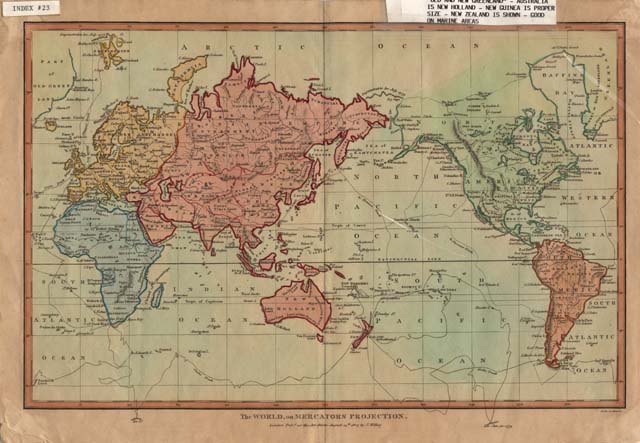
Item
Number: 1970:02007.23
Date of
map: 1807 Place
of publication: London
Cartographer
(personal name): Wilkes, J.
Height
(inches): 10.7 Width (inches): 15.2
This map depicts
explorers' "tracks," shows locations of ethnic groups and
communities, and shows Greenland as a peninsula, designated as "Old
Greenland" and "New Greenland."
Shows rivers on all continents except Australia.
Most of these areas are not mapped: central and northern North America
towards the Arctic, central Africa, central South America, and Australia.
Mercator projection.
This
map forms part of the Cutter World Map Collection, collection C 003, at the Center of Southwest Studies, Fort Lewis
College.
© 2003 Center of Southwest Studies,
Fort Lewis College
All rights reserved (click here for Property Rights Statement).
1000
Rim Dr., Durango, CO 81301-3999 ~ Phone
970-247-7126 ~ Fax 970-247-7422
Page revised: November 14, 2003