
|
| Start | Previous image | Next image | End |
|
|
|
|
|
|
|
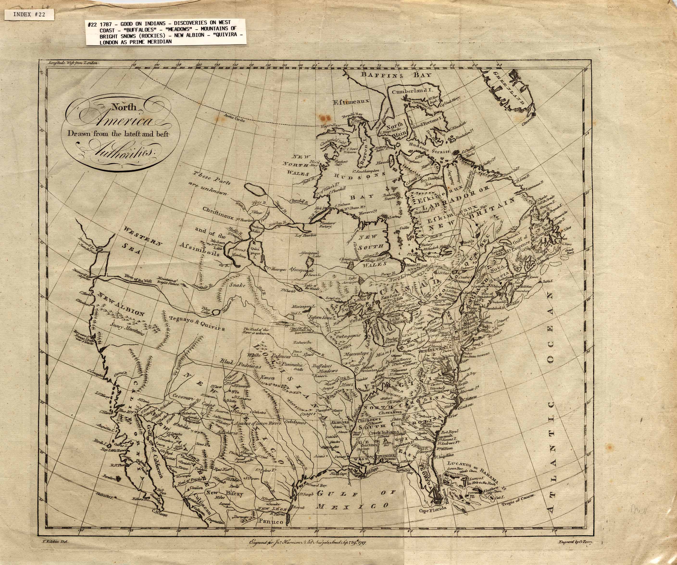
Item
Number: 1970:02007.22
Date of
map: 1787
Cartographer
(personal name name): Kitchin, T.
Height
(inches): 15.7
Width (inches):
18.7
This map shows states
along the Eastern Seabord, mentions discoveries of the West Coast of North
America, shows locations of Indian tribes and a few other ethnic groups,
communities and settlements, and notes unknown heads of rivers.
It mentions the legendary Quivara (an alternative name for southwestern
North America). Shows New Albion in California (California is shown as a
peninsula), and depicts Canada as a major area north of the present U.S. and
south of New Britain and New South Wales, and depicts "mountains of
bright stones," bison ("buffaloes"), and "meadows."
Conical projection.
This
map forms part of the Cutter World Map Collection, collection C 003, at the Center of Southwest Studies, Fort Lewis
College.
© 2003 Center of Southwest Studies,
Fort Lewis College
All rights reserved (click here for Property Rights Statement).
1000
Rim Dr., Durango, CO 81301-3999 ~ Phone
970-247-7126 ~ Fax 970-247-7422
Page revised: November 14, 2003