
|
| Start | Previous image | Next image | End |
|
|
|
|
|
|
|
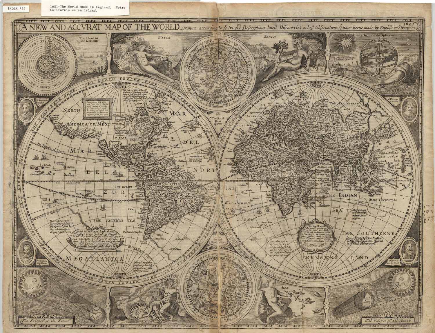
Item
Number: 1970:02007.26
Date
of
map: 1651
Place
of publication: [London?]
Title:
A
new and accurate map of the world, "drawn according to ye truest
descriptions, latest discoveries and best observations that have been made by
English or strangers"
Height
(inches): 17
Width
(inches): 21.6
This
map includes notes regarding voyages in the South Pacific, shows locations of
communities, includes meteorological, astronomical and zodiacal information,
mentioning the four elements of water, fire, earth, and air.
It depicts California as an island and Greenland as a peninsula.
Shows the legendary gold-rich city of Manoa and Lake Parime.
Curved projection.
This
map forms part of the Cutter World Map Collection, collection C 003, at the Center of Southwest Studies, Fort Lewis
College.
© 2003 Center of Southwest Studies,
Fort Lewis College
All rights reserved (click here for Property Rights Statement).
1000
Rim Dr., Durango, CO 81301-3999 ~ Phone
970-247-7126 ~ Fax 970-247-7422
Page revised: November 14, 2003