
|
| Start | Previous image | Next image | End |
|
|
|
|
|
|
|
Item
Number: 1970:02007.10 Date of
map: 1595 Place
of publication: Amsterdam
Cartographer
(personal name): Sanson, Nicolao [Nicholas Sanson]
Height
(inches): 16.5
Width (inches):
22.2
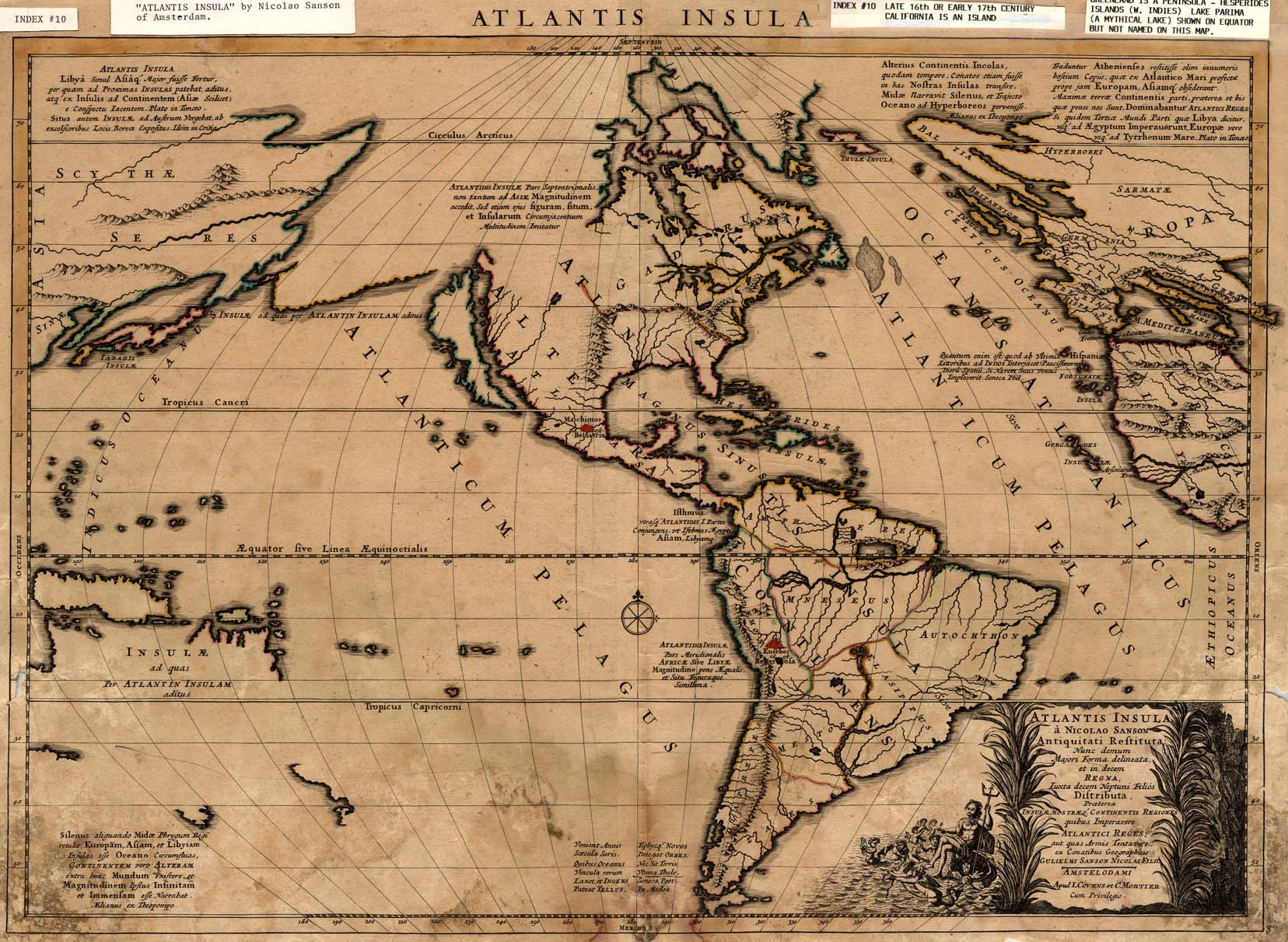
This map of the Western
Hemisphere and edges of the Eastern Hemisphere shows the locations of a few
communities and depicts Greenland as a peninsula extending from the North
American sector of the boreal land mass, which itself continues to Asia.
Canada is labeled Gadinus. Both
California and Tierra del Fuego are shown as islands.
It is possible that the 1595 year attribution is in error.
Conical projection.
This
map forms part of the Cutter World Map Collection, collection C 003, at the Center of Southwest Studies, Fort Lewis
College.
© 2003 Center of Southwest Studies,
Fort Lewis College
All rights reserved (click here for Property Rights Statement).
1000
Rim Dr., Durango, CO 81301-3999 ~ Phone
970-247-7126 ~ Fax 970-247-7422
Page revised: November 14, 2003