
|
| Start | Previous image | Next image | End |
|
|
|
|
|
|
|
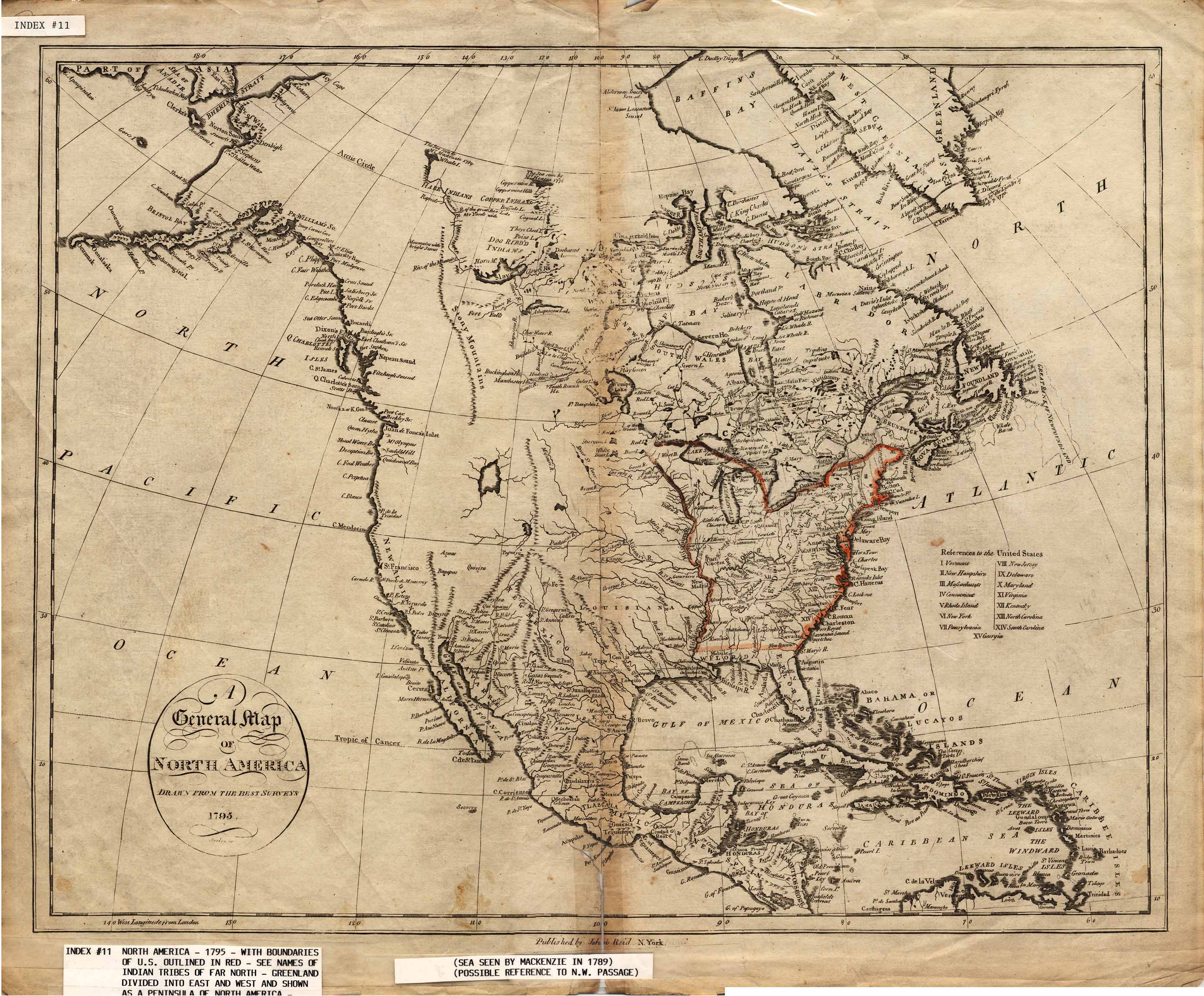
Item
Number: 1970:02007.11
Date of
map: 1795
Title: A general map of North America, drawn from the best surveys of 1795
This map shows the
locations of states and cities on the Eastern Seaboard and a few settlements
elsewhere. Indians of the Far
North are named. The map
indicates a sea described by 18th century explorers, with Greenland as a
peninsula north of North America and divided into east and west parts.
The map infers (by reference to explorers of the 18th century) the
existence of a sea (Arctic Ocean, seen by MacKenzie in 1789); Canada is
depicted as a large area south of Labrador, north of the present U.S., and
south of New South Wales. Curved
projection.
This
map forms part of the Cutter World Map Collection, collection C 003, at the Center of Southwest Studies, Fort Lewis
College.
© 2003 Center of Southwest Studies,
Fort Lewis College
All rights reserved (click here for Property Rights Statement).
1000
Rim Dr., Durango, CO 81301-3999 ~ Phone
970-247-7126 ~ Fax 970-247-7422
Page revised: November 14, 2003