
|
| Start | Previous image | Next image | End |
|
|
|
|
|
|
|
Item
Number: 1970:02007.06
Date of
map: 1560
Cartographer
(personal name): P., F., engraver
Height
(inches): 8.25
Width (inches):
11
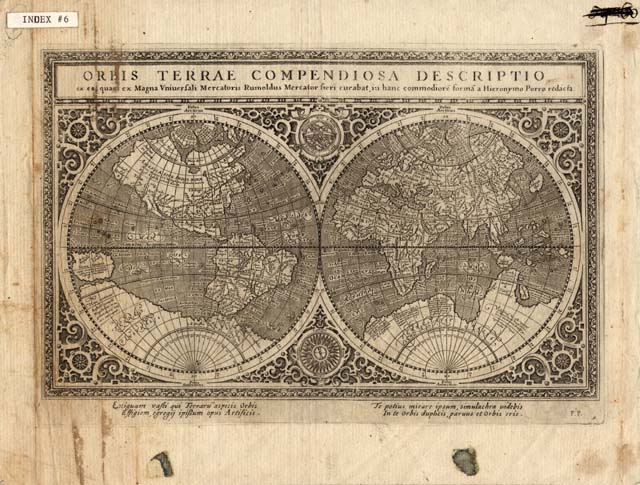
This map shows locations
of some communities (mostly in the Eastern Hemisphere), and mentions some
navigational aids. Mentions the
Seven Cities of Cibola, depicts California and Greenland as peninsulas and
Terra Australis beneath both hemispheres with both Africa and South American
separated from it. New Guinea is
disproportionately large, and the Western Hemisphere land masses are
inaccurately depicted in ratio of length to width. Canada's boundaries are not clearly drawn, and most of North
America is not depicted. Curved
projection.
This
map forms part of the Cutter World Map Collection, collection C 003, at the Center of Southwest Studies, Fort Lewis
College.
© 2003 Center of Southwest Studies,
Fort Lewis College
All rights reserved (click here for Property Rights Statement).
1000
Rim Dr., Durango, CO 81301-3999 ~ Phone
970-247-7126 ~ Fax 970-247-7422
Page revised: November 14, 2003