
|
| Start | Previous image | Next image | End |
|
|
|
|
|
|
|
Item
Number: 1970:02007.05
Date of
map: 1797
Height
(inches): 8.5
Width (inches):
10
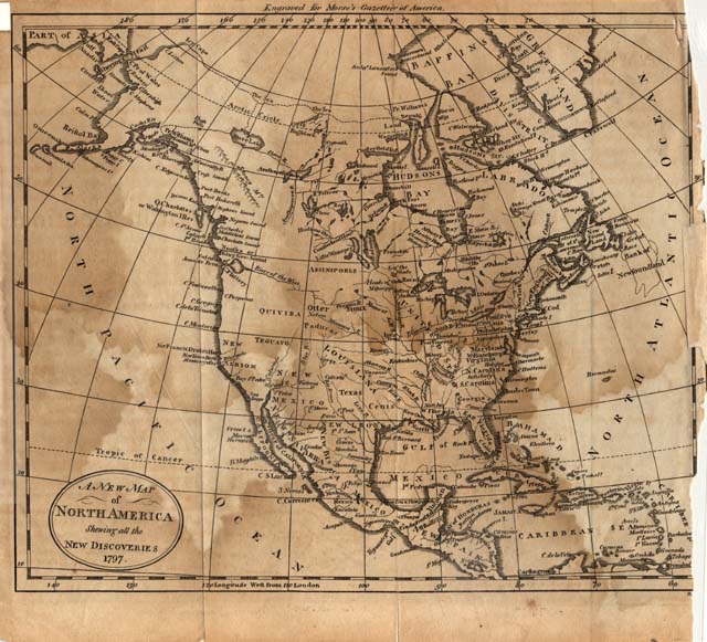
Title:
A
new map of North America showing all the new discoveries, 1797
This map shows New
Albion in California (California is depicted as a peninsula), the headwaters
of the Mississippi River and the names of the new states along the Atlantic
Seaboard. Drake's Harbour is
labeled, as are the Gulfs of Mexico, Florida, and California. Shows locations of ethnic groups and communities.
The name Canada does not appear on this map, but Quebec City and
Montreal are both shown. Curved
projection.
This
map forms part of the Cutter World Map Collection, collection C 003, at the Center of Southwest Studies, Fort Lewis
College.
© 2003 Center of Southwest Studies,
Fort Lewis College
All rights reserved (click here for Property Rights Statement).
1000
Rim Dr., Durango, CO 81301-3999 ~ Phone
970-247-7126 ~ Fax 970-247-7422
Page revised: November 14, 2003