
|
| Start | Previous image | Next image | End |
|
|
|
|
|
|
|
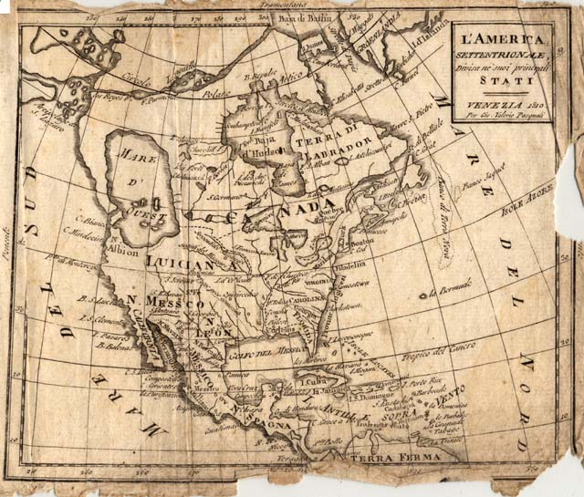
Item
Number: 1970:02007.03P
Date of
map: 1810
Place
of publication: Venice
Title:
L'America
settentrionale, divisa ne'suoi princpali stati [map of North America]
Cartographer
(personal name):
Giorgio Valerio Pasquali, engraver Height
(inches): 7.5
Width (inches): 10.5
This is one map (page
25) in a collection of 22 maps produced for the London Magazine.
These maps represent a standardized cartography, with fairly faithfully
reproduced major features -- both political and physiographic -- throughout.
The labeling is in Italian. On
this map, Canada is shown as the large area northerly with Quebec City/
Montreal. Some attention is given
to colonial possessions. The
polar regions are not well done; a large Mare d'Ouest is obviously in error.
This
map forms part of the Cutter World Map Collection, collection C 003, at the Center of Southwest Studies, Fort Lewis
College.
© 2003 Center of Southwest Studies,
Fort Lewis College
All rights reserved (click here for Property Rights Statement).
1000
Rim Dr., Durango, CO 81301-3999 ~ Phone
970-247-7126 ~ Fax 970-247-7422
Page revised: April 05, 2005