
|
| Start | Previous image | Next image | End |
|
|
|
|
|
|
|
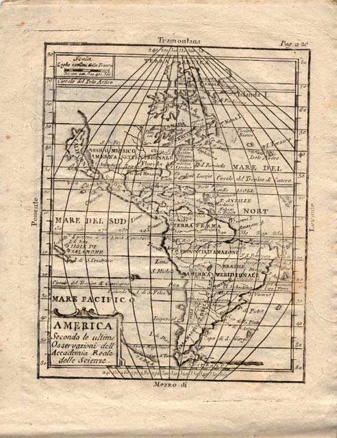
Item
Number: 1970:02007.01S
Date of
map:
1700?
Title:
America,
secondo le ultime osservazioni dell Accademia Reale delle Scienze di Parigi
[map of the Western Hemisphere -- the Americas]
Cartographer
(corporate name): Academy of Sciences (Paris)
Height
(inches): 7.5
Width (inches):
10
This is one map (page
220) in a bound volume of
twenty maps that are from a geography textbook
that is missing its table of contents. The
page numbering of the maps is not consecutive.
The titles are in Italian, derived from an edition issued by the Royal Academy
of Sciences in Paris, France. Each map includes lines of latitude and
longitude.
Because the Royal Academy of Sciences of Paris was established in 1666, it is
estimated that this textbook was published in the late 17th century or the
early 18th century.
This map of North America is remarkably accurate with respect to size
and length:width ratio.
This
map forms part of the Cutter World Map Collection, collection C 003, at the Center of Southwest Studies, Fort Lewis
College.
© 2003 Center of Southwest Studies,
Fort Lewis College
All rights reserved (click here for Property Rights Statement).
1000
Rim Dr., Durango, CO 81301-3999 ~ Phone
970-247-7126 ~ Fax 970-247-7422
Page revised: April 05, 2005