
|
| Start | Previous image | Next image | End |
|
|
|
|
|
|
|
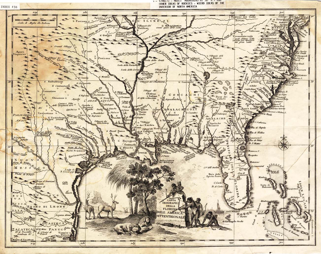
Item
Number: 1970:02007.36
Date of
map: 1790
Title:
Carta
geografica della Florida dell America settentrionale [map of Florida: the
southeastern portion of the present day United States; but it includes much of
the Southwest also]
Height
(inches): 13.7
Width
(inches):
17.5
This map, ca. 1790,
shows locations of ethnic groups and communities, and mentions some
navigational aids. The title of
this map is misleading, as the area shown includes much of southwestern
present U.S.; it would more properly be called a map of "Florida,"
i.e. the region extending from Florida towards southwestern North America.
The Gulf of Mexico is not labeled.
Illustrations of animals, plants and people are in the margins.
Conical projection.
This
map forms part of the Cutter World Map Collection, collection C 003, at the Center of Southwest Studies, Fort Lewis
College.
© 2003 Center of Southwest Studies,
Fort Lewis College
All rights reserved (click here for Property Rights Statement).
1000
Rim Dr., Durango, CO 81301-3999 ~ Phone
970-247-7126 ~ Fax 970-247-7422
Page revised: November 14, 2003