
|
| Start | Previous image | Next image | End |
|
|
|
|
|
|
|
Item
Number: 1970:02007.35
Date of
map: 1750
Place
of publication: Venice
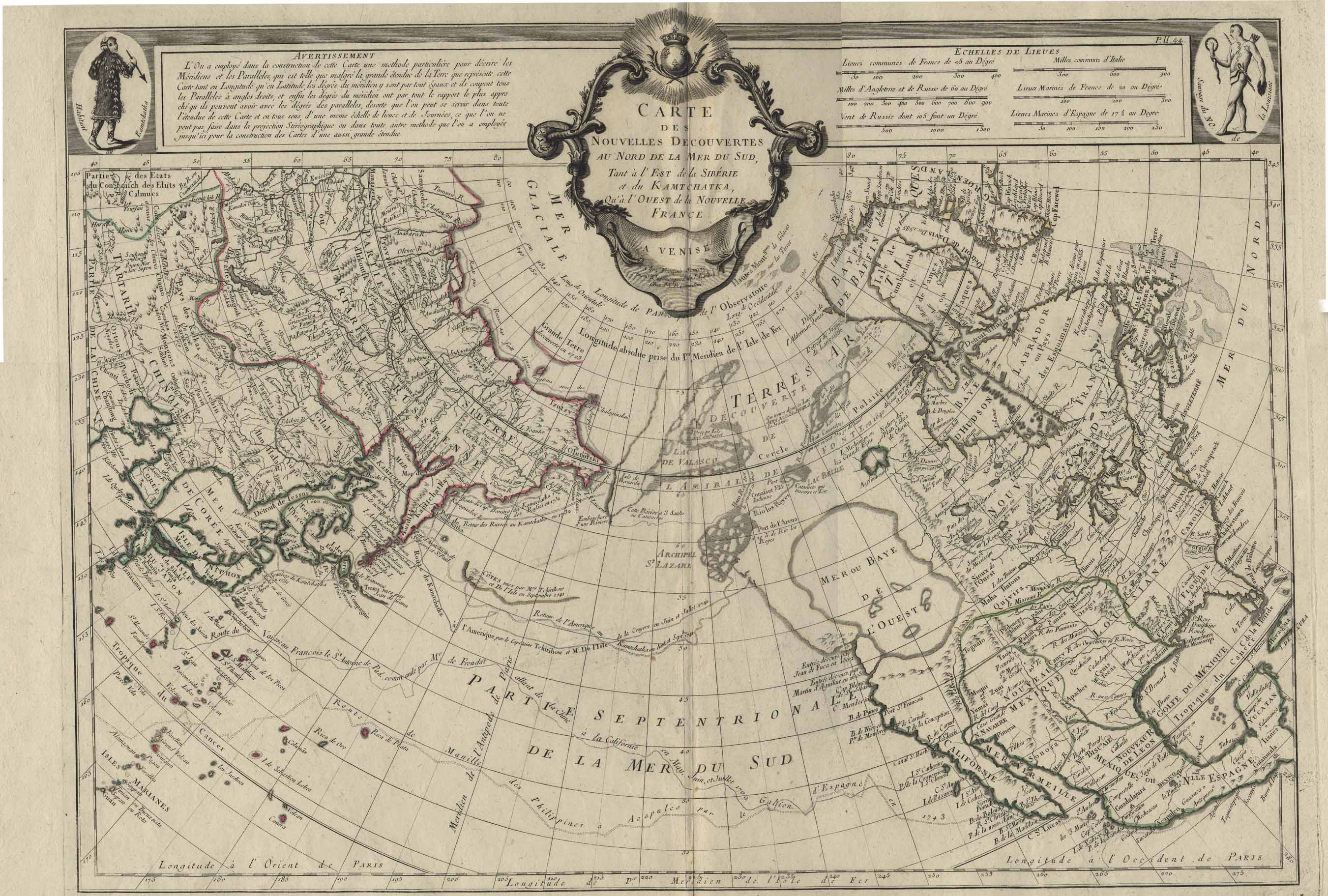
Title:
Carte
des nouvelles descouvertes, au Nord de la Mer du Sud, tant a l’Est de la
Siberie dt du Kamtchatka, qu’al Ouest de la Nouvelle France [map of new
discoveries to the north of La Mer du Sud]
Cartographer
(personal name): Santini, Francois
Height
(inches): 21.5
Width (inches):
30.5
This map of the northern
hemisphere including North America and Asia includes notes re: discoveries,
shows locations of Indians and other ethnic groups and communities, mentions
the legendary Quivara (an alternative name for southwestern North America),
and shows California as a peninsula. Greenland
is also depicted as a peninsula, related to the North American land mass.
Canada is broadly conceived as the whole area north of the present U.S.
Quebec City and Montreal are both shown as if on Lake Huron.
Conical projection.
This
map forms part of the Cutter World Map Collection, collection C 003, at the Center of Southwest Studies, Fort Lewis
College.
© 2003 Center of Southwest Studies,
Fort Lewis College
All rights reserved (click here for Property Rights Statement).
1000
Rim Dr., Durango, CO 81301-3999 ~ Phone
970-247-7126 ~ Fax 970-247-7422
Page revised: November 14, 2003