
|
| Start | Previous image | Next image | End |
|
|
|
|
|
|
|
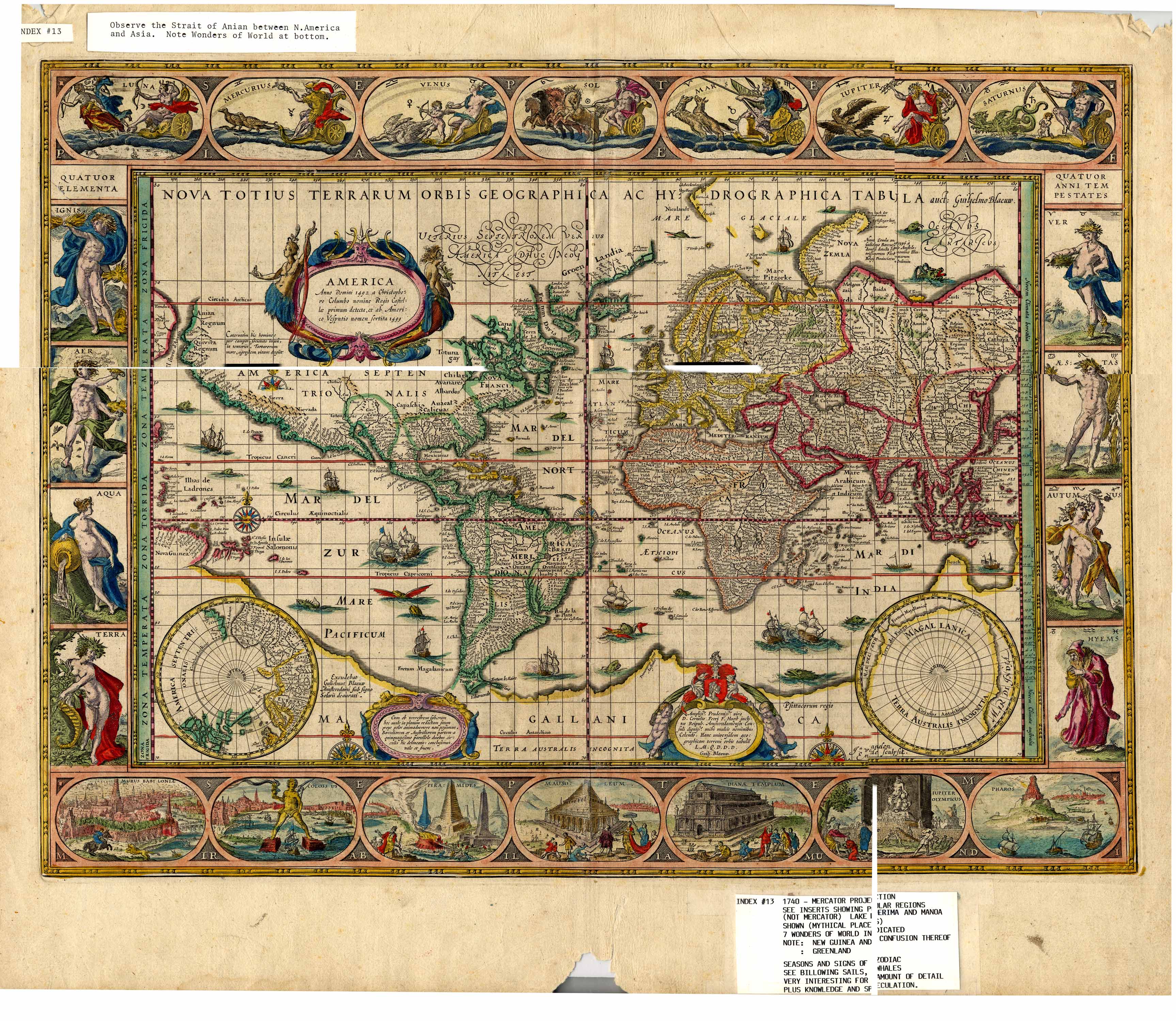
Item
Number: 1970:02007.13
Date
of
map: 1740
Title:
Nova
totius terrarum orbis geographica ac hydrographica tabula [map of the world]
Cartographer
(personal name): Blaeou, Guilielmo
Height
(inches): 19.5
Width (inches): 23.2
Some historical
information is included on the map. Shows
locations of some ethnic groups and communities, and mentions some
navigational aids. Shows the
legendary Manoa and Lake Parime. Depicts
California and Tierra del Fuego as peninsulas. Western and northern North America are not mapped, nor
are eastern and northern Asia. The
Seven Wonders of the World and the Spirit of the Four Elements are shown in
the margins. Mercator projection.
Below are digital views of the two pages of textual descriptions that are on the back of this map. First, the back right, then the back left page.
This
map forms part of the Cutter World Map Collection, collection C 003, at the Center of Southwest Studies, Fort Lewis
College.
© 2003 Center of Southwest Studies,
Fort Lewis College
All rights reserved (click here for Property Rights Statement).
1000
Rim Dr., Durango, CO 81301-3999 ~ Phone
970-247-7126 ~ Fax 970-247-7422
Page revised: November 14, 2003