|
|
Collection
M 194:
Nina
Heald Webber Southwest Colorado collection:
Series 1: the printed
materials
American Smelting and Refining Co.:
map of smelter, railroad terminus and nearby features in Durango,
Colorado, circa 1942/1952
click here to search
other Southwest maps descriptions
|
 To thumbnail
|
|
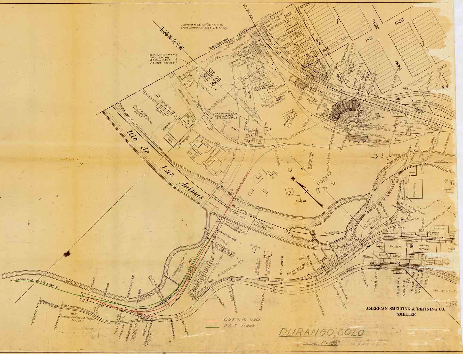
American Smelting and Refining Co. smelter map, showing adjacent areas in
the city of Durango, including barns, warehouses, sheds, a slaughter
house, a rendering house, mills, stock yards, the railroad yards, and a
pump house, etc., east/across the Animas River from the smelter and
other structures including coke ovens, a dwelling, a barn, scales, and a
power house on the same side of the river as the smelter. Denver and Rio
Grande Western (D&RGW) tracks are shown in red; Rio Grande Southern
(RGS) tracks to Ridgway are shown in green on the original. Undated.
Includes a mention of "AFE 2898 - 1952 Retire Tracks." Scale: 1" = 100'. |
|
This map forms part of
the
Nina
Heald Webber Southwest Colorado collection
M 194 at
the Center of Southwest Studies.
Accession 2007:103.002
© 2007 Center of Southwest Studies,
Fort Lewis College
All rights reserved (click here for Property Rights Statement).
1000
Rim Dr., Durango, CO 81301-3999 ~ Phone
970-247-7126 ~ Fax 970-247-7422
Page revised:
October 26, 2007