
|
| Start | Previous image | Next image | End |
|
|
|
|
|
|
|
Item
Number: 1970:02007.17
Date of
map: 1775
Place
of publication: Venice
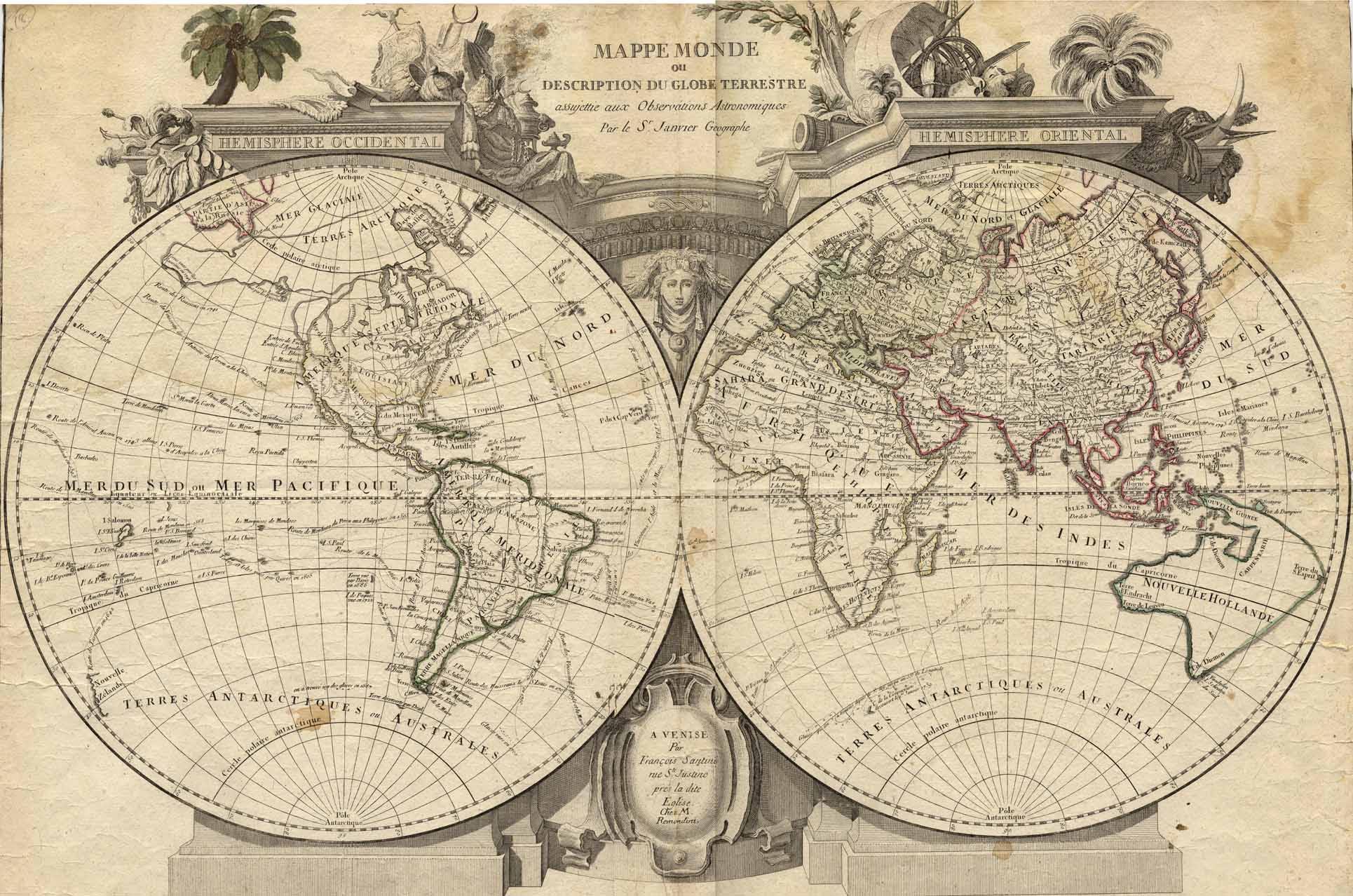
Title:
Mappe
monde ou description du globe terrestre [map of the world]
Cartographer
(personal name): Santini, Francois
Height
(inches): 18.5
Width (inches): 25.5
This map, drawn
"according to astronomical observation of Sr. Janvier, geographer"
sometime between 1772 and 1783 (after the voyage of Cook which disproved the
notion of a large Southern Continent, but before 1783 when the Treaty of Paris
disclaimed British possessions along the Atlantic Coast), shows the locations
of a few communities in the Western Hemisphere and in the Eastern Hemisphere
south of the Equator. It shows
compass points and many routes of exploration, mentions the search for a
Northwest Passage, an interconnecting waterway across North America.
Greenland is drawn as a peninsula extending from Arctic land, and
California is also shown as a peninsula.
The northwestern portion of North America is not mapped; neither are
Central and South America, much of Africa, or Australia.
Deserts are shown in Africa and China. Conical projection.
This
map forms part of the Cutter World Map Collection, collection C 003, at the Center of Southwest Studies, Fort Lewis
College.
© 2003 Center of Southwest Studies,
Fort Lewis College
All rights reserved (click here for Property Rights Statement).
1000
Rim Dr., Durango, CO 81301-3999 ~ Phone
970-247-7126 ~ Fax 970-247-7422
Page revised: November 14, 2003